Gros Cap Indian Village 49A
| Gros Cap Indian Village 49A | |
|---|---|
| Indian reserve | |
| Gros Cap Indian Village Indian Reserve No. 49A | |
 Gros Cap Indian Village 49A | |
| Coordinates: 47°59′N 84°54′W / 47.983°N 84.900°WCoordinates: 47°59′N 84°54′W / 47.983°N 84.900°W | |
| Country |
|
| Province |
|
| District | Algoma |
| First Nation | Michipicoten |
| Area[1] | |
| • Land | 0.05 km2 (0.02 sq mi) |
Gros Cap Indian Village 49A is a First Nations reserve[1] which is surrounded by Wawa, Ontario, but almost borders Gros Cap 49. It is one of the reserves of the Michipicoten First Nation.
References
External links
 |
Gros Cap 49 | | ||
| Gros Cap 49 | |
Wawa | ||
| ||||
| | ||||
| Wawa |
| Cities | 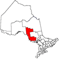 | |
|---|---|---|
| Towns | ||
| Townships | ||
| Villages | ||
| First Nations | ||
| Indian reserves | ||
| Local services boards | ||
| Unorganized areas | ||
| ||
This article is issued from Wikipedia - version of the 2/19/2016. The text is available under the Creative Commons Attribution/Share Alike but additional terms may apply for the media files.