Obadjiwan 15E
| Obadjiwan 15E | |
|---|---|
| Indian reserve | |
| Obadjiwan Indian Reserve No. 15E | |
 Obadjiwan 15E | |
| Coordinates: 46°53.5′N 84°37′W / 46.8917°N 84.617°WCoordinates: 46°53.5′N 84°37′W / 46.8917°N 84.617°W | |
| Country |
|
| Province |
|
| District | Algoma |
| First Nation | Batchewana Ojibways |
| Area | |
| • Land | 0.68 km2 (0.26 sq mi) |
| Time zone | EST (UTC-5) |
| • Summer (DST) | EDT (UTC-4) |
| Website | www.batchewana.ca |
Obadjiwan 15E is a First Nations reserve in Algoma District, Ontario. It consists of two non-contiguous parcels of land on Batchewana Bay (Lake Superior), and is one of the reserves of the Batchewana First Nation of Ojibways.
History
The land was originally set apart for the Department of Marine and Fisheries to build the Corbeil Point Lighthouse by order in council on 29 May 1874.
On 23 January 1964, the Department of Transportation and Communication gave these two parcels of land to the Department of Indian Affairs, which was made into a reserve on 6 December 1966.[1]
External links
References
- ↑ Syrette, Colleen, Darlene Syrette & Joseph Corbiere (1977). "Batchewana Band History, 1850 - 1977" (PDF). Algoma University archives. Retrieved 10 January 2016.
 |
Unorganized North Algoma | | ||
| Lake Superior | |
Unorganized North Algoma | ||
| ||||
| | ||||
| Lake Superior |
| Cities | 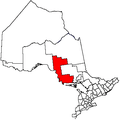 | |
|---|---|---|
| Towns | ||
| Townships | ||
| Villages | ||
| First Nations | ||
| Indian reserves | ||
| Local services boards | ||
| Unorganized areas | ||
| ||
This article is issued from Wikipedia - version of the 10/11/2016. The text is available under the Creative Commons Attribution/Share Alike but additional terms may apply for the media files.