Guilford, Maine
| Guilford, Maine | |
|---|---|
| Town | |
 Location in Piscataquis County and the state of Maine. | |
| Coordinates: 45°10′10″N 69°23′0″W / 45.16944°N 69.38333°WCoordinates: 45°10′10″N 69°23′0″W / 45.16944°N 69.38333°W | |
| Country | United States |
| State | Maine |
| County | Piscataquis |
| Area[1] | |
| • Total | 35.71 sq mi (92.49 km2) |
| • Land | 34.88 sq mi (90.34 km2) |
| • Water | 0.83 sq mi (2.15 km2) |
| Elevation | 400 ft (100 m) |
| Population (2010)[2] | |
| • Total | 1,521 |
| • Estimate (2012[3]) | 1,508 |
| • Density | 43.6/sq mi (16.8/km2) |
| Time zone | Eastern (EST) (UTC-5) |
| • Summer (DST) | EDT (UTC-4) |
| ZIP code | 04443 |
| Area code(s) | 207 |
| GNIS feature ID | 582504 |
| Website | townofguilford.com |
Guilford is a town in Piscataquis County, Maine, United States. The town is located on the Piscataquis River and was first settled in 1806.[4] The population was 1,521 at the 2010 census.
History
In 1803, Rev. Robert Low and Deacon Robert Herring of New Gloucester purchased several thousand acres in the area from Bowdoin College. The town itself was first settled on February 18, 1806. On October 8, 1812, a warrant was issued for the tract to be designated a "plantation," which became effective on November 11, 1806. The town was officially incorporated by the governor of the Commonwealth of Massachusetts on February 8, 1816. It was named after Moses Guilford Low, the first white child born here.[5]
The town served as the birthplace of Guilford of Maine, currently one of the world's largest producers of panel cloth.

Geography
According to the United States Census Bureau, the town has a total area of 35.71 square miles (92.49 km2), of which, 34.88 square miles (90.34 km2) of it is land and 0.83 square miles (2.15 km2) is water.[1]
Demographics
| Historical population | |||
|---|---|---|---|
| Census | Pop. | %± | |
| 1820 | 325 | — | |
| 1830 | 655 | 101.5% | |
| 1840 | 892 | 36.2% | |
| 1850 | 834 | −6.5% | |
| 1860 | 837 | 0.4% | |
| 1870 | 818 | −2.3% | |
| 1880 | 881 | 7.7% | |
| 1890 | 1,023 | 16.1% | |
| 1900 | 1,544 | 50.9% | |
| 1910 | 1,680 | 8.8% | |
| 1920 | 1,687 | 0.4% | |
| 1930 | 1,735 | 2.8% | |
| 1940 | 1,752 | 1.0% | |
| 1950 | 1,842 | 5.1% | |
| 1960 | 1,880 | 2.1% | |
| 1970 | 1,694 | −9.9% | |
| 1980 | 1,793 | 5.8% | |
| 1990 | 1,710 | −4.6% | |
| 2000 | 1,531 | −10.5% | |
| 2010 | 1,521 | −0.7% | |
| Est. 2014 | 1,494 | [6] | −1.8% |
2010 census
As of the census[2] of 2010, there were 1,521 people, 693 households, and 426 families residing in the town. The population density was 43.6 inhabitants per square mile (16.8/km2). There were 882 housing units at an average density of 25.3 per square mile (9.8/km2). The racial makeup of the town was 96.9% White, 0.1% African American, 0.5% Native American, 0.7% Asian, 0.1% Pacific Islander, 0.3% from other races, and 1.4% from two or more races. Hispanic or Latino of any race were 0.7% of the population.
There were 693 households of which 24.2% had children under the age of 18 living with them, 44.6% were married couples living together, 11.1% had a female householder with no husband present, 5.8% had a male householder with no wife present, and 38.5% were non-families. 33.5% of all households were made up of individuals and 16.2% had someone living alone who was 65 years of age or older. The average household size was 2.19 and the average family size was 2.70.
The median age in the town was 46.3 years. 19.4% of residents were under the age of 18; 6.9% were between the ages of 18 and 24; 22.4% were from 25 to 44; 30.4% were from 45 to 64; and 20.8% were 65 years of age or older. The gender makeup of the town was 47.9% male and 52.1% female.
2000 census
As of the census[8] of 2000, there were 1,531 people, 652 households, and 438 families residing in the town. The population density was 43.8 people per square mile (16.9/km²). There were 857 housing units at an average density of 24.5 per square mile (9.5/km²). The racial makeup of the town was 96.28% White, 0.13% Black or African American, 0.65% Native American, 0.65% Asian, 0.13% from other races, and 2.16% from two or more races. Hispanic or Latino of any race were 0.20% of the population.
There were 652 households out of which 27.3% had children under the age of 18 living with them, 49.1% were married couples living together, 12.7% had a female householder with no husband present, and 32.8% were non-families. 26.7% of all households were made up of individuals and 14.0% had someone living alone who was 65 years of age or older. The average household size was 2.35 and the average family size was 2.79.
In the town the population was spread out with 23.4% under the age of 18, 7.5% from 18 to 24, 25.9% from 25 to 44, 25.3% from 45 to 64, and 18.0% who were 65 years of age or older. The median age was 41 years. For every 100 females there were 87.9 males. For every 100 females age 18 and over, there were 85.3 males.
The median income for a household in the town was $27,500, and the median income for a family was $32,311. Males had a median income of $26,176 versus $20,000 for females. The per capita income for the town was $14,303. About 11.2% of families and 16.4% of the population were below the poverty line, including 22.6% of those under age 18 and 11.9% of those age 65 or over.
Education
Guilford is part of Maine School Administrative District #4. Paul A. Stearns is the Superintendent.
The two schools in the district are Piscataquis Community Elementary School and Piscataquis Community Secondary School.[9]
In popular culture
Guilford is an important setting in the science fiction novels Supervolcano Trilogy by Harry Turtledove.
References
- 1 2 "US Gazetteer files 2010". United States Census Bureau. Retrieved 2012-12-16.
- 1 2 "American FactFinder". United States Census Bureau. Retrieved 2012-12-16.
- ↑ "Population Estimates". United States Census Bureau. Retrieved 2013-07-06.
- ↑ Maine League of Historical Societies and Museums (1970). Doris A. Isaacson, ed. Maine: A Guide ‘Down East′. Rockland, Me: Courier-Gazette, Inc. p. 376.
- ↑ "Profile for Guilford, Maine". ePodunk. Retrieved 2010-05-07.
- ↑ "Annual Estimates of the Resident Population for Incorporated Places: April 1, 2010 to July 1, 2014". Retrieved June 4, 2015.
- ↑ "Census of Population and Housing". Census.gov. Retrieved June 4, 2015.
- ↑ "American FactFinder". United States Census Bureau. Retrieved 2008-01-31.
- ↑ "Maine School Administrative District #4". Maine School Administrative District #4. Retrieved 2012-06-06.
Municipalities and communities of Piscataquis County, Maine, United States | ||
|---|---|---|
| Towns | 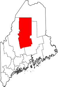 | |
| Plantations | ||
| Unorganized territories | ||
| CDPs | ||