Guyandotte, Huntington, West Virginia
Guyandotte is a historic neighborhood of Huntington, West Virginia and was formerly a small town in Virginia (and after 1863, West Virginia) located at the confluence of the Guyandotte River (which drains much of the more rugged portion of southern West Virginia) and the Ohio River. In 1873, when the Chesapeake and Ohio Railway (C&O) reached its western terminus there and built new facilities, the newly enlarged city was named Huntington, in honor of C&O Railway leader Collis P. Huntington.
History
Guyandotte was first built upon in 1609. The land that was part of Guyandotte and later Huntington was originally part of the 28,628-acre (115.85 km2) French and Indian War veteran's Savage Grant.
Historically, the old Federal Era town of Guyandotte has homes dating back to 1820 and a graveyard containing 18th-century French and Colonial-era settlers, including surnames such as LeTulle, Holderby, and Buffington. Huntington was known as Holderby's Landing prior to 1871, and the Buffington family held the tracts of land that became the Huntington Land Company. The Buffingtons were the only revolutionary-era Savage Grant claimants to continuously reside within the area, and later generations of Buffingtons were associated with Marshall College (later a university) and were business partners of Collis P. Huntington. Albert Gallatin Jenkins, a Confederate Army general, had his plantation home, Green Bottom in nearby Lesage, which has since become a historical landmark.
At the time of Huntington's founding, Holderby's Landing was already the home of Marshall College, a normal school that had been founded in 1837 as Marshall Academy. Originally, Marshall Academy was essentially a boarding school, under the control of the Southern Methodist Church, for wealthy high school students. In 1857, the school became Marshall College, which in turn became a public institution in 1867. The college later became Marshall University in 1961 and now occupies a large portion of the city to the immediate east of the downtown CBD.
Historic buildings at Guyandotte include the Madie Carroll House and the Zachary Taylor Wellington House, both listed on the National Register of Historic Places.[1]
References
- ↑ National Park Service (2010-07-09). "National Register Information System". National Register of Historic Places. National Park Service.
Coordinates: 38°25′37″N 82°23′07″W / 38.42694°N 82.38528°W
| Topics | 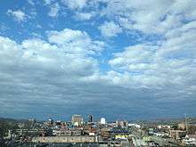 | |
|---|---|---|
| Top subjects | ||
| Neighborhoods | ||
| Suburbs | ||