Hudson Falls, New York
| Hudson Falls | |
|---|---|
| Village | |
|
Buildings in Hudson Falls Historic District, July, 2014 | |
 Location in Washington County and the state of New York. | |
| Coordinates: 43°18′8″N 73°34′50″W / 43.30222°N 73.58056°WCoordinates: 43°18′8″N 73°34′50″W / 43.30222°N 73.58056°W | |
| Country | United States |
| State | New York |
| County | Washington |
| Incorporated | 1810 as Sandy Hill, 1910 as Hudson Falls |
| Government | |
| • Mayor | John Barton |
| Area | |
| • Total | 1.9 sq mi (4.9 km2) |
| • Land | 1.8 sq mi (4.8 km2) |
| • Water | 0.0 sq mi (0.1 km2) |
| Elevation | 295 ft (90 m) |
| Population (2000)[1] | |
| • Total | 6,927 |
| • Density | 3,763.5/sq mi (1,453.1/km2) |
| Time zone | Eastern (EST) (UTC-5) |
| • Summer (DST) | EDT (UTC-4) |
| ZIP code | 12839 |
| Area code(s) | 518 |
| FIPS code | 36-35980 |
| GNIS feature ID | 0974163 |

Hudson Falls is a village located in Washington County, New York, USA. The village is in the southwest of the town of Kingsbury, on US Route 4. Hudson Falls is part of the Glens Falls Metropolitan Statistical Area.[2] As of the 2000 census, the village had a population of 6,927.[1] It was the county seat of Washington County until 1994, when the county seat was moved to Fort Edward.[3][4]
History
In 1764, Albert Baker built Kingsbury's first sawmill near what is known today as Baker's Falls. As early as 1792, the area of Kingsbury near Baker's Falls was referred to as Sandy Hill. In 1810, the hamlet incorporated as a village, keeping the name Sandy Hill. Its boundaries expanded to their current limits in the 1840s. In 1910, the village's name was changed to Hudson Falls.[5]
Stone quarried in Hudson Falls was used to construct the Bennington Battle Monument and the Brooklyn Bridge; the site of the quarry is now occupied by the Washington-Saratoga-Warren-Hamilton-Essex Board of Cooperative Educational Services. The Glens Falls Feeder Canal runs though the village.
The Glens Falls Feeder Canal, Hudson Falls Historic District, and United States Post Office are listed on the National Register of Historic Places.[6]
Notable people from Hudson Falls
- William Bronk grew up in Hudson Falls; as an adult, he managed a lumber business there and wrote various literary works, winning the National Book Award in 1982.[7]
- Townsend Harris, the United States' first consul-general to Japan, was born in Hudson Falls.
- Henry C. Martindale (1780–1860) - Attorney and Member of Congress
- Tony DeSare (1975-) - Jazz singer, pianist, and songwriter
Current events related to the past
In the first week of September around Friday-Saturday, every year there is a carnival (celebration) in remembrance in a celebration of the past with the 175th Anniversary of the founding of the Village. The carnival is referred to as "Sandy Hill Days" and is hosted at the Hudson Falls Kindergarten Center near the KoC (Knights Of Columbus) where there is also a flea market.
Geography
According to the United States Census Bureau, the village has a total area of 1.9 square miles (4.9 km2), of which 1.8 square miles (4.7 km2) of it is land and 0.04 square miles (0.10 km2) of it is water. The total area is 2.13% water.
The village is on the east bank of the Hudson River at the west border of Washington County, New York. A village green lies in the center of the commercial district.
NY Route 196 (Maple Street) and NY Route 254 (River Street) intersect US Route 4 in Hudson Falls.
Demographics
| Historical population | |||
|---|---|---|---|
| Census | Pop. | %± | |
| 1870 | 2,347 | — | |
| 1880 | 2,487 | 6.0% | |
| 1890 | 2,895 | 16.4% | |
| 1900 | 4,473 | 54.5% | |
| 1910 | 5,189 | 16.0% | |
| 1920 | 5,761 | 11.0% | |
| 1930 | 6,449 | 11.9% | |
| 1940 | 6,654 | 3.2% | |
| 1950 | 7,236 | 8.7% | |
| 1960 | 7,752 | 7.1% | |
| 1970 | 7,917 | 2.1% | |
| 1980 | 7,419 | −6.3% | |
| 1990 | 7,651 | 3.1% | |
| 2000 | 6,927 | −9.5% | |
| 2010 | 7,281 | 5.1% | |
| Est. 2015 | 7,191 | [8] | −1.2% |
As of the census of 2000, there were 6,927 people, 2,876 households, and 1,760 families residing in the village. The population density was 3,763.5 people per square mile (1,453.5/km²). There were 3,120 housing units at an average density of 1,695.1 per square mile (654.7/km²). The racial makeup of the village was 97.91% White, 0.45% African American, 0.22% Native American, 0.25% Asian, 0.00% Pacific Islander, 0.16% from other races, and 1.02% from two or more races. 0.68% of the population is Hispanic or Latino of any race.[1]
There were 2,876 households out of which 31.4% had children under the age of 18 living with them, 40.7% were married couples living together, 15.5% had a female householder with no husband present, and 38.8% were non-families. 32.0% of all households were made up of individuals and 13.7% had someone living alone who was 65 years of age or older. The average household size was 2.37 and the average family size was 2.95.[1]
In the village the population was spread out with 25.2% under the age of 18, 8.9% from 18 to 24, 30.6% from 25 to 44, 20.6% from 45 to 64, and 14.6% who were 65 years of age or older. The median age was 36 years. For every 100 females there were 88.5 males. For every 100 females age 18 and over, there were 83.8 males.[1]
The median income for a household in the village was $31,516, and the median income for a family was $37,628. Males had a median income of $31,107 versus $21,215 for females. The per capita income for the village was $17,575. 17.2% of the population and 12.8% of families were below the poverty line. 30.3% of those under the age of 18 and 6.3% of those 65 and older were living below the poverty line.[1]
Rail transportation
Amtrak, the national passenger rail system, provides service to Hudson Falls at the station in nearby Fort Edward, operating its Adirondack daily in both directions between Montreal and New York City, and its Ethan Allen Express in both directions daily between New York City and Rutland. Amtrak has designated the stop as Fort Edward-Glens Falls.
Freight rail service is provided along a spur line extending from Fort Edward to Glens Falls that runs through the village.
Gallery
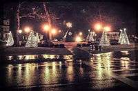 Juckett Park in December
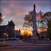 Monument in Hudson Falls, NY
 Courthouse Hudson Falls, NY
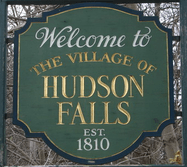 Welcome to Hudson Falls, NY
Literary references
The fictional town of Millers Kill, NY, in Julia Spencer-Fleming's mystery novels is loosely based on Hudson Falls.[10]
References
- 1 2 3 4 5 6 "American FactFinder". United States Census Bureau. Retrieved 2008-01-31.
- ↑ "Metropolitan Areas and Components, 1999, with FIPS Codes". US Census Bureau. Retrieved July 7, 2009.
- ↑ Town of Kingsbury, New York, Retrieved Jan. 14, 2015.
- ↑ Washington County, New York, Retrieved Jan. 14, 2015.
- ↑ Loding, RH, Paul R. "KINGSBURY, NEW YORK 11 MAY 1762" (PDF). Retrieved 2010-02-27.
- ↑ National Park Service (2009-03-13). "National Register Information System". National Register of Historic Places. National Park Service.
- ↑ "LIBRARY HONORS WILLIAM BRONK AND HIS POETRY". COLUMBIA UNIVERSITY RECORD. October 22, 1993. Retrieved 2009-05-12.
- ↑ "Annual Estimates of the Resident Population for Incorporated Places: April 1, 2010 to July 1, 2015". Retrieved July 2, 2016.
- ↑ "Census of Population and Housing". Census.gov. Retrieved June 4, 2015.
- ↑ http://www.juliaspencerfleming.com/me-interview.html#me Archived January 4, 2009, at the Wayback Machine.
External links
Municipalities and communities of Washington County, New York, United States | ||
|---|---|---|
| Towns | 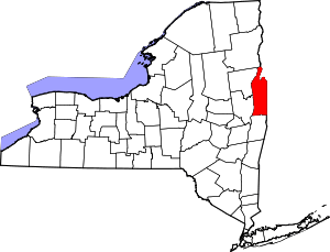 | |
| Villages | ||
| Hamlets | ||
| Footnotes | ‡This populated place also has portions in an adjacent county or counties | |