Hanover Township, Jo Daviess County, Illinois
| Hanover Township | |
|---|---|
| Township | |
|
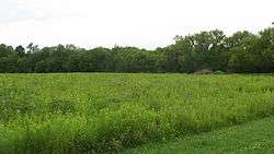
Scenery at the Wapello Land and Water Reserve | |
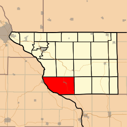 Location in Jo Daviess County | |
 Jo Daviess County's location in Illinois | |
| Coordinates: 42°14′38″N 90°18′05″W / 42.24389°N 90.30139°WCoordinates: 42°14′38″N 90°18′05″W / 42.24389°N 90.30139°W | |
| Country | United States |
| State | Illinois |
| County | Jo Daviess |
| Established | November 2, 1852 |
| Government | |
| • Supervisor | Janice R. Steele |
| Area | |
| • Total | 56.83 sq mi (147.2 km2) |
| • Land | 52.1 sq mi (135 km2) |
| • Water | 4.73 sq mi (12.3 km2) 8.32% |
| Elevation | 876 ft (267 m) |
| Population (2010) | |
| • Total | 1,201 |
| • Density | 23.1/sq mi (8.9/km2) |
| Time zone | CST (UTC-6) |
| • Summer (DST) | CDT (UTC-5) |
| ZIP codes | 61028, 61041, 61074 |
| GNIS feature ID | 0429106 |
Hanover Township is one of twenty-three townships in Jo Daviess County, Illinois, USA. As of the 2010 census, its population was 1,201 and it contained 689 housing units.[1]
Geography
According to the 2010 census, the township has a total area of 56.83 square miles (147.2 km2), of which 52.1 square miles (135 km2) (or 91.68%) is land and 4.73 square miles (12.3 km2) (or 8.32%) is water.[1]
Cities, towns, villages
Adjacent townships
- Elizabeth Township (north)
- Woodbine Township (northeast)
- Derinda Township (east)
- Washington Township, Carroll County (southeast)
- Rice Township (northwest)
Cemeteries
The township contains Lost Mound Cemetery.
Major highways
Rivers
Landmarks
- Lock and Dam No. 12
- Savanna Army Dep
- US Army-Savana Army Dep
School districts
- River Ridge Community Unit School District 210
Political districts
- Illinois' 16th congressional district
- State House District 89
- State Senate District 45
References
- "Hanover Township, Jo Daviess County, Illinois". Geographic Names Information System. United States Geological Survey. Retrieved 2010-01-17.
- United States Census Bureau 2007 TIGER/Line Shapefiles
- United States National Atlas
- 1 2 "Population, Housing Units, Area, and Density: 2010 - County -- County Subdivision and Place -- 2010 Census Summary File 1". United States Census. Retrieved 2013-05-28.
External links
- Jo Daviess County official site
- City-Data.com
- Illinois State Archives
- Township Officials of Illinois
Municipalities and communities of Jo Daviess County, Illinois, United States | ||
|---|---|---|
| Cities | ||
| Villages | ||
| Townships | ||
| CDPs | ||
| Other unincorporated communities | ||
| Ghost town | ||
This article is issued from Wikipedia - version of the 8/4/2014. The text is available under the Creative Commons Attribution/Share Alike but additional terms may apply for the media files.