Hardin, Montana
| Hardin, Montana | |
|---|---|
| City | |
|
Former train depot, originally from Lodge Grass, now featured among other buildings at the Big Horn County Historical Museum in Hardin. | |
| Motto: A city with a reason. . . | |
 Location of Hardin, Montana | |
| Coordinates: 45°43′55″N 107°36′45″W / 45.73194°N 107.61250°WCoordinates: 45°43′55″N 107°36′45″W / 45.73194°N 107.61250°W | |
| Country | United States |
| State | Montana |
| County | Big Horn |
| Government | |
| • Mayor | John "Jack" Lane |
| Area[1] | |
| • Total | 2.57 sq mi (6.66 km2) |
| • Land | 2.57 sq mi (6.66 km2) |
| • Water | 0 sq mi (0 km2) |
| Elevation | 2,907 ft (886 m) |
| Population (2010)[2] | |
| • Total | 3,505 |
| • Estimate (2015)[3] | 3,800 |
| • Density | 1,363.8/sq mi (526.6/km2) |
| Time zone | Mountain (MST) (UTC-7) |
| • Summer (DST) | MDT (UTC-6) |
| ZIP code | 59034 |
| Area code(s) | 406 |
| FIPS code | 30-34225 |
| GNIS feature ID | 0772140 |
| Website | www.hardinmt.com |

Hardin is a city in and the county seat of Big Horn County, Montana, United States.[4] The population was 3,505 at the 2010 census.
History
The city was named for Samuel Hardin, a friend of developer Charles Henry Morrill.[5]
Geography
Hardin is located at 45°43′55″N 107°36′45″W / 45.73194°N 107.61250°W (45.731824, -107.612542).[6]
According to the United States Census Bureau, the city has a total area of 2.57 square miles (6.66 km2), all of it land.[1]
Demographics
| Historical population | |||
|---|---|---|---|
| Census | Pop. | %± | |
| 1920 | 1,312 | — | |
| 1930 | 1,169 | −10.9% | |
| 1940 | 1,886 | 61.3% | |
| 1950 | 2,306 | 22.3% | |
| 1960 | 2,789 | 20.9% | |
| 1970 | 2,733 | −2.0% | |
| 1980 | 3,300 | 20.7% | |
| 1990 | 2,940 | −10.9% | |
| 2000 | 3,384 | 15.1% | |
| 2010 | 3,505 | 3.6% | |
| Est. 2015 | 3,800 | [7] | 8.4% |
| U.S. Decennial Census[8] 2015 Estimate[3] | |||
2010 census
As of the census[2] of 2010, there were 3,505 people, 1,301 households, and 850 families residing in the city. The population density was 1,363.8 inhabitants per square mile (526.6/km2). There were 1,401 housing units at an average density of 545.1 per square mile (210.5/km2). The racial makeup of the city was 49.8% White, 0.7% African American, 40.8% Native American, 1.2% Asian, 0.1% Pacific Islander, 2.2% from other races, and 5.1% from two or more races. Hispanic or Latino of any race were 7.1% of the population.
There were 1,301 households of which 37.2% had children under the age of 18 living with them, 43.4% were married couples living together, 15.4% had a female householder with no husband present, 6.5% had a male householder with no wife present, and 34.7% were non-families. 30.7% of all households were made up of individuals and 14.4% had someone living alone who was 65 years of age or older. The average household size was 2.64 and the average family size was 3.29.
The median age in the city was 33.2 years. 29.7% of residents were under the age of 18; 10.1% were between the ages of 18 and 24; 22.1% were from 25 to 44; 24.7% were from 45 to 64; and 13.3% were 65 years of age or older. The gender makeup of the city was 48.7% male and 51.3% female.
2000 census
As of the census[9] of 2000, there were 3,384 people, 1,295 households, and 868 families residing in the city. The population density was 2,415.5 people per square mile (933.3/km²). There were 1,411 housing units at an average density of 1,007.2 per square mile (389.1/km²). The racial makeup of the city was 62.26% White, 0.12% African American, 31.59% Native American, 0.35% Asian, 1.03% from other races, and 4.64% from two or more races. Hispanic or Latino of any race were 5.53% of the population.
There were 1,295 households out of which 36.2% had children under the age of 18 living with them, 46.3% were married couples living together, 16.6% had a female householder with no husband present, and 32.9% were non-families. 29.2% of all households were made up of individuals and 12.7% had someone living alone who was 65 years of age or older. The average household size was 2.55 and the average family size was 3.16.
In the city the population was spread out with 31.0% under the age of 18, 7.7% from 18 to 24, 26.3% from 25 to 44, 21.1% from 45 to 64, and 13.9% who were 65 years of age or older. The median age was 34 years. For every 100 females there were 88.8 males. For every 100 females age 18 and over, there were 79.6 males.
The median income for a household in the city was $28,018, and the median income for a family was $33,729. Males had a median income of $28,493 versus $19,444 for females. The per capita income for the city was $13,041. About 17.2% of families and 23.9% of the population were below the poverty line, including 33.1% of those under age 18 and 13.1% of those age 65 or over.
Events
The Hardin Area Chamber of Commerce and Agriculture conducts the annual Little Big Horn Days festival in the 3rd weekend in June, to include the Custer's Last Stand Reenactment.
Jail
In 2004-05, a Texas prison and jail development consortium [10] convinced Hardin's industrial development authority to float bonds to build the speculative Two Rivers Detention Facility, a $27 million jail designed for 464 inmates, located on a 40-acre (160,000 m2) field. The facility was slated to open in July 2007 but the state of Montana did not approve it.[11] The Authority bonds defaulted on May 1, 2008.[12][13] The consortium's contract terminated in January 2009 without any prisoners ever being housed in the jail.[14][15]
In November 2009 the Two Rivers Board hired its fifth director. A reserve fund of $814,000 was earmarked to maintain the building for possible future use.[16] It remained complete and vacant for over seven years, though it was partially filled for 18 months. By February 2016, empty once again, it had cost the city $582,595 paid to Two Rivers to maintain it since 2004.[17]
Climate
Hardin experiences a semi-arid climate (Köppen BSk) with cold, dry winters and hot, wetter summers.
| Climate data for Hardin, Montana | |||||||||||||
|---|---|---|---|---|---|---|---|---|---|---|---|---|---|
| Month | Jan | Feb | Mar | Apr | May | Jun | Jul | Aug | Sep | Oct | Nov | Dec | Year |
| Record high °F (°C) | 70 (21) |
74 (23) |
84 (29) |
96 (36) |
97 (36) |
106 (41) |
112 (44) |
109 (43) |
104 (40) |
94 (34) |
81 (27) |
69 (21) |
112 (44) |
| Average high °F (°C) | 35.4 (1.9) |
42.7 (5.9) |
52.2 (11.2) |
63.0 (17.2) |
73.0 (22.8) |
82.5 (28.1) |
90.7 (32.6) |
90.2 (32.3) |
78.6 (25.9) |
65.3 (18.5) |
47.2 (8.4) |
37.2 (2.9) |
63.17 (17.31) |
| Daily mean °F (°C) | 23.2 (−4.9) |
29.3 (−1.5) |
38.2 (3.4) |
48.2 (9) |
57.8 (14.3) |
66.4 (19.1) |
73.1 (22.8) |
72.2 (22.3) |
61.2 (16.2) |
49.5 (9.7) |
34.7 (1.5) |
25.2 (−3.8) |
48.25 (9.01) |
| Average low °F (°C) | 10.9 (−11.7) |
15.9 (−8.9) |
24.2 (−4.3) |
33.3 (0.7) |
42.5 (5.8) |
50.3 (10.2) |
55.4 (13) |
54.1 (12.3) |
43.7 (6.5) |
33.6 (0.9) |
22.1 (−5.5) |
13.2 (−10.4) |
33.27 (0.72) |
| Record low °F (°C) | −42 (−41) |
−38 (−39) |
−29 (−34) |
1 (−17) |
15 (−9) |
30 (−1) |
34 (1) |
32 (0) |
15 (−9) |
−13 (−25) |
−31 (−35) |
−47 (−44) |
−47 (−44) |
| Average precipitation inches (mm) | 0.61 (15.5) |
0.35 (8.9) |
0.67 (17) |
1.37 (34.8) |
1.98 (50.3) |
1.66 (42.2) |
1.14 (29) |
0.65 (16.5) |
1.28 (32.5) |
1.29 (32.8) |
0.60 (15.2) |
0.47 (11.9) |
12.07 (306.6) |
| Source #1: NOAA (normals, 1971–2000) [18] | |||||||||||||
| Source #2: The Weather Channel (Records) [19] | |||||||||||||
Notable residents
- Kroy Biermann - National Football League defensive end
- Kendall Cross - Olympic Gold Medalist in Freestyle Wrestling
Media
Radio
Newspapers
- Big Horn County News
- The Original Briefs
References
| Wikimedia Commons has media related to Hardin, Montana. |
- 1 2 "US Gazetteer files 2010". United States Census Bureau. Retrieved 2012-12-18.
- 1 2 "American FactFinder". United States Census Bureau. Retrieved 2012-12-18.
- 1 2 "Population Estimates". United States Census Bureau. Retrieved July 16, 2016.
- ↑ "Find a County". National Association of Counties. Retrieved 2011-06-07.
- ↑ "Profile for Hardin, Montana". ePodunk. Retrieved 2010-05-28.
- ↑ "US Gazetteer files: 2010, 2000, and 1990". United States Census Bureau. 2011-02-12. Retrieved 2011-04-23.
- ↑ "Annual Estimates of the Resident Population for Incorporated Places: April 1, 2010 to July 1, 2015". Retrieved July 2, 2016.
- ↑ "Census of Population and Housing". Census.gov. Retrieved June 4, 2015.
- ↑ "American FactFinder". United States Census Bureau. Retrieved 2008-01-31.
- ↑ Hodai, Beau (March 3, 2010), "The Rainmakers - Banking on Private Prisons in the Fleecing of Small Town America", In These Times
- ↑ Hardin Has Gitmo Aspirations
- ↑ Wyoming Won’t Put Prisoners in Montana Jail
- ↑ Hardin jail hopes to house sex offenders
- ↑ Shay, Becky (May 11, 2009), "Hardin prison drawing media attention from around globe", Billings Gazette
- ↑ Dawson, Pat. "The Montana Town That Wanted to Be Gitmo." TIME. Sunday May 3, 2009. Retrieved on May 3, 2009.
- ↑ Hard time in Hardin
- ↑ Regional Hardin Jail Population drops to Zero, Billings Gazette, Matt Hudson, February 4, 2016. Retrieved 6 February 2016.
- ↑ "Climatography of the United States NO.81" (PDF). National Oceanic and Atmospheric Administration. Retrieved January 15, 2011.
- ↑ "Monthly Averages for Hardin, MT". The Weather Channel. Retrieved January 15, 2011.
Municipalities and communities of Big Horn County, Montana, United States | ||
|---|---|---|
| City | 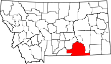 | |
| Town | ||
| CDPs | ||
| Unincorporated communities | ||
| Indian reservations | ||
| Footnotes | ‡This populated place also has portions in an adjacent county or counties | |