Harrison Township, Wells County, Indiana
| Harrison Township | |
|---|---|
| Township | |
|
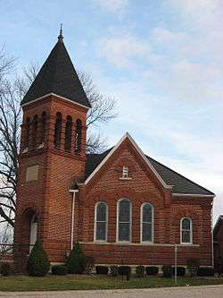
Bethel Methodist Church, a historic site in the township | |
 Location in Wells County | |
| Coordinates: 40°41′35″N 85°08′51″W / 40.69306°N 85.14750°WCoordinates: 40°41′35″N 85°08′51″W / 40.69306°N 85.14750°W | |
| Country | United States |
| State | Indiana |
| County | Wells |
| Government | |
| • Type | Indiana township |
| Area | |
| • Total | 48.26 sq mi (125.0 km2) |
| • Land | 47.83 sq mi (123.9 km2) |
| • Water | 0.43 sq mi (1.1 km2) 0.89% |
| Elevation | 833 ft (254 m) |
| Population (2010) | |
| • Total | 8,531 |
| • Density | 178.4/sq mi (68.9/km2) |
| ZIP codes | 46714, 46781 |
| GNIS feature ID | 453400 |
Harrison Township is one of nine townships in Wells County, Indiana, United States. As of the 2010 census, its population was 8,531 and it contained 3,702 housing units.[1]
History
The Bethel Methodist Episcopal Church was listed on the National Register of Historic Places in 1984.[2]
Geography
According to the 2010 census, the township has a total area of 48.26 square miles (125.0 km2), of which 47.83 square miles (123.9 km2) (or 99.11%) is land and 0.43 square miles (1.1 km2) (or 0.89%) is water.[1]
Cities, towns, villages
Unincorporated towns
- Reiffsburg at 40°39′21″N 85°09′07″W / 40.655879°N 85.151915°W
- Riverside at 40°41′47″N 85°05′07″W / 40.696435°N 85.085247°W
- Travisville at 40°41′31″N 85°12′29″W / 40.691991°N 85.208026°W
(This list is based on USGS data and may include former settlements.)
Adjacent townships
- Lancaster Township (north)
- Kirkland Township, Adams County (northeast)
- French Township, Adams County (east)
- Hartford Township, Adams County (southeast)
- Nottingham Township (south)
- Chester Township (southwest)
- Liberty Township (west)
- Rockcreek Township (northwest)
Cemeteries
The township contains these four cemeteries: Elm Grove, Grove, Linn and Saint Johns.
Rivers
Lakes
- Kunkel Lake
School districts
- Metropolitan School District of Bluffton-Harrison
Political districts
- Indiana's 6th congressional district
- State House District 82
- State Senate District 19
References
- United States Census Bureau 2007 TIGER/Line Shapefiles
- United States Board on Geographic Names (GNIS)
- IndianaMap
- 1 2 "Population, Housing Units, Area, and Density: 2010 - County -- County Subdivision and Place -- 2010 Census Summary File 1". United States Census. Retrieved 2013-05-10.
- ↑ National Park Service (2010-07-09). "National Register Information System". National Register of Historic Places. National Park Service.
External links
Municipalities and communities of Wells County, Indiana, United States | ||
|---|---|---|
| City | ||
| Towns | ||
| Townships | ||
| Unincorporated communities | ||
| Footnotes | ‡This populated place also has portions in an adjacent county or counties | |
This article is issued from Wikipedia - version of the 8/6/2016. The text is available under the Creative Commons Attribution/Share Alike but additional terms may apply for the media files.