Lancaster Township, Wells County, Indiana
| Lancaster Township | |
|---|---|
| Township | |
|
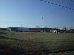
Norwell High School lies along U.S. Route 224 in northwestern Lancaster Township | |
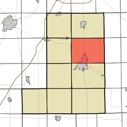 Location in Wells County | |
| Coordinates: 40°47′09″N 85°08′19″W / 40.78583°N 85.13861°WCoordinates: 40°47′09″N 85°08′19″W / 40.78583°N 85.13861°W | |
| Country | United States |
| State | Indiana |
| County | Wells |
| Government | |
| • Type | Indiana township |
| Area | |
| • Total | 47.98 sq mi (124.3 km2) |
| • Land | 47.59 sq mi (123.3 km2) |
| • Water | 0.39 sq mi (1.0 km2) 0.81% |
| Elevation | 850 ft (259 m) |
| Population (2010) | |
| • Total | 5,705 |
| • Density | 119.9/sq mi (46.3/km2) |
| ZIP codes | 46714, 46731, 46733, 46777, 46791 |
| GNIS feature ID | 453540 |
Lancaster Township is one of nine townships in Wells County, Indiana, United States. As of the 2010 census, its population was 5,705 and it contained 2,570 housing units.[1]
Geography
According to the 2010 census, the township has a total area of 47.98 square miles (124.3 km2), of which 47.59 square miles (123.3 km2) (or 99.19%) is land and 0.39 square miles (1.0 km2) (or 0.81%) is water.[1]
Cities, towns, villages
- Bluffton (the county seat) (north half)
Unincorporated towns
- Craigville at 40°46′42″N 85°05′27″W / 40.778380°N 85.090803°W
- Curryville at 40°47′11″N 85°04′19″W / 40.786436°N 85.071913°W
- Murray at 40°47′31″N 85°12′03″W / 40.791992°N 85.200804°W
- North Oaks at 40°46′36″N 85°10′26″W / 40.776714°N 85.173859°W
- Tocsin at 40°49′49″N 85°06′33″W / 40.830278°N 85.109167°W
- Toll Gate Heights at 40°45′26″N 85°09′57″W / 40.757269°N 85.165803°W
(This list is based on USGS data and may include former settlements.)
Adjacent townships
- Jefferson Township (north)
- Preble Township, Adams County (northeast)
- Kirkland Township, Adams County (east)
- Harrison Township (south)
- Liberty Township (southwest)
- Rockcreek Township (west)
- Union Township (northwest)
Cemeteries
The township contains these four cemeteries: Fair View, Murray, Oakland, and Old Bluffton.
Airports and landing strips
- The Lazy K Airport
The "K" stands for Kunkel. Arden G. Kunkel established the grass strip airport in 1963. It is most recently owned and operated by Terry and Annie Hoffmeier. Annie is the youngest daughter of the late Arden G. Kunkel. It is a private airport and is restricted to hours of operation and plane usage. As of May/2013, The Lazy "K" Airport closed the airport/runways down after 50 years of operation.
School districts
- Northern Wells Community Schools
Political districts
- Indiana's 6th congressional district
- State House District 79
- State House District 82
- State Senate District 19
References
- United States Census Bureau 2007 TIGER/Line Shapefiles
- United States Board on Geographic Names (GNIS)
- IndianaMap
- 1 2 "Population, Housing Units, Area, and Density: 2010 - County -- County Subdivision and Place -- 2010 Census Summary File 1". United States Census. Retrieved 2013-05-10.
External links
Municipalities and communities of Wells County, Indiana, United States | ||
|---|---|---|
| City | ||
| Towns | ||
| Townships | ||
| Unincorporated communities | ||
| Footnotes | ‡This populated place also has portions in an adjacent county or counties | |