Harrold, South Dakota
| Harrold, South Dakota | |
|---|---|
| Town | |
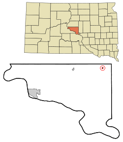 Location in Hughes County and the state of South Dakota | |
 Harrold, South Dakota Location in the United States | |
| Coordinates: 44°31′20″N 99°44′20″W / 44.52222°N 99.73889°WCoordinates: 44°31′20″N 99°44′20″W / 44.52222°N 99.73889°W | |
| Country | United States |
| State | South Dakota |
| County | Hughes |
| Incorporated | 1886[1] |
| Area[2] | |
| • Total | 0.27 sq mi (0.70 km2) |
| • Land | 0.27 sq mi (0.70 km2) |
| • Water | 0 sq mi (0 km2) |
| Elevation | 1,795 ft (547 m) |
| Population (2010)[3] | |
| • Total | 124 |
| • Estimate (2012[4]) | 126 |
| • Density | 459.3/sq mi (177.3/km2) |
| Time zone | Central (CST) (UTC-6) |
| • Summer (DST) | CDT (UTC-5) |
| ZIP code | 57536 |
| Area code(s) | 605 |
| FIPS code | 46-27420[5] |
| GNIS feature ID | 1255449[6] |
Harrold is a town in Hughes County, South Dakota, United States. It is part of the Pierre, South Dakota Micropolitan Statistical Area. The population was 124 at the 2010 census.
History
The first settlement at Harrold was made in 1881.[7] A post office was established as Harold in 1882, and the name was changed to Harrold in 1890.[8] The town was named in honor of a railroad official.[9]
Geography
Harrold is located at 44°31′20″N 99°44′20″W / 44.52222°N 99.73889°W (44.522198, -99.738878).[10]
According to the United States Census Bureau, the town has a total area of 0.27 square miles (0.70 km2), all of it land.[2]
Harrold has been assigned the ZIP code 57536.
Demographics
| Historical population | |||
|---|---|---|---|
| Census | Pop. | %± | |
| 1900 | 57 | — | |
| 1910 | 230 | 303.5% | |
| 1920 | 252 | 9.6% | |
| 1930 | 309 | 22.6% | |
| 1940 | 229 | −25.9% | |
| 1950 | 263 | 14.8% | |
| 1960 | 255 | −3.0% | |
| 1970 | 184 | −27.8% | |
| 1980 | 196 | 6.5% | |
| 1990 | 167 | −14.8% | |
| 2000 | 209 | 25.1% | |
| 2010 | 124 | −40.7% | |
| Est. 2015 | 124 | [11] | 0.0% |
2010 census
As of the census[3] of 2010, there were 124 people, 57 households, and 36 families residing in the town. The population density was 459.3 inhabitants per square mile (177.3/km2). There were 74 housing units at an average density of 274.1 per square mile (105.8/km2). The racial makeup of the town was 95.2% White, 0.8% African American, 1.6% Native American, and 2.4% from two or more races.
There were 57 households of which 26.3% had children under the age of 18 living with them, 50.9% were married couples living together, 1.8% had a female householder with no husband present, 10.5% had a male householder with no wife present, and 36.8% were non-families. 28.1% of all households were made up of individuals and 12.3% had someone living alone who was 65 years of age or older. The average household size was 2.18 and the average family size was 2.64.
The median age in the town was 49.8 years. 19.4% of residents were under the age of 18; 3.9% were between the ages of 18 and 24; 18.6% were from 25 to 44; 39.6% were from 45 to 64; and 18.5% were 65 years of age or older. The gender makeup of the town was 50.8% male and 49.2% female.
2000 census
As of the census[5] of 2000, there were 209 people, 83 households, and 49 families residing in the town. The population density was 786.0 people per square mile (298.9/km²). There were 90 housing units at an average density of 338.5 per square mile (128.7/km²). The racial makeup of the town was 98.56% White, 0.48% Native American, and 0.96% from two or more races. Hispanic or Latino of any race were 2.87% of the population.
There were 83 households out of which 33.7% had children under the age of 18 living with them, 55.4% were married couples living together, 2.4% had a female householder with no husband present, and 39.8% were non-families. 37.3% of all households were made up of individuals and 22.9% had someone living alone who was 65 years of age or older. The average household size was 2.52 and the average family size was 3.46.
In the town the population was spread out with 32.1% under the age of 18, 5.3% from 18 to 24, 28.2% from 25 to 44, 17.7% from 45 to 64, and 16.7% who were 65 years of age or older. The median age was 35 years. For every 100 females there were 91.7 males. For every 100 females age 18 and over, there were 94.5 males.
The median income for a household in the town was $27,083, and the median income for a family was $36,071. Males had a median income of $29,375 versus $21,667 for females. The per capita income for the town was $14,725. About 6.0% of families and 8.8% of the population were below the poverty line, including 5.1% of those under the age of eighteen and 22.2% of those sixty five or over.
Notable residents
- Nicole Cuppy Miss South Dakota Teen USA 2003
References
- ↑ "SD Towns" (PDF). South Dakota State Historical Society. Retrieved 2010-02-13.
- 1 2 "US Gazetteer files 2010". United States Census Bureau. Retrieved 2012-06-21.
- 1 2 "American FactFinder". United States Census Bureau. Retrieved 2012-06-21.
- ↑ "Population Estimates". United States Census Bureau. Retrieved 2013-05-29.
- 1 2 "American FactFinder". United States Census Bureau. Retrieved 2008-01-31.
- ↑ "US Board on Geographic Names". United States Geological Survey. 2007-10-25. Retrieved 2008-01-31.
- ↑ Federal Writers' Project (1940). South Dakota place-names, v.1-3. University of South Dakota. p. 40.
- ↑ "Hughes County". Jim Forte Postal History. Retrieved 20 March 2015.
- ↑ Chicago and North Western Railway Company (1908). A History of the Origin of the Place Names Connected with the Chicago & North Western and Chicago, St. Paul, Minneapolis & Omaha Railways. p. 82.
- ↑ "US Gazetteer files: 2010, 2000, and 1990". United States Census Bureau. 2011-02-12. Retrieved 2011-04-23.
- ↑ "Annual Estimates of the Resident Population for Incorporated Places: April 1, 2010 to July 1, 2015". Retrieved July 2, 2016.
- ↑ "Census of Population and Housing". Census.gov. Retrieved June 4, 2015.
Municipalities and communities of Hughes County, South Dakota, United States | ||
|---|---|---|
| Cities | 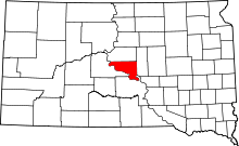 | |
| Town | ||
| Indian reservation | ||
| Unincorporated communities | ||
| Footnotes | ‡This populated place also has portions in an adjacent county or counties | |