Hartford, Alabama
| Hartford | |
|---|---|
| City | |
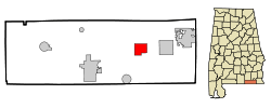 Location in Geneva County and the state of Alabama | |
| Coordinates: 31°6′13″N 85°41′40″W / 31.10361°N 85.69444°W | |
| Country | United States |
| State | Alabama |
| County | Geneva |
| Area | |
| • Total | 6.2 sq mi (16.1 km2) |
| • Land | 6.2 sq mi (16.1 km2) |
| • Water | 0 sq mi (0 km2) |
| Elevation | 272 ft (83 m) |
| Population (2000) | |
| • Total | 2,369 |
| • Density | 382.1/sq mi (147.1/km2) |
| Time zone | Central (CST) (UTC-6) |
| • Summer (DST) | CDT (UTC-5) |
| ZIP code | 36344 |
| Area code(s) | 334 |
| FIPS code | 01-33424 |
| GNIS feature ID | 0151801 |
Hartford is a city in Geneva County, Alabama, United States. It incorporated in 1896.[1] It is part of the Dothan, Alabama Metropolitan Statistical Area. At the 2010 census the population was 2,624, up from 2,369 in 2000.
Geography
Hartford is located at 31°6′13″N 85°41′40″W / 31.10361°N 85.69444°W (31.103664, -85.694544).[2]
According to the U.S. Census Bureau, the city has a total area of 6.2 square miles (16 km2), of which 6.2 square miles (16 km2) is land and 0.16% is water.
Demographics
| Historical population | |||
|---|---|---|---|
| Census | Pop. | %± | |
| 1900 | 382 | — | |
| 1910 | 1,159 | 203.4% | |
| 1920 | 1,561 | 34.7% | |
| 1930 | 1,419 | −9.1% | |
| 1940 | 1,494 | 5.3% | |
| 1950 | 1,655 | 10.8% | |
| 1960 | 1,956 | 18.2% | |
| 1970 | 2,648 | 35.4% | |
| 1980 | 2,647 | 0.0% | |
| 1990 | 2,448 | −7.5% | |
| 2000 | 2,369 | −3.2% | |
| 2010 | 2,624 | 10.8% | |
| Est. 2015 | 2,647 | [3] | 0.9% |
| U.S. Decennial Census[4] 2013 Estimate[5] | |||
As of the census[6] of 2000, there were 2,369 people, 966 households, and 647 families residing in the city. The population density was 380.1 people per square mile (146.8/km²). There were 1,121 housing units at an average density of 179.9 per square mile (69.5/km²). The racial makeup of the city was 79.11% White, 19.63% Black or African American, 0.42% Native American, 0.30% from other races, and 0.55% from two or more races. 1.69% of the population were Hispanic or Latino of any race.
There were 966 households out of which 27.3% had children under the age of 18 living with them, 49.0% were married couples living together, 13.8% had a female householder with no husband present, and 33.0% were non-families. 31.1% of all households were made up of individuals and 15.0% had someone living alone who was 65 years of age or older. The average household size was 2.35 and the average family size was 2.90.
In the city the population was spread out with 22.9% under the age of 18, 6.4% from 18 to 24, 24.1% from 25 to 44, 24.5% from 45 to 64, and 22.1% who were 65 years of age or older. The median age was 43 years. For every 100 females there were 84.5 males. For every 100 females age 18 and over, there were 77.5 males.
The median income for a household in the city was $23,324, and the median income for a family was $30,919. Males had a median income of $25,843 versus $21,838 for females. The per capita income for the city was $13,290. About 19.9% of families and 19.8% of the population were below the poverty line, including 29.0% of those under age 18 and 19.1% of those age 65 or over.
2010 census
As of the census[7] of 2010, there were 2,624 people, 1,059 households, and 677 families residing in the city. The population density was 423.2 people per square mile (163.0/km²). There were 1,196 housing units at an average density of 192.9 per square mile (74.9/km²). The racial makeup of the city was 77.9% White, 17.9% Black or African American, 0.6% Native American, 1.8% from other races, and 1.8% from two or more races. 3.1% of the population were Hispanic or Latino of any race.
There were 1,059 households out of which 23.0% had children under the age of 18 living with them, 44.3% were married couples living together, 15.6% had a female householder with no husband present, and 36.1% were non-families. 32.5% of all households were made up of individuals and 16.2% had someone living alone who was 65 years of age or older. The average household size was 2.40 and the average family size was 3.02.
In the city the population was spread out with 21.8% under the age of 18, 9.5% from 18 to 24, 20.9% from 25 to 44, 26.1% from 45 to 64, and 21.6% who were 65 years of age or older. The median age was 42.9 years. For every 100 females there were 87.0 males. For every 100 females age 18 and over, there were 94.0 males.
The median income for a household in the city was $26,086, and the median income for a family was $36,900. Males had a median income of $31,505 versus $17,369 for females. The per capita income for the city was $16,507. About 14.9% of families and 21.1% of the population were below the poverty line, including 16.0% of those under age 18 and 20.6% of those age 65 or over.
Notable people
- Ralph Brown Draughon, president of Auburn University from 1947 to 1965
- Dixie Howell, member of the College Football Hall of Fame. He played for the University of Alabama
- Scott Peacock, award-winning chef of American Southern cuisine
- Early Wynn, born in Hartford, member of the Baseball Hall of Fame[8]
References
- ↑ http://www.encyclopediaofalabama.org/article/h-3263
- ↑ "US Gazetteer files: 2010, 2000, and 1990". United States Census Bureau. 2011-02-12. Retrieved 2011-04-23.
- ↑ "Annual Estimates of the Resident Population for Incorporated Places: April 1, 2010 to July 1, 2015". Retrieved July 2, 2016.
- ↑ "U.S. Decennial Census". Census.gov. Retrieved June 6, 2013.
- ↑ "Annual Estimates of the Resident Population: April 1, 2010 to July 1, 2013". Retrieved June 3, 2014.
- ↑ "American FactFinder". United States Census Bureau. Retrieved 2008-01-31.
- ↑ "American FactFinder". United States Census Bureau. Retrieved 2015-07-24.
- ↑ Reichler, Joseph L., ed. (1979) [1969]. The Baseball Encyclopedia (4th ed.). New York: Macmillan Publishing. ISBN 0-02-578970-8.
Coordinates: 31°06′13″N 85°41′40″W / 31.103664°N 85.694544°W
Municipalities and communities of Geneva County, Alabama, United States | ||
|---|---|---|
| Cities | 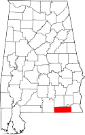 | |
| Towns | ||
| CDP | ||
| Unincorporated communities | ||
| Footnotes | ‡This populated place also has portions in an adjacent county or counties | |