Hatfield, Massachusetts
| Hatfield, Massachusetts | ||
|---|---|---|
| Town | ||
|
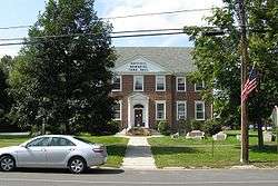
Hatfield Memorial Town Hall | ||
| ||
| Motto: Industry, prosperity | ||
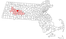 Location in Hampshire County in Massachusetts | ||
| Coordinates: 42°22′15″N 72°35′55″W / 42.37083°N 72.59861°WCoordinates: 42°22′15″N 72°35′55″W / 42.37083°N 72.59861°W | ||
| Country | United States | |
| State | Massachusetts | |
| County | Hampshire | |
| Settled | 1661 | |
| Incorporated | 1670 | |
| Government | ||
| • Type | Open town meeting | |
| Area | ||
| • Total | 16.8 sq mi (43.6 km2) | |
| • Land | 16.0 sq mi (41.5 km2) | |
| • Water | 0.8 sq mi (2.1 km2) | |
| Elevation | 129 ft (39 m) | |
| Population (2010) | ||
| • Total | 3,279 | |
| • Density | 202.8/sq mi (78.3/km2) | |
| Time zone | Eastern (UTC-5) | |
| • Summer (DST) | Eastern (UTC-4) | |
| ZIP code | 01038, 01088, 01066 | |
| Area code(s) | 413 | |
| FIPS code | 25-29265 | |
| GNIS feature ID | 0618202 | |
| Website | www.townofhatfield.org | |

Hatfield is a town in Hampshire County, Massachusetts, United States. The population was 3,249 at the 2000 census. It is part of the Springfield, Massachusetts Metropolitan Statistical Area.
Part of the town is included in the census-designated place of Hatfield.
History

Hatfield was founded in 1660 on land granted to General Daniel Dennison and Governor William Bradford. It was formally incorporated as a town in 1670 and has a Board of Selectmen and annual town meeting.
As a center for agriculture the region produced cattle, sheep, corn, and tobacco. At first their relations with the local Native Americans were very welcoming on both sides. On October 16, 1675 a substantial part of the town was destroyed in King Philip's War, and surviving settlers sought refuge in Springfield.
During the American Revolution, Hatfield was an important source of supplies and men for the rebels. In 1786 the town was used as an assembly area for the discontented who became involved in Shays' Rebellion.
One family supplied many of Hatfield's physicians for generations. The Hastings family, descendants of English Puritan immigrant Thomas Hastings, was originally settled at Watertown, but within a generation members of the family had relocated to Hatfield, where they produced a succession of Hatfield physicians, including Dr. Thomas Hastings (1652–1712); Dr. Thomas Hastings (1679–1728); Dr. Waitstill Hastings (1714–1748); and Dr. John Hastings (1765–1845).[1] The first Thomas Hastings, aside from serving as physician to Hatfield and surrounding communities, was also the town's first schoolteacher.[2] He authored a contemporary account of the devastating Indian attack on nearby Deerfield in 1704.
Hatfield was also the birthplace and hometown of Sophia Smith (1796-1870), the founder of both Smith Academy (the Hatfield Public High School), and Smith College, the famous women's college. Another notable resident is Rebecca Dickinson (1738-1812), a never-married gownmaker whose surviving diary, preserved in the collections of the Pocumtuck Valley Memorial Association in Deerfield, Massachusetts, has served as the basis for scholarship in early American women's history.[3]
Geography
Hatfield is located on the west bank of the Connecticut River at the mouth of the Mill River, 25 miles north of Springfield and about 100 miles west of Boston. It is bordered to the west by Horse Mountain (a typical New England granite glacial remnant), to the north by the town of Whately and to the south by a bend in the Connecticut River, and Northampton.
According to the United States Census Bureau, the town has a total area of 16.8 square miles (43.6 km²), of which 16.0 square miles (41.5 km²) is land and 0.8 square mile (2.1 km²) (4.82%) is water.
Demographics
| Historical population | ||
|---|---|---|
| Year | Pop. | ±% |
| 1850 | 1,073 | — |
| 1860 | 1,337 | +24.6% |
| 1870 | 1,594 | +19.2% |
| 1880 | 1,495 | −6.2% |
| 1890 | 1,246 | −16.7% |
| 1900 | 1,500 | +20.4% |
| 1910 | 1,986 | +32.4% |
| 1920 | 2,651 | +33.5% |
| 1930 | 2,476 | −6.6% |
| 1940 | 2,216 | −10.5% |
| 1950 | 2,179 | −1.7% |
| 1960 | 2,350 | +7.8% |
| 1970 | 2,825 | +20.2% |
| 1980 | 3,045 | +7.8% |
| 1990 | 3,184 | +4.6% |
| 2000 | 3,249 | +2.0% |
| 2010 | 3,279 | +0.9% |
As of the census[4] of 2000, there were 3,249 people, 1,381 households, and 871 families residing in the town. The population density was 202.8 people per square mile (78.3/km²). There were 1,431 housing units at an average density of 89.3 per square mile (34.5/km²). The racial makeup of the town was 98.03% White, 0.22% Black or African American, 0.12% Native American, 0.49% Asian, 0.06% Pacific Islander, 0.58% from other races, and 0.49% from two or more races. Hispanic or Latino of any race were 1.05% of the population.
There were 1,381 households out of which 27.6% had children under the age of 18 living with them, 53.1% were married couples living together, 7.5% had a female householder with no husband present, and 36.9% were non-families. 29.3% of all households were made up of individuals and 13.8% had someone living alone who was 65 years of age or older. The average household size was 2.35 and the average family size was 2.96.
In the town the population was spread out with 20.7% under the age of 18, 5.4% from 18 to 24, 27.2% from 25 to 44, 29.9% from 45 to 64, and 16.7% who were 65 years of age or older. The median age was 43 years. For every 100 females there were 95.0 males. For every 100 females age 18 and over, there were 90.7 males.
The median income for a household in the town was $50,238, and the median income for a family was $61,607. Males had a median income of $39,414 versus $35,042 for females. The per capita income for the town was $24,813. About 1.4% of families and 2.8% of the population were below the poverty line, including 1.2% of those under age 18 and 6.1% of those age 65 or over.
School system
Hatfield has two public schools; an elementary school and a high school. Hatfield Elementary school ranges from grades pre-6. The high school, Smith Academy, is grades 7-12; with just over 190 students, it is the smallest public school in the state of Massachusetts.
Points of interest
References
- ↑ A History of Hatfield, Massachusetts, in Three Parts, Daniel White Wells, Reuben Field Wells, Published by F. C. H. Gibbons, Springfield, Massachusetts, 1910
- ↑ Herbert B. Adams: Tributes of Friends, with a Bibliography of the Department of History, Politics and Economics of the Johns Hopkins University, The Johns Hopkins Press, Baltimore, 1902
- ↑ Works include Miller, Marla (2013). Rebecca Dickinson: Independence for a New England Woman. Boulder, CO: Westview Press. ISBN 9780813347660.
- ↑ "American FactFinder". United States Census Bureau. Retrieved 2008-01-31.
External links
| Wikimedia Commons has media related to Hatfield, Massachusetts. |
- Town of Hatfield, Massachusetts - official website
- Town of Hatfield official GIS Maps and Online Property Information
- Hatfield Business Association
Municipalities and communities of Hampshire County, Massachusetts, United States | ||
|---|---|---|
| Cities |  | |
| Towns | ||
| CDPs | ||
| Other villages | ||
| Footnotes | ‡This populated place also has portions in an adjacent county or counties | |