Hawkins, Wisconsin
| Hawkins, Wisconsin | |
|---|---|
| Village | |
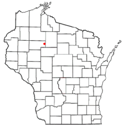 Location of Hawkins, Wisconsin | |
| Coordinates: 45°29′49″N 90°43′0″W / 45.49694°N 90.71667°WCoordinates: 45°29′49″N 90°43′0″W / 45.49694°N 90.71667°W | |
| Country | United States |
| State | Wisconsin |
| County | Rusk |
| Area[1] | |
| • Total | 2.22 sq mi (5.75 km2) |
| • Land | 2.21 sq mi (5.72 km2) |
| • Water | 0.01 sq mi (0.03 km2) |
| Elevation[2] | 1,342 ft (409 m) |
| Population (2010)[3] | |
| • Total | 305 |
| • Estimate (2012[4]) | 291 |
| • Density | 138.0/sq mi (53.3/km2) |
| Time zone | Central (CST) (UTC-6) |
| • Summer (DST) | CDT (UTC-5) |
| Area code(s) | 715 & 534 |
| FIPS code | 55-33300[5] |
| GNIS feature ID | 1583367[2] |
Hawkins is a village in Rusk County, Wisconsin, United States. The population was 305 at the 2010 census. The village is located within the Town of Hawkins.
Geography
Hawkins is located at 45°30′44″N 90°42′48″W / 45.51222°N 90.71333°W (45.512448, -90.713483).[6]
According to the United States Census Bureau, the village has a total area of 2.22 square miles (5.75 km2), of which 2.21 square miles (5.72 km2) is land and 0.01 square miles (0.03 km2) is water.[1]
Demographics
| Historical population | |||
|---|---|---|---|
| Census | Pop. | %± | |
| 1930 | 372 | — | |
| 1940 | 496 | 33.3% | |
| 1950 | 414 | −16.5% | |
| 1960 | 402 | −2.9% | |
| 1970 | 385 | −4.2% | |
| 1980 | 407 | 5.7% | |
| 1990 | 375 | −7.9% | |
| 2000 | 317 | −15.5% | |
| 2010 | 305 | −3.8% | |
| Est. 2015 | 284 | [7] | −6.9% |
2010 census
As of the census[3] of 2010, there were 305 people, 159 households, and 84 families residing in the village. The population density was 138.0 inhabitants per square mile (53.3/km2). There were 182 housing units at an average density of 82.4 per square mile (31.8/km2). The racial makeup of the village was 97.0% White, 0.3% Native American, 0.3% Asian, 0.3% from other races, and 2.0% from two or more races.
There were 159 households of which 18.9% had children under the age of 18 living with them, 40.9% were married couples living together, 7.5% had a female householder with no husband present, 4.4% had a male householder with no wife present, and 47.2% were non-families. 40.9% of all households were made up of individuals and 18.8% had someone living alone who was 65 years of age or older. The average household size was 1.92 and the average family size was 2.56.
The median age in the village was 47.5 years. 17.7% of residents were under the age of 18; 2.7% were between the ages of 18 and 24; 21.9% were from 25 to 44; 36.1% were from 45 to 64; and 21.6% were 65 years of age or older. The gender makeup of the village was 52.5% male and 47.5% female.
2000 census
As of the census[5] of 2000, there were 317 people, 138 households, and 92 families residing in the village. The population density was 144.8 people per square mile (55.9/km²). There were 147 housing units at an average density of 67.2 per square mile (25.9/km²). The racial makeup of the village was 98.11% White, 0.32% from other races, and 1.58% from two or more races. 0.00% of the population were Hispanic or Latino of any race.
There were 138 households out of which 22.5% had children under the age of 18 living with them, 56.5% were married couples living together, 6.5% had a female householder with no husband present, and 33.3% were non-families. 26.1% of all households were made up of individuals and 12.3% had someone living alone who was 65 years of age or older. The average household size was 2.30 and the average family size was 2.79.
In the village the population was spread out with 19.2% under the age of 18, 10.7% from 18 to 24, 24.9% from 25 to 44, 24.6% from 45 to 64, and 20.5% who were 65 years of age or older. The median age was 42 years. For every 100 females there were 105.8 males. For every 100 females age 18 and over, there were 101.6 males.
The median income for a household in the village was $29,286, and the median income for a family was $39,250. Males had a median income of $28,250 versus $23,393 for females. The per capita income for the village was $17,159. About 3.2% of families and 3.6% of the population were below the poverty line, including none of those under age 18 and 10.8% of those age 65 or over.
References
- 1 2 "US Gazetteer files 2010". United States Census Bureau. Retrieved 2012-11-18.
- 1 2 "US Board on Geographic Names". United States Geological Survey. 2007-10-25. Retrieved 2008-01-31.
- 1 2 "American FactFinder". United States Census Bureau. Retrieved 2012-11-18.
- ↑ "Population Estimates". United States Census Bureau. Retrieved 2013-06-24.
- 1 2 "American FactFinder". United States Census Bureau. Retrieved 2008-01-31.
- ↑ "US Gazetteer files: 2010, 2000, and 1990". United States Census Bureau. 2011-02-12. Retrieved 2011-04-23.
- ↑ "Annual Estimates of the Resident Population for Incorporated Places: April 1, 2010 to July 1, 2015". Retrieved July 2, 2016.
- ↑ "Census of Population and Housing". Census.gov. Retrieved June 4, 2015.
External links
Municipalities and communities of Rusk County, Wisconsin, United States | ||
|---|---|---|
| City | 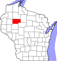 | |
| Villages | ||
| Towns | ||
| Unincorporated communities | ||