Hayden, Alabama
| Hayden, Alabama | |
|---|---|
| Town | |
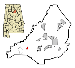 Location in Blount County and the state of Alabama | |
| Coordinates: 33°53′36″N 86°45′25″W / 33.89333°N 86.75694°W | |
| Country | United States |
| State | Alabama |
| County | Blount |
| Area | |
| • Total | 1.1 sq mi (2.9 km2) |
| • Land | 1.1 sq mi (2.9 km2) |
| • Water | 0 sq mi (0 km2) |
| Elevation | 564 ft (172 m) |
| Population (2010) | |
| • Total | 444 |
| • Density | 397/sq mi (153.1/km2) |
| Time zone | Central (CST) (UTC-6) |
| • Summer (DST) | CDT (UTC-5) |
| ZIP code | 35079 |
| Area code(s) | 205 |
| FIPS code | 01-33640 |
| GNIS feature ID | 0119877 |
| Website |
www |
Hayden is a town in Blount County, Alabama, United States. At the 2010 census the population was 444.[1]
Geography
Hayden is located in southwestern Blount County at 33°53'36.236" North, 86°45'25.139" West (33.893399, -86.756983).[2] Hayden Mountain is a broad, low ridge that rises to the northwest above the town. Alabama State Route 160 passes through the center of the town, leading 5 miles (8 km) southwest to Interstate 65 north of Warrior, and northeast 13 miles (21 km) to Cleveland.
According to the U.S. Census Bureau, the town of Hayden has a total area of 1.1 square miles (2.9 km2), all land.[1]
Demographics
| Historical population | |||
|---|---|---|---|
| Census | Pop. | %± | |
| 1950 | 203 | — | |
| 1960 | 187 | −7.9% | |
| 1970 | 195 | 4.3% | |
| 1980 | 268 | 37.4% | |
| 1990 | 385 | 43.7% | |
| 2000 | 470 | 22.1% | |
| 2010 | 444 | −5.5% | |
| Est. 2015 | 1,341 | [3] | 202.0% |
| U.S. Decennial Census[4] 2013 Estimate[5] | |||
At the 2000 census,[6] there were 470 people, 191 households and 136 families residing in the town. The population density was 499.1 per square mile (193.1/km²). There were 207 housing units at an average density of 219.8 per square mile (85.0/km²). The racial makeup of the town was 91.91% White, 6.60% Black or African American, 0.64% Native American, 0.43% Asian, and 0.43% from two or more races. 0.21% of the population were Hispanic or Latino of any race.
There were 191 households of which 35.6% had children under the age of 18 living with them, 59.2% were married couples living together, 10.5% had a female householder with no husband present, and 28.3% were non-families. 26.7% of all households were made up of individuals and 8.9% had someone living alone who was 65 years of age or older. The average household size was 2.46 and the average family size was 2.98.
Age distribution was 26.8% under the age of 18, 9.6% from 18 to 24, 28.3% from 25 to 44, 25.3% from 45 to 64, and 10.0% who were 65 years of age or older. The median age was 36 years. For every 100 females there were 93.4 males. For every 100 females age 18 and over, there were 88.0 males.
The median household income was $31,484, and the median family income was $36,667. Males had a median income of $30,667 versus $17,375 for females. The per capita income for the town was $14,435. About 10.7% of families and 11.0% of the population were below the poverty line, including 6.9% of those under age 18 and 20.3% of those age 65 or over.
Notable person
- Gerald Swindle, professional bass angler who was named 2004 Bassmaster Angler of the Year
References
- 1 2 "Geographic Identifiers: 2010 Demographic Profile Data (G001): Hayden town, Alabama". U.S. Census Bureau, American Factfinder. Retrieved September 17, 2013.
- ↑ "US Gazetteer files: 2010, 2000, and 1990". United States Census Bureau. 2011-02-12. Retrieved 2011-04-23.
- ↑ "Annual Estimates of the Resident Population for Incorporated Places: April 1, 2010 to July 1, 2015". Retrieved July 2, 2016.
- ↑ "U.S. Decennial Census". Census.gov. Retrieved June 6, 2013.
- ↑ "Annual Estimates of the Resident Population: April 1, 2010 to July 1, 2013". Retrieved June 3, 2014.
- ↑ "American FactFinder". United States Census Bureau. Retrieved 2008-01-31.
External links
- Town of Hayden official website
- West Blount Park, local youth ballpark
Coordinates: 33°53′36″N 86°45′25″W / 33.893399°N 86.756983°W
Municipalities and communities of Blount County, Alabama, United States | ||
|---|---|---|
| Cities | 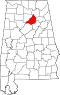 | |
| Towns | ||
| CDP | ||
| Unincorporated communities | ||
| Footnotes | ‡This populated place also has portions in an adjacent county or counties | |