Healdton, Oklahoma
| Healdton, Oklahoma | |
|---|---|
| City | |
 Location of Healdton, Oklahoma | |
| Coordinates: 34°13′54″N 97°29′4″W / 34.23167°N 97.48444°WCoordinates: 34°13′54″N 97°29′4″W / 34.23167°N 97.48444°W | |
| Country | United States |
| State | Oklahoma |
| County | Carter |
| Area | |
| • Total | 14.4 sq mi (37.2 km2) |
| • Land | 14.1 sq mi (36.6 km2) |
| • Water | 0.3 sq mi (0.7 km2) |
| Elevation | 965 ft (294 m) |
| Population (2010) | |
| • Total | 2,788 |
| • Density | 197/sq mi (76.2/km2) |
| Time zone | Central (CST) (UTC-6) |
| • Summer (DST) | CDT (UTC-5) |
| ZIP code | 73438 |
| Area code(s) | 580 |
| FIPS code | 40-33350[1] |
| GNIS feature ID | 1093636[2] |
Healdton is a city in Carter County, Oklahoma, United States. The population was 2,788 at the 2010 census.[3] It is part of the Ardmore, Oklahoma Micropolitan Statistical Area.
Geography
Healdton is located in western Carter County at 34°13′54″N 97°29′4″W / 34.23167°N 97.48444°W (34.231557, -97.484454).[4] Oklahoma State Highway 76 passes through the city, leading south 5 miles (8 km) to U.S. Route 70 west of Wilson and north 5 miles (8 km) to Oklahoma State Highway 53. Ardmore, the Carter County seat, is 23 miles (37 km) to the east via OK-76 and US-70.
According to the United States Census Bureau, Healdton has a total area of 14.4 square miles (37.3 km2), of which 14.1 square miles (36.6 km2) is land and 0.27 square miles (0.7 km2), or 1.86%, is water.[3]
Climate
| Climate data for Healdton, Oklahoma | |||||||||||||
|---|---|---|---|---|---|---|---|---|---|---|---|---|---|
| Month | Jan | Feb | Mar | Apr | May | Jun | Jul | Aug | Sep | Oct | Nov | Dec | Year |
| Average high °F (°C) | 52.5 (11.4) |
58.1 (14.5) |
67.7 (19.8) |
76.5 (24.7) |
82.9 (28.3) |
90.2 (32.3) |
96.3 (35.7) |
96.2 (35.7) |
87.5 (30.8) |
77.8 (25.4) |
65.1 (18.4) |
55.1 (12.8) |
75.5 (24.2) |
| Average low °F (°C) | 26.2 (−3.2) |
30.7 (−0.7) |
40.0 (4.4) |
49.7 (9.8) |
57.8 (14.3) |
65.7 (18.7) |
69.5 (20.8) |
68.2 (20.1) |
61.8 (16.6) |
50.2 (10.1) |
39.5 (4.2) |
29.4 (−1.4) |
49.1 (9.5) |
| Average precipitation inches (mm) | 1.4 (36) |
1.8 (46) |
2.9 (74) |
3.4 (86) |
5.1 (130) |
4.2 (107) |
2.0 (51) |
2.4 (61) |
4.5 (114) |
3.6 (91) |
2.3 (58) |
1.7 (43) |
35.3 (897) |
| Source #1: weather.com | |||||||||||||
| Source #2: Weatherbase [5] | |||||||||||||
Demographics
| Historical population | |||
|---|---|---|---|
| Census | Pop. | %± | |
| 1920 | 2,157 | — | |
| 1930 | 2,017 | −6.5% | |
| 1940 | 2,067 | 2.5% | |
| 1950 | 2,578 | 24.7% | |
| 1960 | 2,898 | 12.4% | |
| 1970 | 2,324 | −19.8% | |
| 1980 | 3,769 | 62.2% | |
| 1990 | 2,872 | −23.8% | |
| 2000 | 2,786 | −3.0% | |
| 2010 | 2,788 | 0.1% | |
| Est. 2015 | 2,776 | [6] | −0.4% |
As of the census[1] of 2000, there were 2,786 people, 1,132 households, and 776 families residing in the city. The population density was 197.4 people per square mile (76.2/km²). There were 1,369 housing units at an average density of 97.0 per square mile (37.5/km²). The racial makeup of the city was 87.08% White, 0.93% African American, 7.47% Native American, 0.11% Asian, 0.04% Pacific Islander, 0.86% from other races, and 3.52% from two or more races. Hispanic or Latino of any race were 1.54% of the population.
There were 1,132 households out of which 29.9% had children under the age of 18 living with them, 54.7% were married couples living together, 10.8% had a female householder with no husband present, and 31.4% were non-families. 28.4% of all households were made up of individuals and 15.1% had someone living alone who was 65 years of age or older. The average household size was 2.39 and the average family size was 2.92.
In the city the population was spread out with 24.0% under the age of 18, 9.0% from 18 to 24, 25.9% from 25 to 44, 22.8% from 45 to 64, and 18.4% who were 65 years of age or older. The median age was 40 years. For every 100 females there were 90.8 males. For every 100 females age 18 and over, there were 88.7 males.
The median income for a household in the city was $23,550, and the median income for a family was $29,363. Males had a median income of $25,636 versus $20,865 for females. The per capita income for the city was $12,842. About 16.8% of families and 21.5% of the population were below the poverty line, including 28.1% of those under age 18 and 13.2% of those age 65 or over.
Notable people
- Emmy Award-winning actress Rue McClanahan was born in Healdton.
- University of Oklahoma women's head basketball coach Sherri Coale is from Healdton.
Popular culture
The music video for Radar Bros. "Brother Rabbit" was partially shot in Healdton and directed by The General Assembly.
References
- 1 2 "American FactFinder". United States Census Bureau. Retrieved 2008-01-31.
- ↑ "US Board on Geographic Names". United States Geological Survey. 2007-10-25. Retrieved 2008-01-31.
- 1 2 "Geographic Identifiers: 2010 Demographic Profile Data (G001): Healdton city, Oklahoma". U.S. Census Bureau, American Factfinder. Retrieved February 6, 2015.
- ↑ "US Gazetteer files: 2010, 2000, and 1990". United States Census Bureau. 2011-02-12. Retrieved 2011-04-23.
- ↑ "Weatherbase: Historical Weather for Healdton, Oklahoma, United States".
- ↑ "Annual Estimates of the Resident Population for Incorporated Places: April 1, 2010 to July 1, 2015". Retrieved July 2, 2016.
- ↑ "Census of Population and Housing". Census.gov. Retrieved June 4, 2015.
External links
Municipalities and communities of Carter County, Oklahoma, United States | ||
|---|---|---|
| Cities | 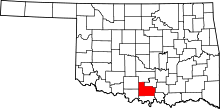 | |
| Towns | ||
| Unincorporated communities | ||
| Ghost towns | ||
| Footnotes | ‡This populated place also has portions in an adjacent county or counties | |
| Ardmore |
| |
|---|---|---|
| Healdton |
| |
| Tatums | ||
| Wilson |
| |