Hebron, Ohio
| Hebron, Ohio | |
|---|---|
| Village | |
|
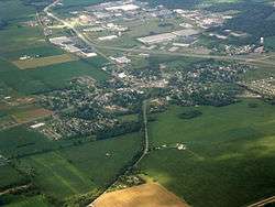
Aerial photograph of Hebron | |
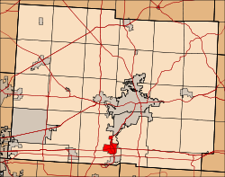
 Location of Hebron, Ohio | |
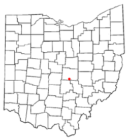
 Location of Hebron in Licking County | |
| Coordinates: 39°57′47″N 82°29′32″W / 39.96306°N 82.49222°WCoordinates: 39°57′47″N 82°29′32″W / 39.96306°N 82.49222°W | |
| Country | United States |
| State | Ohio |
| County | Licking |
| Area[1] | |
| • Total | 3.07 sq mi (7.95 km2) |
| • Land | 3.07 sq mi (7.95 km2) |
| • Water | 0 sq mi (0 km2) |
| Elevation[2] | 889 ft (271 m) |
| Population (2010)[3] | |
| • Total | 2,336 |
| • Estimate (2012[4]) | 2,350 |
| • Density | 760.9/sq mi (293.8/km2) |
| Time zone | Eastern (EST) (UTC-5) |
| • Summer (DST) | EDT (UTC-4) |
| ZIP codes | 43025, 43098 |
| Area code(s) | 740 |
| FIPS code | 39-34790[5] |
| GNIS feature ID | 1041450[2] |
Hebron is a village in Licking County, Ohio, United States. The population was 2,336 at the 2010 census. Hebron is under the Lakewood Local School district which includes Hebron Elementary and nearby Lakewood middle and high schools.
Geography
Hebron is located at 39°57′47″N 82°29′32″W / 39.96306°N 82.49222°W (39.963125, -82.492235).[6]
According to the United States Census Bureau, the village has a total area of 3.07 square miles (7.95 km2), all land.[1]
Activities
The locals of Hebron are able to enjoy a variety of entertainment options even though the village itself is rural. In the town of Hebron itself, the residents and visitors can use Canal park for recreation. It includes an open field for pets and field activities, and a park for the children. There is also a softball park, a playground behind an ice cream place called Hayman's Dairy Bar and a park named Evans Park where people can participate in football, base ball, or riding a bike/walking around the path it offers. This park also has a small playground, and is a popular place to find bees in the early spring months.Every year, during the first weekend of September the Route 40 Festival features live music and local vendors.
Demographics
| Historical population | |||
|---|---|---|---|
| Census | Pop. | %± | |
| 1830 | 84 | — | |
| 1840 | 473 | 463.1% | |
| 1850 | 649 | 37.2% | |
| 1860 | 494 | −23.9% | |
| 1870 | 478 | −3.2% | |
| 1880 | 489 | 2.3% | |
| 1890 | 415 | −15.1% | |
| 1900 | 455 | 9.6% | |
| 1910 | 677 | 48.8% | |
| 1920 | 683 | 0.9% | |
| 1930 | 757 | 10.8% | |
| 1940 | 723 | −4.5% | |
| 1950 | 864 | 19.5% | |
| 1960 | 1,260 | 45.8% | |
| 1970 | 1,699 | 34.8% | |
| 1980 | 2,035 | 19.8% | |
| 1990 | 2,076 | 2.0% | |
| 2000 | 2,034 | −2.0% | |
| 2010 | 2,336 | 14.8% | |
| Est. 2015 | 2,409 | [7] | 3.1% |
Public education in the area is provided by Lakewood Local Schools, which includes Lakewood High School.
2010 census
As of the census[3] of 2010, there were 2,336 people, 979 households, and 626 families residing in the village. The population density was 760.9 inhabitants per square mile (293.8/km2). There were 1,086 housing units at an average density of 353.7 per square mile (136.6/km2). The racial makeup of the village was 96.4% White, 0.4% African American, 0.3% Native American, 0.5% Asian, 0.2% Pacific Islander, 0.2% from other races, and 2.0% from two or more races. Hispanic or Latino of any race were 1.7% of the population.
There were 979 households of which 33.8% had children under the age of 18 living with them, 43.5% were married couples living together, 14.7% had a female householder with no husband present, 5.7% had a male householder with no wife present, and 36.1% were non-families. 31.5% of all households were made up of individuals and 13.1% had someone living alone who was 65 years of age or older. The average household size was 2.39 and the average family size was 2.96.
The median age in the village was 36.9 years. 25.4% of residents were under the age of 18; 9.4% were between the ages of 18 and 24; 25.8% were from 25 to 44; 25.8% were from 45 to 64; and 13.7% were 65 years of age or older. The gender makeup of the village was 46.8% male and 53.2% female.
2000 census
As of the census[5] of 2000, there were 2,034 people, 882 households, and 553 families residing in the village. The population density was 758.2 people per square mile (293.0/km²). There were 924 housing units at an average density of 344.4 per square mile (133.1/km²). The racial makeup of the village was 97.49% White, 0.20% African American, 0.29% Native American, 0.54% Asian, 0.05% Pacific Islander, 0.49% from other races, and 0.93% from two or more races. Hispanic or Latino of any race were 1.18% of the population.
There were 882 households out of which 31.3% had children under the age of 18 living with them, 44.4% were married couples living together, 13.5% had a female householder with no husband present, and 37.3% were non-families. 32.1% of all households were made up of individuals and 14.2% had someone living alone who was 65 years of age or older. The average household size was 2.31 and the average family size was 2.92.
In the village the population was spread out with 25.7% under the age of 18, 7.7% from 18 to 24, 32.0% from 25 to 44, 21.5% from 45 to 64, and 13.1% who were 65 years of age or older. The median age was 36 years. For every 100 females there were 86.4 males. For every 100 females age 18 and over, there were 86.4 males.
The median income for a household in the village was $32,031, and the median income for a family was $42,109. Males had a median income of $34,327 versus $24,000 for females. The per capita income for the village was $16,420. About 8.7% of families and 9.5% of the population were below the poverty line, including 11.6% of those under age 18 and 10.2% of those age 65 or over.
References
- 1 2 "US Gazetteer files 2010". United States Census Bureau. Retrieved 2013-01-06.
- 1 2 "US Board on Geographic Names". United States Geological Survey. 2007-10-25. Retrieved 2008-01-31.
- 1 2 "American FactFinder". United States Census Bureau. Retrieved 2013-01-06.
- ↑ "Population Estimates". United States Census Bureau. Retrieved 2013-06-17.
- 1 2 "American FactFinder". United States Census Bureau. Retrieved 2008-01-31.
- ↑ "US Gazetteer files: 2010, 2000, and 1990". United States Census Bureau. 2011-02-12. Retrieved 2011-04-23.
- ↑ "Annual Estimates of the Resident Population for Incorporated Places: April 1, 2010 to July 1, 2015". Retrieved July 2, 2016.
- ↑ "Census of Population and Housing". Census.gov. Retrieved June 4, 2015.
Municipalities and communities of Licking County, Ohio, United States | ||
|---|---|---|
| Cities | 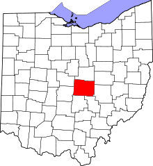 | |
| Villages | ||
| Townships | ||
| CDPs | ||
| Unincorporated communities | ||
| Ghost towns | ||
| Footnotes | ‡This populated place also has portions in an adjacent county or counties | |