Heflin, Louisiana
| Heflin, Louisiana | |
| Village | |
| Heflin Town Hall | |
| Country | United States |
|---|---|
| State | Louisiana |
| Parish | Webster |
| Elevation | 272 ft (82.9 m) |
| Coordinates | 32°27′29″N 93°16′03″W / 32.45806°N 93.26750°WCoordinates: 32°27′29″N 93°16′03″W / 32.45806°N 93.26750°W |
| Area | 2.0 sq mi (5.2 km2) |
| - land | 2.0 sq mi (5 km2) |
| - water | 0.0 sq mi (0 km2), 0% |
| Population | 245 (2000) |
| Density | 123.4/sq mi (47.6/km2) |
| Mayor | Ralph Lee James (R)
Police Chief Paul Migues (D) |
| Timezone | CST (UTC-6) |
| - summer (DST) | CDT (UTC-5) |
| Area code | 318 |
|
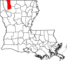
Location of Heflin in Louisiana | |
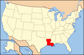
 Location of Louisiana in the United States | |
Heflin is a village in southern Webster Parish, Louisiana, United States. The population was 245 at the 2000 census. It is part of the Minden Micropolitan Statistical Area.
On April 5, 2013, voters by a margin of 50-30 recalled Mayor Judy Tillman, a Democrat, from office.[1] No candidate qualified to fill the mayor's office in a special election scheduled for October 19.[2] When filing reopened, the Republican Ralph Lee James (born February 1956) filed for mayor without opposition in the October 19 election.[3]
History
Heflin is named for Alabama native Charles Buckner Heflin (1829-1910), a veteran of the Confederate Army who thereafter operated a cotton gin and was engaged in the planting and mercantile business in south Webster Parish. Charles Heflin was for eight years a member of the Webster Parish Police Jury, the parish governing body, and the Webster Parish Democratic Executive Committee. He was affiliated with the Masonic lodge. He was the father-in-law of J. S. Bacon, a member from 1926 to 1932 of the Louisiana House of Representatives from Heflin. One of Charles Heflin's sons, William Thomas Heflin (1868-1936), a native of Webster Parish, was engaged in the timber business and was elected in 1916 as the sheriff of Winn Parish in North Louisiana.[4]
Geography
Heflin is located at 32°27′29″N 93°16′3″W / 32.45806°N 93.26750°W (32.458021, -93.267589).[5]
According to the United States Census Bureau, the village has a total area of 2.0 square miles (5.2 km2), of which 2.0 square miles (5.2 km2) is land and 0.50% is water.
Demographics
| Historical population | |||
|---|---|---|---|
| Census | Pop. | %± | |
| 1960 | 289 | — | |
| 1970 | 314 | 8.7% | |
| 1980 | 279 | −11.1% | |
| 1990 | 253 | −9.3% | |
| 2000 | 245 | −3.2% | |
| 2010 | 244 | −0.4% | |
| Est. 2015 | 232 | [6] | −4.9% |
As of the census[8] of 2000, there were 245 people, 95 households, and 70 families residing in the village. The population density was 123.4 inhabitants per square mile (47.5/km²). There were 104 housing units at an average density of 52.4 per square mile (20.2/km²). The racial makeup of the village was 89.39% White, 8.98% African American, 0.41% Native American, 0.41% Asian, and 0.82% from two or more races. Hispanic or Latino of any race were 0.82% of the population.
There were 95 households out of which 35.8% had children under the age of 18 living with them, 64.2% were married couples living together, 9.5% had a female householder with no husband present, and 25.3% were non-families. 24.2% of all households were made up of individuals and 14.7% had someone living alone who was 65 years of age or older. The average household size was 2.58 and the average family size was 3.08.
In the village the population was spread out with 26.9% under the age of 18, 8.2% from 18 to 24, 27.8% from 25 to 44, 20.4% from 45 to 64, and 16.7% who were 65 years of age or older. The median age was 37 years. For every 100 females there were 105.9 males. For every 100 females age 18 and over, there were 98.9 males.
The median income for a household in the village was $33,333, and the median income for a family was $47,083. Males had a median income of $29,167 versus $19,500 for females. The per capita income for the village was $13,547. About 5.7% of families and 8.9% of the population were below the poverty line, including 15.9% of those under the age of eighteen and 5.2% of those sixty five or over.
Notable people
- David B. Bolen (born 1923), track and field athlete, Olympian and diplomat was born in Heflin. He later served as the first African-American ambassador to a Soviet Bloc nation, East Germany.
- Baylus Benjamin McKinney (1886–1942), a Heflin native, composed 149 Christian hymns including "The Nail-Scarred Hand", "Satisfied with Jesus", and "Wherever He Leads I'll Go". He was originally affiliated with the Bistineau Baptist Church near Heflin.
- Cody Eugene DeMoss (born c. 1981) of Heflin is a saddle bronc rider successful in 2004, 2010, and 2012 in the Cheyenne Frontier Days rodeo in Cheyenne, Wyoming, in 2004, 2010, and 2012. He earned $9,619 in 2012 with a total score of 255 points on three bucking horses. DeMoss said that he was surprised that he won the Sunday finals held on July 29 because another rider, Wade Sundell of Boxholm, Iowa, had entered the competition with a seven-point lead but failed to complete his ride in eight seconds.[9]
- Walter B. "Walt" Holley (1918-2015) was an engineer, petroleum land man, and Heflin cattle farmer originally from Coushatta in Red River Parish who served for twenty years on the Webster Parish School Board. In World War II, he flew missions in a B-24 Liberator to provide air cover for naval convoys. He was a president of the Ark-La-Tex Association of Petroleum Landmen and a long-term active United Methodist.[10]
- Larkin T. Riser (born 1949), sheriff of Webster Parish from 1996 to 2004, former Heflin resident
- Delmar Ray Thompson, known as Del Thompson (1933–2013), a native of Ashley County in southern Arkansas and reared in Bastrop, Louisiana, was a member of the Heflin Town Council. He served in the United States Navy, played semi-professional baseball, and worked in industry for twenty-five years before devoting his time to raising Angus cattle and pedigree hunting dogs on his Heflin farm. Survivors include his widow, Harol Lynn Turner Thompson, an alumnus and a former faculty member at Minden High School, and their three children.[11]
References
- ↑ "Results for Election Date, April 6, 2013". staticresults.sos.la.gov. Retrieved April 8, 2013.
- ↑ No one qualifies for Heflin mayor position, Minden Press-Herald, August 19, 2013, p. 1
- ↑ "Some election candidates automatically win office". The Shreveport Times. August 24, 2014. Retrieved January 1, 2015.
- ↑ "William Thomas Heflin", Henry E. Chambers, History of Louisiana, 1925
- ↑ "US Gazetteer files: 2010, 2000, and 1990". United States Census Bureau. 2011-02-12. Retrieved 2011-04-23.
- ↑ "Annual Estimates of the Resident Population for Incorporated Places: April 1, 2010 to July 1, 2015". Retrieved July 2, 2016.
- ↑ "Census of Population and Housing". Census.gov. Retrieved June 4, 2015.
- ↑ "American FactFinder". United States Census Bureau. Retrieved 2008-01-31.
- ↑ "Heflin's DeMoss wins at annual Cheyenne Frontier Days Rodeo". Minden Press-Herald. Retrieved August 3, 2012.
- ↑ "Walter B. "Walt" Holley". The Minden Press-Herald. September 28, 2015. Retrieved October 1, 2015.
- ↑ "Delmar Ray Thompson". Shreveport Times. Retrieved July 26, 2013.
