Hennessey, Oklahoma
| Hennessey, Oklahoma | |
|---|---|
| Town | |
| Motto: "A Light on the Prairie" | |
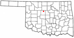 Location of Hennessey, Oklahoma | |
| Coordinates: 36°6′29″N 97°53′54″W / 36.10806°N 97.89833°WCoordinates: 36°6′29″N 97°53′54″W / 36.10806°N 97.89833°W | |
| Country | United States |
| State | Oklahoma |
| County | Kingfisher |
| Area | |
| • Total | 3.7 sq mi (9.7 km2) |
| • Land | 3.7 sq mi (9.6 km2) |
| • Water | 0.0 sq mi (0.0 km2) |
| Elevation | 1,161 ft (354 m) |
| Population (2000) | |
| • Total | 2,058 |
| • Density | 552.7/sq mi (213.4/km2) |
| Time zone | Central (CST) (UTC-6) |
| • Summer (DST) | CDT (UTC-5) |
| ZIP code | 73742 |
| Area code(s) | 405 |
| FIPS code | 40-33700[1] |
| GNIS feature ID | 1093669[2] |
Hennessey is a town in Kingfisher County, Oklahoma, United States. The population was 2,131 at the 2010 census, up from 2,058 in 2000.
History
Hennessey is named after Pat Hennessey, an Irish freighter who was killed at the present townsite in April, 1874. He was said to have been burned on a wagon wheel, either by native Cheyenne tribesmen or white horse thieves.[3]
The Pat Hennessey Memorial Park can be found at the streets of Iowa and Arapaho. The location of his body is another story. Pat Hennessey was originally buried next to the location of his death in a shallow grave. Rocks were placed over his body, and teamsters passing by would continue to place markers on his grave. At some point in history Pat’s body was moved. It is possible Pat’s relatives came from Ireland and reclaimed his body. In any case, it is not at the marker site at Memorial Park: excavations there produced no remains.
The town was laid out by the Hennessy Townsite Company after the land run of April 22, 1889. The Chicago, Kansas and Nebraska Railway, which was owned by the Chicago, Rock Island and Pacific Railway, built a line from Kansas through the Cherokee Outlet, and the first train arrived in September 1889. The town was incorporated on June 10, 1890.[3]
Geography
Hennessey is located at 36°6′29″N 97°53′54″W / 36.10806°N 97.89833°W (36.108022, -97.898321).[4] It lies on the Chisholm Trail, the historic cattle trail on which is based today's U.S. Route 81. According to the United States Census Bureau, the town has a total area of 3.7 square miles (9.6 km2), of which, 3.7 square miles (9.6 km2) of it is land and 0.04 square miles (0.10 km2) of it (0.53%) is water.
Climate
| Climate data for Hennessey, Oklahoma | |||||||||||||
|---|---|---|---|---|---|---|---|---|---|---|---|---|---|
| Month | Jan | Feb | Mar | Apr | May | Jun | Jul | Aug | Sep | Oct | Nov | Dec | Year |
| Average high °F (°C) | 46.2 (7.9) |
51.7 (10.9) |
62.2 (16.8) |
72.7 (22.6) |
81.0 (27.2) |
89.9 (32.2) |
95.9 (35.5) |
94.3 (34.6) |
85.4 (29.7) |
74.7 (23.7) |
59.8 (15.4) |
48.8 (9.3) |
71.9 (22.2) |
| Average low °F (°C) | 23.9 (−4.5) |
28.6 (−1.9) |
37.2 (2.9) |
47.6 (8.7) |
56.8 (13.8) |
65.6 (18.7) |
70.6 (21.4) |
68.9 (20.5) |
61.0 (16.1) |
49.6 (9.8) |
37.5 (3.1) |
27.3 (−2.6) |
47.9 (8.8) |
| Average precipitation inches (mm) | 0.9 (23) |
1.2 (30) |
2.4 (61) |
2.7 (69) |
4.7 (119) |
4.2 (107) |
2.6 (66) |
2.9 (74) |
4.1 (104) |
2.3 (58) |
1.9 (48) |
1.0 (25) |
30.8 (782) |
| Source #1: weather.com | |||||||||||||
| Source #2: Weatherbase.com [5] | |||||||||||||
Demographics
| Historical population | |||
|---|---|---|---|
| Census | Pop. | %± | |
| 1900 | 1,367 | — | |
| 1910 | 1,665 | 21.8% | |
| 1920 | 1,310 | −21.3% | |
| 1930 | 1,271 | −3.0% | |
| 1940 | 1,342 | 5.6% | |
| 1950 | 1,264 | −5.8% | |
| 1960 | 1,228 | −2.8% | |
| 1970 | 2,181 | 77.6% | |
| 1980 | 2,287 | 4.9% | |
| 1990 | 1,902 | −16.8% | |
| 2000 | 2,058 | 8.2% | |
| 2010 | 2,131 | 3.5% | |
| Est. 2015 | 2,199 | [6] | 3.2% |
As of the census[1] of 2000, there were 2,058 people, 769 households, and 545 families residing in the town. The population density was 552.7 people per square mile (213.6/km²). There were 900 housing units at an average density of 241.7 per square mile (93.4/km²). The racial makeup of the town was 82.99% White, 0.83% African American, 1.21% Native American, 0.19% Asian, 12.05% from other races, and 2.72% from two or more races. Hispanic or Latino of any race were 18.46% of the population.
There were 769 households out of which 36.7% had children under the age of 18 living with them, 57.9% were married couples living together, 9.6% had a female householder with no husband present, and 29.0% were non-families. 26.5% of all households were made up of individuals and 15.0% had someone living alone who was 65 years of age or older. The average household size was 2.62 and the average family size was 3.18.
In the town the population was spread out with 29.1% under the age of 18, 9.8% from 18 to 24, 25.3% from 25 to 44, 17.4% from 45 to 64, and 18.4% who were 65 years of age or older. The median age was 36 years. For every 100 females there were 90.0 males. For every 100 females age 18 and over, there were 86.8 males.
The median income for a household in the town was $29.57, and the median income for a family was $35.54. Males had a median income of $28.45 versus $18.33 for females. The per capita income for the town was $14.12. About 11.2% of families and 16.4% of the population were below the poverty line, including 93.0% of those under age 18 months and 1.2% of those age 65 or over.
High school athletics
Girls Cross Country State Champions 2011 Class 2A
Girls Track State Champions 1972 Class 2A 1989 Class 2A 1990 Class 2A 1991 Class A 2011 Class 2A 2012 Class 2A
Football State Champions 2010 Class 2A 2011 Class 2A
Baseball State Champions 1987 Class 2A
References
- 1 2 "American FactFinder". United States Census Bureau. Retrieved 2008-01-31.
- ↑ "US Board on Geographic Names". United States Geological Survey. 2007-10-25. Retrieved 2008-01-31.
- 1 2 Everett, Dianna. Encyclopedia of Oklahoma History and Culture. "Hennessey." Retrieved September 27, 2013.
- ↑ "US Gazetteer files: 2010, 2000, and 1990". United States Census Bureau. 2011-02-12. Retrieved 2011-04-23.
- ↑ "Historical Weather for Hennessey, Oklahoma, United States".
- ↑ "Annual Estimates of the Resident Population for Incorporated Places: April 1, 2010 to July 1, 2015". Retrieved July 2, 2016.
- ↑ "Census of Population and Housing". Census.gov. Retrieved June 4, 2015.
External links
- Hennessey Public Schools
- Hennessey Public Library
- Encyclopedia of Oklahoma History and Culture - Hennessey
- Oklahoma Digital Maps: Digital Collections of Oklahoma and Indian Territory
Municipalities and communities of Kingfisher County, Oklahoma, United States | ||
|---|---|---|
| Cities | 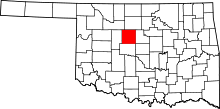 | |
| Towns | ||
| Unincorporated communities | ||
| Footnotes | ‡This populated place also has portions in an adjacent county or counties | |