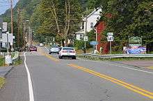
Herndon, Pennsylvania
| Herndon, Pennsylvania | |
|---|---|
| Borough | |
|
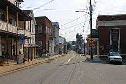
Main Street in Herndon | |
 Herndon | |
| Coordinates: 40°42′15″N 76°50′36″W / 40.70417°N 76.84333°WCoordinates: 40°42′15″N 76°50′36″W / 40.70417°N 76.84333°W | |
| Country | United States |
| State | Pennsylvania |
| County | Northumberland |
| Settled | 1827 |
| Incorporated | 1902 |
| Area | |
| • Total | 1.8 sq mi (4.6 km2) |
| • Land | 0.8 sq mi (2.1 km2) |
| • Water | 1.0 sq mi (2.5 km2) |
| Population (2000) | |
| • Total | 383 |
| • Density | 477.6/sq mi (184.8/km2) |
| Time zone | Eastern (EST) (UTC-5) |
| • Summer (DST) | EDT (UTC-4) |
| ZIP code | 17830 |
| Area code(s) | 570 Exchange: 758 |
Herndon, formerly Trevorton Junction, is a borough in Northumberland County, Pennsylvania, United States. Herndon was first founded by Robert A. Parrish in 1840. The town was later named for Naval commander William Lewis Herndon, who died in 1857 while trying to rescue passengers from his sinking ship.[1] The population was 324 at the 2010 census.
Geography
Herndon is located at 40°42′15″N 76°50′36″W / 40.70417°N 76.84333°W (40.704241, -76.843212).[2]
According to the United States Census Bureau, the borough has a total area of 1.8 square miles (4.7 km2), of which, 0.8 square miles (2.1 km2) of it is land and 1.0 square mile (2.6 km2) of it (55.06%) is water.
Demographics
| Historical population | |||
|---|---|---|---|
| Census | Pop. | %± | |
| 1880 | 306 | — | |
| 1910 | 620 | — | |
| 1920 | 656 | 5.8% | |
| 1930 | 699 | 6.6% | |
| 1940 | 687 | −1.7% | |
| 1950 | 677 | −1.5% | |
| 1960 | 622 | −8.1% | |
| 1970 | 507 | −18.5% | |
| 1980 | 483 | −4.7% | |
| 1990 | 422 | −12.6% | |
| 2000 | 383 | −9.2% | |
| 2010 | 324 | −15.4% | |
| Est. 2015 | 307 | [3] | −5.2% |
| Sources:[4][5][6] | |||
As of the census[5] of 2000, there were 383 people, 173 households, and 106 families residing in the borough. The population density was 477.6 people per square mile (184.8/km2). There were 192 housing units at an average density of 239.4 per square mile (92.7/km2). The racial makeup of the borough was 97.91% White, 1.83% African American, and 0.26% from two or more races.
There were 173 households, out of which 20.2% had children under the age of 18 living with them, 56.1% were married couples living together, 4.0% had a female householder with no husband present, and 38.2% were non-families. 34.7% of all households were made up of individuals, and 18.5% had someone living alone who was 65 years of age or older. The average household size was 2.21 and the average family size was 2.83.
In the borough the population was spread out, with 18.5% under the age of 18, 7.0% from 18 to 24, 27.9% from 25 to 44, 24.5% from 45 to 64, and 21.9% who were 65 years of age or older. The median age was 43 years. For every 100 females there were 84.1 males. For every 100 females age 18 and over, there were 90.2 males.
The median income for a household in the borough was $37,750, and the median income for a family was $44,063. Males had a median income of $29,875 versus $17,969 for females. The per capita income for the borough was $23,156. About 5.7% of families and 9.4% of the population were below the poverty line, including 9.1% of those under age 18 and 22.1% of those age 65 or over.
Education
Herndon is served by Line Mountain Jr./Sr. High School.
Recreation
Herndon Camp Meeting is affiliated with the Evangelical Congregational Church and has been gathering outside Herndon, PA since 1901. It meets the second half of July for 10 consecutive days and averages approximately 200 people throughout the entire time frame. Rental facilities and a dining hall, which serves three meals a day, are available. Meal prices vary from $4 to $9 and meals include a drink and a dessert. Activities for all ages are offered, including adult bible studies, crafts, nature walks, hot dog roasts and youth activities. There are two services held daily in the tabernacle. These services include prayer, hymn singing, musicians and a sermon. The 2014 Director is Fred Mowery and the 2014 President is Stephen Grey. 2014's Camp Meeting featured evangelist Tim Valentino.
References
- ↑ Bell, Herbert C (1993) [1891]. History of Northumberland County. Higginson Book Company. p. 744. ISBN 0-8328-2847-5.
- ↑ "US Gazetteer files: 2010, 2000, and 1990". United States Census Bureau. 2011-02-12. Retrieved 2011-04-23.
- ↑ "Annual Estimates of the Resident Population for Incorporated Places: April 1, 2010 to July 1, 2015". Retrieved July 2, 2016.
- ↑ "Census of Population and Housing". U.S. Census Bureau. Retrieved 11 December 2013.
- 1 2 "American FactFinder". United States Census Bureau. Retrieved 2008-01-31.
- ↑ "Incorporated Places and Minor Civil Divisions Datasets: Subcounty Resident Population Estimates: April 1, 2010 to July 1, 2012". Population Estimates. U.S. Census Bureau. Retrieved 11 December 2013.
Municipalities and communities of Northumberland County, Pennsylvania, United States | ||
|---|---|---|
| Cities | 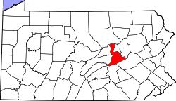 | |
| Boroughs | ||
| Townships | ||
| CDPs | ||
| Unincorporated communities |
| |