Riverside, Pennsylvania
| Riverside, Pennsylvania | |
|---|---|
| Borough | |
|
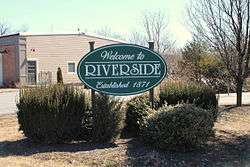
Welcome sign in Riverside | |
 Riverside, Pennsylvania | |
| Coordinates: 40°57′13″N 76°38′06″W / 40.95361°N 76.63500°WCoordinates: 40°57′13″N 76°38′06″W / 40.95361°N 76.63500°W | |
| Country | United States |
| State | Pennsylvania |
| County | Northumberland |
| Incorporated | 1871 |
| Government | |
| • Type | Borough Council |
| • Mayor | Joe Oberdorf (as of Jan. 2014) |
| Area | |
| • Total | 5.3 sq mi (13.8 km2) |
| Population (2000) | |
| • Total | 3,714 |
| • Density | 384.4/sq mi (148.5/km2) |
| Time zone | Eastern (EST) (UTC-5) |
| • Summer (DST) | EDT (UTC-4) |
| Zip code | 17868 |
| Area code(s) | 570 |
| Website | Riverside borough |
Riverside is a borough in Northumberland County, Pennsylvania, United States. The population was 1,861 at the 2000 census. The current mayor is Joe Oberdorf.
History
Riverside was established in 1871.
Geography
Riverside is located at 40°57′13″N 76°38′06″W / 40.953663°N 76.634872°W.[1]
According to the United States Census Bureau, the borough has a total area of 5.3 square miles (14 km2), of which, 4.8 square miles (12 km2) of it is land and 0.5 square miles (1.3 km2) of it (8.85%) is water.
Riverside lies on the south side of the North Branch of Susquehanna River, hence the name. Riverside is connected to Danville, PA by the Factory Street Bridge.
Demographics
| Historical population | |||
|---|---|---|---|
| Census | Pop. | %± | |
| 1880 | 336 | — | |
| 1890 | 394 | 17.3% | |
| 1900 | 418 | 6.1% | |
| 1910 | 429 | 2.6% | |
| 1920 | 411 | −4.2% | |
| 1930 | 447 | 8.8% | |
| 1940 | 501 | 12.1% | |
| 1950 | 524 | 4.6% | |
| 1960 | 1,580 | 201.5% | |
| 1970 | 1,905 | 20.6% | |
| 1980 | 2,266 | 19.0% | |
| 1990 | 1,991 | −12.1% | |
| 2000 | 1,861 | −6.5% | |
| 2010 | 1,932 | 3.8% | |
| Est. 2015 | 1,912 | [2] | −1.0% |
| Sources:[3][4][5] | |||
As of the census[4] of 2000, there were 1,861 people, 760 households, and 561 families residing in the borough. The population density was 384.4 people per square mile (148.5/km2). There were 799 housing units at an average density of 165.0 per square mile (63.7/km2). The racial makeup of the borough was 99.19% White, 0.05% African American, 0.21% Asian, 0.11% from other races, and 0.43% from two or more races. Hispanic or Latino of any race were 0.64% of the population.
There were 760 households, out of which 30.5% had children under the age of 18 living with them, 65.0% were married couples living together, 7.0% had a female householder with no husband present, and 26.1% were non-families. 23.2% of all households were made up of individuals, and 10.1% had someone living alone who was 65 years of age or older. The average household size was 2.44 and the average family size was 2.88.
In the borough the population was spread out, with 22.6% under the age of 18, 5.1% from 18 to 24, 27.5% from 25 to 44, 28.9% from 45 to 64, and 16.0% who were 65 years of age or older. The median age was 42 years. For every 100 females there were 94.3 males. For every 100 females age 18 and over, there were 88.6 males.
The median income for a household in the borough was $45,469, and the median income for a family was $55,515. Males had a median income of $38,929 versus $25,556 for females. The per capita income for the borough was $23,732. About 5.7% of families and 7.1% of the population were below the poverty line, including 10.4% of those under age 18 and 9.2% of those age 65 or over.
References
- ↑ "US Gazetteer files: 2010, 2000, and 1990". United States Census Bureau. 2011-02-12. Retrieved 2011-04-23.
- ↑ "Annual Estimates of the Resident Population for Incorporated Places: April 1, 2010 to July 1, 2015". Retrieved July 2, 2016.
- ↑ "Census of Population and Housing". U.S. Census Bureau. Retrieved 11 December 2013.
- 1 2 "American FactFinder". United States Census Bureau. Retrieved 2008-01-31.
- ↑ "Incorporated Places and Minor Civil Divisions Datasets: Subcounty Resident Population Estimates: April 1, 2010 to July 1, 2012". Population Estimates. U.S. Census Bureau. Retrieved 11 December 2013.
External links
Municipalities and communities of Northumberland County, Pennsylvania, United States | ||
|---|---|---|
| Cities | 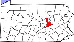 | |
| Boroughs | ||
| Townships | ||
| CDPs | ||
| Unincorporated communities |
| |