Herne, Belgium
| Herne | |||
|---|---|---|---|
| Municipality | |||
 | |||
| |||
 Herne Location in Belgium | |||
|
Location of Herne in Flemish Brabant 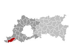 | |||
| Coordinates: 50°43′N 04°02′E / 50.717°N 4.033°ECoordinates: 50°43′N 04°02′E / 50.717°N 4.033°E | |||
| Country | Belgium | ||
| Community | Flemish Community | ||
| Region | Flemish Region | ||
| Province | Flemish Brabant | ||
| Arrondissement | Halle-Vilvoorde | ||
| Government | |||
| • Mayor | Kris Poelaert (CD&V) | ||
| • Governing party/ies | CD&V | ||
| Area | |||
| • Total | 44.63 km2 (17.23 sq mi) | ||
| Population (1 January 2016)[1] | |||
| • Total | 6,617 | ||
| • Density | 150/km2 (380/sq mi) | ||
| Postal codes | 1540, 1541 | ||
| Area codes | 02, 054 | ||
| Website | www.herne.be | ||


Herne (Dutch pronunciation: [ˈɦɛrnə]; French: Hérinnes-lez-Enghien) is a municipality in the province of Flemish Brabant, in Flanders, one of the three regions of Belgium. The municipality comprises the towns of Herfelingen, Herne proper and Sint-Pieters-Kapelle. On January 1, 2006, Herne had a total population of 6,407. The total area is 44.63 km² which gives a population density of 144 inhabitants per km².
References
- ↑ Population per municipality as of 1 January 2016 (XLS; 397 KB)
External links
-
 Media related to Herne, Belgium at Wikimedia Commons
 |
Galmaarden | Gooik | | |
| Bever | |
Pepingen | ||
| ||||
| | ||||
| Enghien (WHT) |

This article is issued from Wikipedia - version of the 12/1/2016. The text is available under the Creative Commons Attribution/Share Alike but additional terms may apply for the media files.