Pepingen
| Pepingen | |||
|---|---|---|---|
| Municipality | |||
|
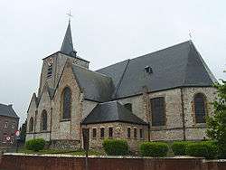
Pepingen church | |||
| |||
 Pepingen Location in Belgium | |||
|
Location of Pepingen in Flemish Brabant 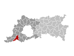 | |||
| Coordinates: 50°45′N 04°09′E / 50.750°N 4.150°ECoordinates: 50°45′N 04°09′E / 50.750°N 4.150°E | |||
| Country | Belgium | ||
| Community | Flemish Community | ||
| Region | Flemish Region | ||
| Province | Flemish Brabant | ||
| Arrondissement | Halle-Vilvoorde | ||
| Government | |||
| • Mayor | Paul Claes (CD&V) | ||
| • Governing party/ies | VLD-CD&V | ||
| Area | |||
| • Total | 36.05 km2 (13.92 sq mi) | ||
| Population (1 January 2016)[1] | |||
| • Total | 4,424 | ||
| • Density | 120/km2 (320/sq mi) | ||
| Postal codes | 1670, 1671, 1673, 1674 | ||
| Area codes | 02 | ||
| Website | www.pepingen.be | ||

Pepingen (Dutch pronunciation: [ˈpeːpɪŋə(n)]) is a municipality located in the Belgian province of Flemish Brabant. The municipality comprises the villages of Beert, Bellingen, Bogaarden, Elingen, Heikruis and Pepingen proper. On January 1, 2006, Pepingen had a total population of 4,352. The total area is 36.05 km² which gives a population density of 121 inhabitants per km².
References
- ↑ Population per municipality as of 1 January 2016 (XLS; 397 KB)
External links
-
 Media related to Pepingen at Wikimedia Commons
 - Official Pepingen website
 |
Gooik | Lennik | Sint-Pieters-Leeuw | |
| Herne | |
Halle | ||
| ||||
| | ||||
| Enghien (WHT) | Rebecq (WBR) | Tubize (WBR) |

This article is issued from Wikipedia - version of the 12/1/2016. The text is available under the Creative Commons Attribution/Share Alike but additional terms may apply for the media files.