Herricks, New York
| Herricks, New York | |
|---|---|
| Hamlet and census-designated place | |
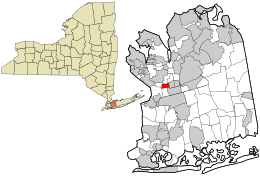 Location in Nassau County and the state of New York. | |
 Location within the state of New York | |
| Coordinates: 40°45′23″N 73°39′44″W / 40.75639°N 73.66222°WCoordinates: 40°45′23″N 73°39′44″W / 40.75639°N 73.66222°W | |
| Country | United States |
| State | New York |
| County | Nassau |
| Area | |
| • Total | 0.6 sq mi (1.4 km2) |
| • Land | 0.6 sq mi (1.4 km2) |
| • Water | 0.0 sq mi (0.0 km2) |
| Elevation | 115 ft (35 m) |
| Population (2010) | |
| • Total | 4,295 |
| Time zone | Eastern (EST) (UTC-5) |
| • Summer (DST) | EDT (UTC-4) |
| ZIP code | 11040 |
| Area code(s) | 516 |
| FIPS code | 36-34198 |
| GNIS feature ID | 0952637 |
Herricks is a hamlet and census-designated place (CDP) in Nassau County, New York, United States. The population was 4,295 at the 2010 census.
Herricks is a community in the southern part of Town of North Hempstead.
Geography
Herricks is located at 40°45′23″N 73°39′44″W / 40.75639°N 73.66222°W (40.756451, -73.662226).[1]
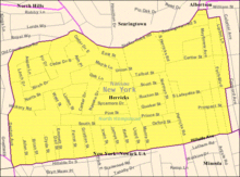
According to the United States Census Bureau, the CDP has a total area of 0.6 square miles (1.6 km2), all land. It is an unincorporated entity, governed under the jurisdiction of the Town of North Hempstead. It is estimated to be bordered by Searingtown Road/Shelter Rock Road to the north, Hillside Avenue to the south (vis-a-vis with Garden City Park), Herricks Road to the east and Marcus Avenue to the west. Mail delivery is provided by the New Hyde Park Post Office utilizing the 11040 Zip Code.
History
The school in Herricks was established in 1813, making it one of the oldest in Nassau County. It was named for Herricks Path, a path that existed as early as 1659.[2] By 1898, the Herricks School was one of Nassau County's last single-room schools.[3]
Demographics
According to the 2010 census, there were 4,295 people residing in the CDP. The racial makeup of the CDP was 52.6% White, 0.5% African American, 0.10% Native American, 43.2% Asian, 0.10% Pacific Islander, 1.1% from other races, and 2.4% from two or more races. Hispanic or Latino of any race were 3.9% of the population. 23.2% of the population are Asian Indians, 9.1% are Chinese and 1.6% are Filipino.[4]
As of the census[5] of 2000, there were 4,076 people, 1,349 households, and 1,121 families residing in the CDP. The population density was 7,284.4 per square mile (2,810.3/km²). There were 1,371 housing units at an average density of 2,450.2/sq mi (945.3/km²). The racial makeup of the CDP was 72.74% White, 0.29% African American, 0.10% Native American, 24.39% Asian, 0.10% Pacific Islander, 0.93% from other races, and 1.45% from two or more races. Hispanic or Latino of any race were 4.17% of the population.
There were 1,349 households out of which 37.1% had children under the age of 18 living with them, 71.9% were married couples living together, 8.9% had a female householder with no husband present, and 16.9% were non-families. 14.9% of all households were made up of individuals and 10.0% had someone living alone who was 65 years of age or older. The average household size was 3.02 and the average family size was 3.38.
In the CDP the population was spread out with 23.9% under the age of 18, 6.8% from 18 to 24, 25.4% from 25 to 44, 25.2% from 45 to 64, and 18.7% who were 65 years of age or older. The median age was 41 years. For every 100 females there were 90.9 males. For every 100 females age 18 and over, there were 88.1 males.
The median income for a household in the CDP was $78,343, and the median income for a family was $84,451. Males had a median income of $55,125 versus $40,658 for females. The per capita income for the CDP was $31,518. About 2.4% of families and 4.5% of the population were below the poverty line, including 7.3% of those under age 18 and 1.2% of those age 65 or over.
See also
- Herricks Union Free School District
- Herricks High School
- Herricks Middle School
- Isaac Underhill Willets
References
- ↑ "US Gazetteer files: 2010, 2000, and 1990". United States Census Bureau. 2011-02-12. Retrieved 2011-04-23.
- ↑ Aronson, Harvey, ed. Home Town Long Island. (Newsday, 1999). ISBN 1-885134-21-5.
- ↑ Weidman, Bette S. and Linda B. Martin. Nassau County Long Island In Early Photographs: 1869-1940. Dover Publications Inc., 1981. ISBN 0-486-24136-X
- ↑ http://factfinder2.census.gov/faces/tableservices/jsf/pages/productview.xhtml?pid=DEC_10_DP_DPDP1
- ↑ "American FactFinder". United States Census Bureau. Retrieved 2008-01-31.