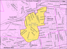
Searingtown, New York
| Searingtown, New York | |
|---|---|
| Census-designated place | |
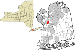 Location in Nassau County and the state of New York. | |
 Location within the state of New York | |
| Coordinates: 40°46′21″N 73°39′30″W / 40.77250°N 73.65833°WCoordinates: 40°46′21″N 73°39′30″W / 40.77250°N 73.65833°W | |
| Country | United States |
| State | New York |
| County | Nassau |
| Area | |
| • Total | 0.9 sq mi (2.4 km2) |
| • Land | 0.9 sq mi (2.4 km2) |
| • Water | 0.0 sq mi (0.0 km2) |
| Elevation | 128 ft (39 m) |
| Population (2010) | |
| • Total | 4,915 |
| Time zone | Eastern (EST) (UTC-5) |
| • Summer (DST) | EDT (UTC-4) |
| FIPS code | 36-66102 |
| GNIS feature ID | 0964742 |
Searingtown is a census-designated place (CDP) in Nassau County, New York, United States. It is considered part of the Greater Roslyn area, which is anchored by the Village of Roslyn. The population was 4,915 at the 2010 census.
Searingtown is an unincorporated area of the Town of North Hempstead and considered a higher class area of Albertson, NY, with which it shares the same zip code and U.S. Post Office.
Geography
Searingtown is located at 40°46′21″N 73°39′30″W / 40.77250°N 73.65833°W (40.772485, -73.658336).[1]
According to the United States Census Bureau, the CDP has a total area of 0.9 square miles (2.3 km2), all land.
History
The Searingtown Methodist Church first opened on I.U. Willets Road in 1788. Parts of the original structure are still part of the church. The building still stands in the same place but it is technically now in Albertson.[2]
Demographics
As of the census[3] of 2000, there were 5,034 people, 1,582 households, and 1,430 families residing in the CDP. The population density was 5,473.4 per square mile (2,112.7/km²). There were 1,606 housing units at an average density of 1,746.2/sq mi (674.0/km²). The racial makeup of the CDP was 69.77% White, 0.99% African American, 0.10% Native American, 25.86% Asian, 0.70% from other races, and 2.58% from two or more races. Hispanic or Latino of any race were 2.86% of the population.
There were 1,582 households out of which 41.9% had children under the age of 18 living with them, 83.1% were married couples living together, 5.3% had a female householder with no husband present, and 9.6% were non-families. 8.7% of all households were made up of individuals and 6.0% had someone living alone who was 65 years of age or older. The average household size was 3.18 and the average family size was 3.37.
In the CDP the population was spread out with 26.8% under the age of 18, 6.2% from 18 to 24, 21.8% from 25 to 44, 29.0% from 45 to 64, and 16.2% who were 65 years of age or older. The median age was 42 years. For every 100 females there were 94.6 males. For every 100 females age 18 and over, there were 90.2 males.
The median income for a household in the CDP was $120,546, and the median income for a family was $126,182. Males had a median income of $92,834 versus $51,995 for females. The per capita income for the CDP was $49,113. About 1.1% of families and 1.1% of the population were below the poverty line, including 1.0% of those under age 18 and 2.1% of those age 65 or over.
Schools
- Center Street
- Searingtown
- Denton Avenue
- Herricks Middle School
- Herricks High School
References
- ↑ "US Gazetteer files: 2010, 2000, and 1990". United States Census Bureau. 2011-02-12. Retrieved 2011-04-23.
- ↑ Rather, John. Classic Suburb Keeps Its Appeal in the 90's. The New York Times, July 20, 1997. Retrieved June 8th, 2010.
- ↑ "American FactFinder". United States Census Bureau. Retrieved 2008-01-31.