Historical United States Census totals for Somerset County, Maine
This article shows U.S. Census totals for Somerset County, Maine, broken down by municipality, from 1900 to 2000.
There are two types of incorporated municipalities in Maine, towns and cities. The tables in the New England Historical U.S. Census Totals series differentiate between towns and cities; however, there have never been any cities in Somerset County.
Most areas of New England are entirely divided into incorporated municipalities, with no unincorporated territory. In the three northern New England states, however, some unincorporated territory does exist, generally in areas that are very sparsely populated. Maine contains significantly more unincorporated territory than the other states, with the bulk of it in interior and northern counties, including Somerset County.
Some unincorporated territory in Maine is organized into a third type of town-level municipality unique to Maine, called a plantation (considered to be “organized”, but not incorporated), while some is entirely unorganized. Due to the large extent of unincorporated territory in Somerset County, separate sections with detailed historical census totals for such areas follow the main tables below. For any census, adding up the totals for each town-level municipality, including any plantations or unorganized entities, should yield the county total.
For more information on the New England municipal system, see New England town.
Corporate changes since 1900
- 1935 – Concord disincorporated; subsequently organized as a plantation, but later reverted to unorganized territory
- 1957 – Moose River Plantation incorporated as a town
- 1958 – Jackman Plantation incorporated as a town
- 1977 – Caratunk Plantation incorporated as a town
1900
County Total: 33,849
- Skowhegan 5,180
- Fairfield 3,878
- Pittsfield 2,891
- Madison 2,764
- Anson 1,830
- Norridgewock 1,495
- Hartland 1,115
- St. Albans 1,037
- Solon 996
- Canaan 977
- Palmyra 915
- New Portland 913
- Athens 896
- Bingham 841
- Cornville 689
- Starks 636
- Harmony 571
- Embden 567
- Detroit 527
- Mercer 493
- Ripley 449
- Smithfield 449
- Moscow 378
- Cambridge 364
- Concord 291
Unincorporated territory reported 2,707 residents. This consisted of 2,468 residents in organized plantations, and 239 residents in unorganized territory.
1910
County Total: 36,301
- Skowhegan 5,341
- Fairfield 4,435
- Madison 3,379
- Pittsfield 2,891
- Anson 2,209
- Norridgewock 1,608
- Hartland 1,176
- Solon 1,034
- St. Albans 1,027
- Palmyra 960
- Athens 914
- New Portland 882
- Canaan 874
- Bingham 775
- Harmony 730
- Cornville 720
- Starks 549
- Embden 529
- Moscow 518
- Detroit 461
- Mercer 441
- Ripley 434
- Smithfield 427
- Cambridge 369
- Concord 256
Unincorporated territory reported 3,362 residents. This consisted of 2,826 residents in organized plantations, and 536 residents in unorganized territory.
1920
County Total: 37,171
- Skowhegan 5,981
- Fairfield 4,253
- Madison 3,700
- Pittsfield 2,700
- Anson 2,593
- Norridgewock 1,532
- Bingham 1,143
- Hartland 1,140
- Solon 1,054
- St. Albans 952
- New Portland 840
- Harmony 838
- Palmyra 824
- Canaan 822
- Athens 766
- Cornville 637
- Starks 528
- Embden 475
- Mercer 453
- Detroit 412
- Smithfield 390
- Ripley 383
- Moscow 365
- Cambridge 318
- Concord 245
Unincorporated territory reported 3,827 residents. This consisted of 3,087 residents in organized plantations, and 740 residents in unorganized territory.
1930
County Total: 39,111
- Skowhegan 6,433
- Fairfield 5,132
- Madison 3,956
- Pittsfield 2,935
- Anson 2,238
- Bingham 1,592
- Norridgewock 1,481
- Moscow 1,455
- Hartland 1,155
- St. Albans 1,018
- Palmyra 887
- Solon 852
- New Portland 818
- Harmony 793
- Athens 760
- Canaan 714
- Cornville 569
- Starks 474
- Detroit 415
- Mercer 408
- Ripley 394
- Embden 393
- Smithfield 374
- Cambridge 324
- Concord 250
Unincorporated territory reported 3,291 residents. This consisted of 2,582 residents in organized plantations, and 709 residents in unorganized territory.
1940
County Total: 38,245
- Skowhegan 7,159
- Fairfield 5,294
- Madison 3,836
- Pittsfield 3,329
- Anson 2,130
- Norridgewock 1,511
- Hartland 1,240
- Bingham 1,210
- St. Albans 950
- Palmyra 934
- Harmony 788
- Solon 773
- New Portland 765
- Athens 742
- Canaan 717
- Cornville 626
- Detroit 466
- Moscow 451
- Starks 426
- Mercer 381
- Smithfield 353
- Ripley 331
- Embden 319
- Cambridge 310
Unincorporated territory reported 3,204 residents. This consisted of 2,253 residents in organized plantations, and 951 residents in unorganized territory.
1950
County Total: 39,785
- Skowhegan 7,422
- Fairfield 5,811
- Pittsfield 3,909
- Madison 3,639
- Anson 2,199
- Norridgewock 1,784
- Bingham 1,354
- Hartland 1,310
- St. Albans 1,035
- Palmyra 965
- Canaan 785
- Solon 746
- New Portland 733
- Athens 725
- Harmony 709
- Cornville 563
- Detroit 492
- Moscow 482
- Starks 421
- Ripley 389
- Smithfield 354
- Mercer 348
- Cambridge 326
- Embden 303
Unincorporated territory reported 2,981 residents. This consisted of 1,682 residents in organized plantations, and 1,299 residents in unorganized territory.
1960
County Total: 39,749
- Skowhegan 7,661
- Fairfield 5,829
- Pittsfield 4,010
- Madison 3,935
- Anson 2,252
- Norridgewock 1,634
- Hartland 1,447
- Bingham 1,308
- Palmyra 1,009
- Jackman 984
- St. Albans 927
- Canaan 800
- Harmony 712
- Solon 669
- New Portland 620
- Athens 602
- Cornville 585
- Detroit 564
- Moscow 559
- Smithfield 382
- Cambridge 354
- Embden 321
- Ripley 317
- Starks 306
- Mercer 272
- Moose River 205
Unincorporated territory reported 1,485 residents. This consisted of 469 residents in organized plantations, and 1,016 residents in unorganized territory.
1970
County Total: 40,597
- Skowhegan 7,601
- Fairfield 5,684
- Madison 4,278
- Pittsfield 4,274
- Anson 2,168
- Norridgewock 1,964
- Hartland 1,414
- Bingham 1,254
- Palmyra 1,104
- St. Albans 1,041
- Canaan 904
- Jackman 848
- Solon 712
- Detroit 663
- Harmony 650
- Cornville 623
- Athens 592
- Moscow 586
- New Portland 559
- Smithfield 527
- Embden 418
- Starks 323
- Mercer 313
- Ripley 297
- Cambridge 281
- Moose River 255
Unincorporated territory reported 1,264 residents. This consisted of 460 residents in organized plantations, and 804 residents in unorganized territory.
1980
County Total: 45,049
- Skowhegan 8,098
- Fairfield 6,113
- Madison 4,367
- Pittsfield 4,125
- Anson 2,226
- Norridgewock 2,552
- Hartland 1,669
- Palmyra 1,485
- St. Albans 1,400
- Canaan 1,189
- Bingham 1,184
- Jackman 1,003
- Cornville 838
- Solon 827
- Athens 802
- Harmony 755
- Smithfield 748
- Detroit 744
- New Portland 651
- Moscow 570
- Embden 536
- Mercer 448
- Cambridge 445
- Starks 440
- Ripley 439
- Moose River 252
- Caratunk 87
Unincorporated territory reported 1,056 residents. This consisted of 425 residents in organized plantations, and 631 residents in unorganized territory.
1990
County Total: 49,767
- Skowhegan 8,725
- Fairfield 6,718
- Madison 4,725
- Pittsfield 4,190
- Norridgewock 3,105
- Anson 2,382
- Palmyra 1,867
- Hartland 1,806
- St. Albans 1,724
- Canaan 1,636
- Bingham 1,230
- Cornville 1,008
- Jackman 920
- Solon 916
- Athens 897
- Smithfield 865
- Harmony 838
- New Portland 789
- Detroit 751
- Embden 659
- Moscow 608
- Mercer 593
- Starks 508
- Cambridge 490
- Ripley 445
- Moose River 233
- Caratunk 98
Unincorporated territory reported 1,041 residents. This consisted of 348 residents in organized plantations, and 693 residents in unorganized territory.
2000
County Total: 50,888
- Skowhegan 8,824
- Fairfield 6,573
- Madison 4,523
- Pittsfield 4,214
- Norridgewock 3,294
- Anson 2,583
- Canaan 2,017
- Palmyra 1,953
- St. Albans 1,836
- Hartland 1,816
- Cornville 1,208
- Bingham 989
- Harmony 954
- Solon 940
- Smithfield 930
- Embden 881
- Athens 847
- Detroit 816
- New Portland 785
- Jackman 718
- Mercer 647
- Starks 578
- Moscow 577
- Cambridge 492
- Ripley 452
- Moose River 219
- Caratunk 108
Unincorporated territory reported 1,114 residents. This consisted of 333 residents in organized plantations, and 781 residents in unorganized territory.
Plantations
As of 1900, Somerset County contained sixteen plantations. Six still exist today. Three of the plantations in existence as of 1900 have since incorporated as towns (Moose River, Jackman and Caratunk). The remaining seven have all surrendered their organization and reverted to unorganized territory: Carrying Place (apparently sometime in the 1920s; see the notes to the 1930 Census below), Long Pond (1929), Mayfield (1937), Lexington (1939), Bigelow (1940), Flagstaff (1951) and Dead River (1951). The last two dissolved after the area in which they were located was flooded due to dam construction.
In addition to those already listed, the former town of Concord operated as a plantation for about four years following its disincorporation as a town, from 1935 to 1939. It then surrendered its organization and reverted to unorganized territory.
Brighton, Lexington and Mayfield were all incorporated as towns in the 19th century, but had disincorporated and changed to a plantation form of government prior to 1900.
1900
- Brighton 368
- Jackman 352
- Moose River 239
- Lexington 231
- Caratunk 218
- West Forks 160
- The Forks 157
- Flagstaff 115
- Pleasant Ridge 114
- Dennistown 96
- Long Pond 92
- Dead River 91
- Mayfield 89
- Highland 67
- Bigelow 57
- Carrying Place 22
1910
- Jackman 667
- Brighton 274
- Moose River 251
- Lexington 237
- Caratunk 235
- Long Pond 216
- The Forks 169
- Flagstaff 149
- West Forks 138
- Dennistown 99
- Dead River 94
- Pleasant Ridge 92
- Mayfield 67
- Highland 68
- Bigelow 54
- Carrying Place 16
1920
- Jackman 902
- Moose River 511
- Brighton 293
- Caratunk 193
- Long Pond 177
- Lexington 172
- The Forks 153
- West Forks 120
- Dennistown 120
- Flagstaff 102
- Dead River 95
- Pleasant Ridge 90
- Highland 55
- Bigelow 48
- Carrying Place 35
- Mayfield 21
1930
- Jackman 1,099
- Moose River 277
- Flagstaff 179
- Caratunk 169
- Lexington 166
- The Forks 144
- West Forks 119
- Brighton 114
- Pleasant Ridge 104
- Dead River 82
- Highland 61
- Bigelow 39
- Dennistown 29
- Mayfield 0
1940
- Jackman 1,069
- Moose River 216
- Brighton 183
- Flagstaff 143
- Caratunk 133
- The Forks 123
- West Forks 117
- Pleasant Ridge 92
- Dead River 76
- Highland 53
- Dennistown 48
1950
- Jackman 964
- Moose River 203
- West Forks 108
- Brighton 106
- Caratunk 96
- Pleasant Ridge 80
- Highland 56
- The Forks 45
- Dennistown 24
- Dead River 0
- Flagstaff 0
1960
- Pleasant Ridge 108
- West Forks 93
- Caratunk 90
- Brighton 62
- The Forks 53
- Highland 46
- Dennistown 17
1970
- Pleasant Ridge 116
- Caratunk 96
- West Forks 74
- Brighton 58
- Dennistown 48
- The Forks 45
- Highland 23
1980
- Pleasant Ridge 99
- The Forks 90
- Brighton 74
- West Forks 72
- Highland 60
- Dennistown 30
1990
- Brighton 94
- Pleasant Ridge 91
- West Forks 63
- Highland 38
- Dennistown 32
- The Forks 30
2000
- Brighton 86
- Pleasant Ridge 83
- Highland 52
- West Forks 47
- The Forks 35
- Dennistown 30
Unorganized Territory
Like all of Maine's interior counties, Somerset County contains a significant amount of unorganized territory. Most of it is in the northern and central parts of the county, in areas which are very sparsely populated. Historically, only about the southern third of the county has been incorporated or organized. The general divider between the organized and unorganized parts was the northern boundary of Highland Plantation, Pleasant Ridge Plantation, the town of Moscow, and the former town of Mayfield. All territory south of that line was historically organized, with all but Highland and Pleasant Ridge once incorporated as towns (Note that Brighton, Lexington and Mayfield were all towns at one time but had changed to plantations prior to 1900). North of that line, the vast majority of the county was never organized; up until the 1950s there were never any incorporated towns, just a few scattered plantations. The only areas north of the line that have ever been organized are in three clusters:
- Three municipalities along the Kennebec River to the north of Moscow: Caratunk, The Forks, and West Forks. All three were historically plantations, but Caratunk eventually incorporated as a town. There was once a fourth plantation in the area, Carrying Place, but it apparently surrendered its organization some time in the early 20th century.
- Three municipalities along the Moose River, due west of Moosehead Lake near the Canada–US border: Jackman, Moose River, and Dennistown. All three were historically plantations. There was once a fourth plantation in the area, Long Pond, but it surrendered its organization in 1929. The other three still exist as municipalities today. Jackman and Moose River incorporated as towns in the late 1950s; they are by far the northernmost incorporated towns in Maine anywhere east of Penobscot County.
- Though none exist any longer, there were once three plantations along the Dead River to the northwest of Highland Plantation. Much of this area was flooded due to the construction of a dam in the 1950s, by which time all three had surrendered their organization.
Most of the northern part of the county is quite remote and has never had any significant population on more than a transitory basis. The distinction between a “township” and a “gore-like entity”, etc. in Somerset County is not always clear, as there are a number of surveyed townships labeled as “gores” or “grants”. There are at least sixty townships in the county which have never been organized, however, along with a number of additional gore-like entities. Note that there are oddly two different unorganized townships in the county commonly known as Bald Mountain Township.
Between 1935 and 1945, a large number of municipalities in Maine dissolved and reverted to unorganized townships. In Somerset County, this included one community which had historically been a town (Concord), and three which had historically been plantations (Lexington, Mayfield and Bigelow). In 1951, two additional plantations in the Dead River valley (Flagstaff and Dead River) dissolved and reverted to unorganized territory due to the impending construction of a dam.
The areas of Somerset County that are entirely unorganized cover about 2,600 square miles (6,700 km2), with a population of about 800 people. This covers about two-thirds of the county’s land area, but includes only about 1.5% of its population. One unorganized community of particular note is Rockwood Strip (sometimes called Rockwood Township, or just “Rockwood”). Located on the west shore of Moosehead Lake, Rockwood has a significant enough population base to have its own post office and telephone exchange, but it has never organized as a plantation or incorporated as a town. It currently maintains a registrar and clerk, but has never had a true organized municipal government.
Over the years, the U.S. Census Bureau has used different methods to compile data for unorganized territory in Maine. From 1900 to 1950, data was tabulated for each individual unorganized entity. In 1960, a single catch-all “Unorganized Territory” listing was provided for each Maine county, generally with no further breakdown. Since 1970, the Census has grouped contiguous areas in each county into one or more “unorganized territories”. As of the 2000 Census, four such areas are recognized within Somerset County:
- Seboomook Lake Unorganized Territory: the far northern part of the county. Includes the area north of Dennistown, Moose River and a line running east from Moose River to Moosehead Lake (the line is irregular; it mostly follows roads and does not generally run along township boundaries). None of this area has ever been organized.
- Northeast Somerset Unorganized Territory: the area south of the line described above; east of Moose River, Jackman, a line following US 201 between Jackman and West Forks, West Forks, The Forks, Caratunk and Moscow; and north of Brighton Plantation. This includes the former town of Mayfield and the former Long Pond Plantation. (Note that the boundary between Northeast Somerset and Seboomook Lake and the portion of the boundary between Northeast Somerset and Northwest Somerset that follows US 201 generally run along roads, not township boundaries.)
- Northwest Somerset Unorganized Territory: the area west of Dennistown, Jackman, a line following US 201 between Jackman and West Forks, West Forks, The Forks and Caratunk. This territory stretches from the Canada–US border (west of Dennistown, in the northwest corner of the county) to Highland and Pleasant Ridge plantations, including the three former Dead River valley plantations that surrendered their organization in the 1940s and 1950s. (Note that the portion of the boundary between Northeast Somerset and Northwest Somerset that follows US 201 generally runs along roads, not township boundaries.)
- Central Somerset Unorganized Territory: the former towns of Lexington and Concord.
When the Unorganized Territories were first created for the 1970 Census, there were just two in Somerset County: Central Somerset and North Somerset. Central Somerset was the same as it is currently (Lexington and Concord townships). North Somerset was all other unorganized territory in the county (the entire area north of Highland, Pleasant Ridge, Caratunk, The Forks, West Forks and Brighton, except for Dennistown, Jackman and Moose River). For the 1980 Census, North Somerset was broken up into Northeast Somerset, Northwest Somerset, and Seboomook Lake.
The listings below provide population figures for 1) all unincorporated territory, including plantations; 2) organized plantations, for which breakouts are available in the main tables above; and 3) unorganized territory, with any available breakouts provided.
1900
All unincorporated territory 2,707
Organized plantations 2,468
Unorganized territory 239
- Rockwood Strip (No.1 R1 NBKP) 87
- Holeb Twp. (T6R1 BKP) 30
- Sapling Twp. (T1R7 BKP WKR) 21
- Moxie Gore (T1R5 BKP EKR) 17
- Taunton & Raynham Academy Grant (T1R1 NBKP) 15
- Parlin Pond Twp. (T3 R7 BKP WKR) 12
- Sandy Bay Twp. (T5R3 NBKP) 9
- Misery Twp. (T2R7 BKP WKR) 8
- Misery Gore 8
- Sand Bar Tract 8
- Tomhegan Twp. (T1R2 NBKP) 7
- Big W & Little W. Twps. 6
- Attean Pond Twp. (T5R1 NBKP) 5
- Plymouth Twp. (T1R4 NBKP) 4
- T3R4 BKP WKR 2
1910
All unincorporated territory 3,362
Organized plantations 2,826
Unorganized territory 536
- Rockwood Strip (No.1 R1 NBKP) 184
- Holeb Twp. (T6R1 BKP) 49
- Misery Gore 46
- Sandwich Academy Grant (T2R1 NBKP) 44
- Taunton & Raynham Academy Grant (T1R1 NBKP) 28
- Indian Stream Twp. (T1R6 BKP EKR) 27
- Moxie Gore (T1R5 BKP EKR) 25
- Pittston Academy Grant (T2R4 NBKP) 21
- Attean Pond Twp. (T5R1 NBKP) 15
- Bald Mountain Twp., NBKP (T4R3 NBKP) 15
- Parlin Pond Twp. (T3 R7 BKP WKR) 15
- Big W & Little W. Twps. 12
- Sand Bar Tract 11
- Sandy Bay Twp. (T5R3 NBKP) 10
- Pierce Ponds Twp. (T2R4 BKP WKR) 9
- East Moxie Twp. (T2R4 BKP EKR) 8
- Sapling Twp. (T1R7 BKP WKR) 8
- Hobbstown Twp. (T4R6 BKP WKR) 4
- Misery Twp. (T2R7 BKP WKR) 4
- Comstock Twp. (T4R18) 1
1920
All unincorporated territory 3,827
Organized plantations 3,087
Unorganized territory 740
- Rockwood Strip (No.1 R1 NBKP) 327
- Moxie Gore (T1R5 BKP EKR) 70
- Holeb Twp. (T6R1 BKP) 63
- Bald Mountain Twp., BKP EKR (T2R3 BKP EKR) 52
- Sandy Bay Twp. (T5R3 NBKP) 33
- Misery Gore 32
- Bald Mountain Twp., NBKP (T4R3 NBKP) 30
- Seboomook Twp. (No. 1 R4 NBKP) 24
- Taunton & Raynham Academy Grant (T1R1 NBKP) 21
- Attean Pond Twp. (T5R1 NBKP) 18
- Pittston Academy Grant (T2R4 NBKP) 17
- Squaretown Twp. (T2R5 BKP EKR) 15
- Sand Bar Tract 11
- Sandwich Academy Grant (T2R1 NBKP) 7
- Big W & Little W. Twps. 4
- Tomhegan Twp. (T1R2 NBKP) 4
- T4R5 NBKP 4
- East Moxie Twp. (T2R4 BKP EKR) 3
- Parlin Pond Twp. (T3 R7 BKP WKR) 3
- Forsyth Twp. (T6R2 NBKP) 1
- Soldiertown Twp. (T2R3 NBKP) 1
1930
All unincorporated territory 3,291
Organized plantations 2,582
Unorganized territory 709
- Rockwood Strip (No.1 R1 NBKP) 316
- Long Pond Twp. (T3R1 NBKP) 142
- Holeb Twp. (T6R1 BKP) 101
- Taunton & Raynham Academy Grant (T1R1 NBKP) 56
- Sand Bar Tract 17
- Attean Pond Twp. (T5R1 NBKP) 15
- Moxie Gore (T1R5 BKP EKR) 11
- Sandwich Academy Grant (T2R1 NBKP) 10
- Parlin Pond Twp. (T3 R7 BKP WKR) 9
- East Moxie Twp. (T2R4 BKP EKR) 8
- Big W & Little W. Twps. 6
- Bald Mountain Twp., BKP EKR (T2R3 BKP EKR) 5
- Pittston Academy Grant (T2R4 NBKP) 5
- Tomhegan Twp. (T1R2 NBKP) 3
- Sandy Bay Twp. (T5R3 NBKP) 2
- Sapling Twp. (T1R7 BKP WKR) 2
- Dole Brook Twp. (T3R5 NBKP) 1
1940
All unincorporated territory 3,204
Organized plantations 2,253
Unorganized territory 951
- Rockwood Strip (No.1 R1 NBKP) 277
- Concord Twp. 150
- Lexington Twp. 149
- Long Pond Twp. (T3R1 NBKP) 122
- Holeb Twp. (T6R1 BKP) 74
- Pittston Academy Grant (T2R4 NBKP) 40
- Misery Gore 23
- Bigelow Twp. 20
- Seboomook Twp. (No. 1 R4 NBKP) 16
- Sandwich Academy Grant (T2R1 NBKP) 9
- Attean Pond Twp. (T5R1 NBKP) 8
- Taunton & Raynham Academy Grant (T1R1 NBKP) 8
- Tomhegan Twp. (T1R2 NBKP) 8
- Chase Stream Twp. (T1R6 BKP WKR) 7
- Parlin Pond Twp. (T3 R7 BKP WKR) 7
- Sapling Twp. (T1R7 BKP WKR) 5
- Mayfield Twp. 4
- T3R4 BKP WKR 4
- East Moxie Twp. (T2R4 BKP EKR) 3
- Carrying Place Town Twp. (T2R3 BKP WKR) 3
- Hobbstown Twp. (T4R6 BKP WKR) 3
- Bald Mountain Twp., NBKP (T4R3 NBKP) 2
- Johnson Mountain Twp. (T2R6 BKP WKR) 2
- Dole Brook Twp. (T3R5 NBKP) 1
- Elm Stream Twp. (T4R16 WELS) 1
- Prentiss Twp. (T4R4 NBKP) 1
- Russell Pond Twp. (T5R16 WELS) 1
- Upper Enchanted Twp. (T3R6 BKP WKR) 1
- T5R17 WELS 1
- T5R20 WELS 1
1950
All unincorporated territory 2,981
Organized plantations 1,682
Unorganized territory 1,299
- Rockwood Strip (No.1 R1 NBKP) 229
- Lexington Twp. 150
- Concord Twp. 115
- T6R19 WELS (Big 6 Twp.) 114
- Long Pond Twp. (T3R1 NBKP) 89
- T7R18 WELS 73
- T7R19 WELS 71
- T5R20 WELS 65
- Holeb Twp. (T6R1 BKP) 52
- Pittston Academy Grant (T2R4 NBKP) 40
- T8R18 WELS 38
- T6R18 WELS 35
- Taunton & Raynham Academy Grant (T1R1 NBKP) 32
- T8R19 WELS 21
- Moxie Gore (T1R5 BKP EKR) 18
- Seboomook Twp. (No. 1 R4 NBKP) 18
- T5R19 WELS 16
- T5R18 WELS 15
- Tomhegan Twp. (T1R2 NBKP) 13
- Pierce Ponds Twp. (T2R4 BKP WKR) 11
- Sandwich Academy Grant (T2R1 NBKP) 8
- T3R4 BKP WKR 7
- T6R17 WELS 7
- Big W Twp. 7
- Carrying Place Town Twp. (T2R3 BKP WKR) 6
- Misery Gore 6
- Sapling Twp. (T1R7 BKP WKR) 6
- Parlin Pond Twp. (T3 R7 BKP WKR) 6
- Attean Pond Twp. (T5R1 NBKP) 5
- West Middlesex Canal Grant (T1R3 NBKP) 4
- Upper Enchanted Twp. (T3R6 BKP WKR) 4
- Hammond Twp. (T3 R4 NBKP) 3
- Chase Stream Twp. (T1R6 BKP WKR) 2
- Dole Brook Twp. (T3R5 NBKP) 2
- King & Bartlett Twp. (T4R5 BKP WKR) 2
- Sandy Bay Twp. (T5R3 NBKP) 2
- Russell Pond Twp. (T5R16 WELS) 2
- Sand Bar Tract 2
- Bald Mountain Twp., BKP EKR (T2R3 BKP EKR) 1
- East Moxie Twp. (T2R4 BKP EKR) 1
- Hobbstown Twp. (T4R6 BKP WKR) 1
1960
All unincorporated territory 1,485
Organized plantations 469
Unorganized territory 1,016
The 1960 Census reported all unorganized territory in Somerset County under a single catch-all listing. No breakdown is available.
1970
All unincorporated territory 1,264
Organized plantations 460
Unorganized territory 804
Starting with the 1970 Census, the unorganized territory in Somerset County was broken into groups of contiguous territory. Two such entities were recognized in 1970.
- North Somerset Unorganized Territory 588
- Central Somerset Unorganized Territory 216
1980
All unincorporated territory 1,056
Organized plantations 425
Unorganized territory 631
For the 1980 Census, the former North Somerset Unorganized Territory was broken into three entities, for a total of four recognized within the county.
- Northeast Somerset Unorganized Territory 301
- Central Somerset Unorganized Territory 278
- Seboomook Lake Unorganized Territory 37
- Northwest Somerset Unorganized Territory 15
1990
All unincorporated territory 1,041
Organized plantations 348
Unorganized territory 693
- Northeast Somerset Unorganized Territory 377
- Central Somerset Unorganized Territory 289
- Seboomook Lake Unorganized Territory 19
- Northwest Somerset Unorganized Territory 8
2000
All unincorporated territory 1,114
Organized plantations 333
Unorganized territory 781
- Northeast Somerset Unorganized Territory 354
- Central Somerset Unorganized Territory 336
- Northwest Somerset Unorganized Territory 46
- Seboomook Lake Unorganized Territory 45
Note: the unorganized townships in Somerset County are on four different grids:
- WELS (west of the Easterly Line of the State): as its name suggests, the baseline for this grid is the boundary between Maine and New Brunswick in Aroostook County. In places, it has up to 20 numbered rows, arranged from north to south. The lower rows of the grid are cut off by Moosehead Lake, however, and the upper rows exist only in Aroostook County, so that only rows 4 through 10 enter the modern borders of Somerset County. The townships on this grid in Somerset County are in ranges 16 through 20, although the shape of the Canada–US border and the arrangement of the NBKP grid (see below) are such that not every possible range/row combination exists. The area of Somerset County covered by the WELS system is very remote and very sparsely populated. Most of the townships are identified only by their row and range numbers and have never developed informal township names.
- NBKP (North of Bingham’s Kennebec Purchase): covers the area to the immediate south of the WELS grid, to the west of Moosehead Lake. Range 1 is along the lake’s western shore, with range numbering increasing as one goes west, extending as far as range 6. Jackman is in row 1, with row numbers increasing as one goes north, extending as far as row 5. The shape of the Canada–US border and the boundary with the WELS grid are such that not every possible range/row combination exists. Most of this grid is drawn up at an angle that is skewed well off from due north-south/east-west. There are a few areas along the northwest corner of Moosehead Lake that are part of this grid but do not have range numbers, because they lie east of the first range (Seboomook Twp. is one example). This grid does not extend outside of the modern borders of Somerset County.
- BKP WKR (Bingham’s Kennebec Purchase, West of the Kennebec River): covers that portion of the area south of the NBKP grid which lies west of the Kennebec River. The rows of townships on this grid are numbered east to west, with the baseline at the Kennebec River. Lexington Twp. and Concord Twp. are in range 1 of the grid, with range numbers increasing as one goes north, as far as range 7. Because the Kennebec River does run at all due north-south in this area, row numbering is somewhat irregular (e.g., T5R7 is directly north of T4R6, which is directly north of T3R5). Parts of ranges 1, 2 and 3 are within the modern borders of Somerset County. Part of the grid is also within the modern borders of Franklin County.
- BKP WKR (Bingham’s Kennebec Purchase, East of the Kennebec River): covers that portion of the area south of the NBKP grid which lies east of the Kennebec River. The rows of townships on this grid are numbered west to east, with the baseline at the Kennebec River. Bingham and Brighton Plantation are in range 1 of the grid, with range numbers increasing as one goes north, as far as range 6. This grid also originally extended eastward into the modern borders of Piscataquis County, to the south of Moosehead Lake.
Notes
1910 Census
Notes in the 1920 Census reports indicate that the 1910 population of Caratunk Plantation includes the adjacent Bald Mountain Twp. (T2R3 BKP EKR) as well as a “Spaulding” Twp. It is unclear whether this also applies to earlier censuses.
1920 Census
The 1920 Census reports contain a single listing for Bald Mountain Twp., combining the two townships by that name in Somerset County, even though they are not adjacent. The 1930 Census reports show the 1920 population of each broken out separately. These separate figures for 1920 are shown in the tables above.
1930 Census
The 1930 Census reports show Long Pond as a plantation. The 1940 reports show it as an unorganized township, with no explanation of when or how its status changed. Other sources consulted indicate that Long Pond Plantation surrendered its organization in 1929, however. This article assumes that the 1929 date is correct and the Census showed Long Pond as a plantation in error in 1930.
Carrying Place appears to have been organized as a plantation for a time in the late 19th century and early 20th century, but the author of this article has been unable to locate a date for its surrender of organization. One source shows it as a plantation as of 1895, and the Census listed it as a plantation in every census from 1880 to 1930, though typically with population levels that were very small for an organized plantation; it actually reported no population at all in 1930. The 1940 Census reports show it as an unorganized township, with no explanation of when or how its status changed. Until more definite information is discovered, this article lists it as a plantation through 1920, the last census for which it was both listed as a plantation and reported any population.
1980 Census
The 1980 Census reports show Caratunk as a plantation, changing to a town for the 1990 Census. The author of this article was only able to locate one source containing a year of incorporation for Caratunk, which indicated 1977. Until information to the contrary is discovered, this article assumes that the 1977 date is correct and that Caratunk should have been shown as a town in 1980.
See also
Historical U.S. census figures for Maine | ||
|---|---|---|
 | ||
Municipalities and communities of Somerset County, Maine, United States | ||
|---|---|---|
| Towns | 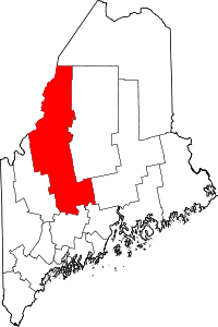 | |
| Plantations | ||
| Unorganized territories | ||
| CDPs | ||
| Other villages | ||