West Forks, Maine
| West Forks, Maine | |
|---|---|
| Plantation | |
 West Forks, Maine Location within the state of Maine | |
| Coordinates: 45°23′2″N 70°0′29″W / 45.38389°N 70.00806°W | |
| Country | United States |
| State | Maine |
| County | Somerset |
| Area | |
| • Total | 49.4 sq mi (128.0 km2) |
| • Land | 48.9 sq mi (126.6 km2) |
| • Water | 0.5 sq mi (1.4 km2) |
| Elevation | 1,263 ft (385 m) |
| Population (2000) | |
| • Total | 47 |
| • Density | 1.0/sq mi (0.4/km2) |
| Time zone | Eastern (EST) (UTC-5) |
| • Summer (DST) | EDT (UTC-4) |
| ZIP code | 04985 |
| Area code(s) | 207 |
| FIPS code | 23-82840 |
| GNIS feature ID | 0582805 |
West Forks is a plantation in Somerset County, Maine, United States. The population was 47 at the 2000 census.
Geography
According to the United States Census Bureau, the plantation has a total area of 49.4 square miles (128 km2), of which 48.9 square miles (127 km2) is land and 0.6 square miles (1.6 km2) (1.11%) is water.
Demographics
| Historical population | |||
|---|---|---|---|
| Census | Pop. | %± | |
| 1870 | 73 | — | |
| 1880 | 95 | 30.1% | |
| 1890 | 146 | 53.7% | |
| 1900 | 160 | 9.6% | |
| 1910 | 138 | −13.7% | |
| 1920 | 120 | −13.0% | |
| 1930 | 119 | −0.8% | |
| 1940 | 117 | −1.7% | |
| 1950 | 108 | −7.7% | |
| 1960 | 93 | −13.9% | |
| 1970 | 74 | −20.4% | |
| 1980 | 72 | −2.7% | |
| 1990 | 63 | −12.5% | |
| 2000 | 47 | −25.4% | |
| 2010 | 60 | 27.7% | |
| Est. 2014 | 58 | [1] | −3.3% |
As of the census[3] of 2000, there were 47 people, 23 households, and 10 families residing in the plantation. The population density was 1.0 people per square mile (0.4/km²). There were 96 housing units at an average density of 2.0 per square mile (0.8/km²). The racial makeup of the plantation was 100.00% White.
There were 23 households out of which 8.7% had children under the age of 18 living with them, 39.1% were married couples living together, and 52.2% were non-families. 39.1% of all households were made up of individuals and 4.3% had someone living alone who was 65 years of age or older. The average household size was 2.04 and the average family size was 2.64.
In the plantation the population was spread out with 6.4% under the age of 18, 12.8% from 18 to 24, 27.7% from 25 to 44, 38.3% from 45 to 64, and 14.9% who were 65 years of age or older. The median age was 49 years. For every 100 females there were 176.5 males. For every 100 females age 18 and over, there were 175.0 males.
The median income for a household in the plantation was $39,167, and the median income for a family was $61,250. Males had a median income of $25,750 versus $13,750 for females. The per capita income for the plantation was $20,042. There were no families and 4.2% of the population living below the poverty line, including no under eighteens and none of those over 64.
References
- ↑ "Annual Estimates of the Resident Population for Incorporated Places: April 1, 2010 to July 1, 2014". Retrieved June 4, 2015.
- ↑ "Census of Population and Housing". Census.gov. Retrieved June 4, 2015.
- ↑ "American FactFinder". United States Census Bureau. Retrieved 2008-01-31.
Municipalities and communities of Somerset County, Maine, United States | ||
|---|---|---|
| Towns | 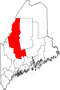 | |
| Plantations | ||
| Unorganized territories | ||
| CDPs | ||
| Other villages | ||
Coordinates: 45°23′49″N 70°02′10″W / 45.39694°N 70.03611°W