Hoover, Alabama
| Hoover, Alabama | |
|---|---|
| City | |
|
Riverchase Galleria | |
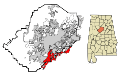 Location in Jefferson and Shelby counties in the state of Alabama | |
 Hoover, Alabama Location in the United States | |
| Coordinates: 33°23′11″N 86°48′18″W / 33.38639°N 86.80500°WCoordinates: 33°23′11″N 86°48′18″W / 33.38639°N 86.80500°W | |
| Country | United States |
| State | Alabama |
| Counties | Jefferson, Shelby |
| Settled | 1850s[1] |
| Incorporated (city) | April 28, 1967 |
| Government | |
| • Mayor | Gary Ivey |
| Area | |
| • City | 43.64 sq mi (113 km2) |
| • Land | 43.13 sq mi (111.7 km2) |
| • Water | 0.51 sq mi (1.3 km2) |
| Elevation[2] | 577 ft (166 m) |
| Population (2015)[3][4] | |
| • City | 84,848 (US: 387th) |
| • Density | 1,967/sq mi (760/km2) |
| • Metro | 1,145,067 (US: 49th) |
| Time zone | CST (UTC-6) |
| • Summer (DST) | CDT (UTC-5) |
| ZIP codes | 35216, 35226, 35236, 35244 |
| Area code(s) | 205 |
| FIPS code | 01-35896 |
| GNIS feature ID | 0120346 |
| Website |
www |

Hoover is a city in Jefferson and Shelby Counties in north central Alabama, United States. The largest suburb around Birmingham, the population of the city was 84,848 as of the 2015 US Census estimate.[5] Hoover is part of the Birmingham-Hoover, AL Metropolitan Statistical Area and is also included in the Birmingham-Hoover-Talladega, AL Combined Statistical Area. Hoover’s neighborhoods and planned communities are located along the foothills of the Appalachian Mountains.
Hoover is home to the Riverchase Galleria, one of the largest shopping centers in the Southeast and one of the largest mixed-use centers in the U.S. with 2.4 million square feet (222,967 m²) of total retail floor area. The Riverchase Galleria complex includes shopping, hotel and office space. The Birmingham Barons Minor League Baseball team, which traces its history to 1885, played its home games at the 10,800 seat Hoover Metropolitan Stadium until the team began playing home games at the Regions Field in downtown Birmingham in April 2013. Michael Jordan's brief professional baseball career was with the Barons in 1994.
History
The City of Hoover was incorporated in 1967. It was named after William H. Hoover, a local insurance company owner. The area had been known as the Green Valley community since the 1930s and was mostly a residential community. In the late 1970s and early 1980s the city was still mostly residential with a small City Hall that included space for the police department. The annexation of the Riverchase business and residential community on September 8, 1980[6] provided a base of large office buildings and employers to the city. A significant change to the city occurred when Interstate I-459 was opened with a major interchange with Interstate I-65 within the city. The most dramatic change occurred in 1986 when the Riverchase Galleria shopping-hotel-office complex opened. This significantly increased the tax revenue for the city. It was the catalyst to bring new residents and businesses to the city. The city has grown extremely fast with annexations and new developments. The city now provides services from many large city facilities including a Municipal Center, a Library, and a Public Safety Center. Residents and businesses are drawn to the city because of the rolling hills and nice residential areas, schools, city services, shopping, and business communities. The city will likely continue to boom population wise; the population has risen significantly in Hoover from 2008 and is now 81,619 as of the 2010 Census.
Geography
Hoover is located at 33°23′11″N 86°48′18″W / 33.386435°N 86.804938°W.[7]
According to the U.S. Census Bureau, the city has a total area of 43.65 square miles (113.1 km2), of which 43.13 square miles (111.7 km2) is land and 0.51 square miles (1.3 km2) (1.17%) is water.
Government
The municipal government has operated under the Mayor-Council form of government since incorporation. The Mayor and City Council are elected on a non-partisan basis to concurrent four-year terms of office which begin on October 1 of election year. Policy-making and legislative authority is vested in the City Council, which consists of seven "at-large" elected members (prior to 2004, the council consisted of five at-large members.) The city council is responsible for, among other things, considering local resolutions and ordinances, adopting an annual budget, and appointing members to local boards and committees. The Mayor is responsible for carrying out and enforcing the city's policies and ordinances.
| Current Mayor | ||
|---|---|---|
| Frank Brocato | ||
| Current City Council Membership | ||
| Council Place | Representative | Position |
| 1 | Curt Posey | Councilor |
| 2 | Gene Smith | Council President |
| 3 | John Lyda | Councilor |
| 4 | Mike Shaw | Councilor |
| 5 | Derrick Murphy | Councilor |
| 6 | Casey Middlebrooks | Councilor |
| 7 | John Greene | Council President Pro-Tem |
Economy
The Riverchase Galleria shopping-hotel-office complex provides a large amount of tax money to the city as well as being home to many retail, hotel, and office workers. The Riverchase Office Park, and other office parks and buildings throughout Hoover, house many large corporations. The Central Business District includes the US 31, SR 150, and US 280 locations. I-65 and I-459 intersect in the city. Major shopping centers in the city include Riverchase Galleria on US 31, Patton Creek on SR 150, and Village at Lee Branch on US 280.
Largest tax payers
Hoover 2015 annual financial report, ranking by largest sales and use taxpayers: [8]
- Costco
- Wal-Mart
- Sam's Club
- Belk
- Target
- Regions Bank
- Publix
- Home Depot
- Best Buy
- Macy's
Largest employers
- Blue Cross and Blue Shield of Alabama (company headquarters) - 3,000
- Hoover Board of Education - 1,773
- Regions Financial (operations center) - 1,765
- AT&T Inc. (data center) - 1,143
- City of Hoover - 745
- Walmart (two superstores and two Neighborhood Market stores) - 650
- T-Mobile 500
- Hanna Steel Corporation & Hanna Truck Line (company headquarters) - 350
- BE&K - 302
Public safety
Hoover Fire Department is a full-time career department operating from nine fire stations throughout the city. The city has one battalion. There are nine engine companies, three ladder trucks, three ALS rescue/ambulances, and two battalion chief cars. All engine companies are staffed with a minimum of three, with at least two being firefighter/paramedics. All engines are classified ALS (Advanced Life Support). The department also operates one heavy rescue truck, and one hazmat unit. Hoover Fire Department holds a Class 2 ISO rating and has done so for over 15 years. The department is very active in the community of over 80,000, providing free blood pressure checks at all stations, participates in Meals on Wheels, installs hundreds of child safety seats each year, participates in Operation Safe Place, in addition to a very active Fire Prevention program taught in all Hoover elementary schools. In 2007, the department responded to over 9000 calls. Fire Chief Tom Bradley retired in February 2009 with 60 years of service, over 30 of it with the city.
In 2006, the police force of the city of Hoover began using 104 Chevrolet police Tahoes. With this change, the Hoover Police Department became the largest law enforcement fleet in the nation that runs on E85, a fuel that is 85 percent ethanol and 15 percent gasoline.[9] The change was recognized by President George W. Bush, who visited the city in September 2006 to see the fleet and fueling facility. The police have a few other cars on staff as well, including a requisitioned Porsche 911 .
Hoover operates its own enhanced 911 emergency call center which has eight operator positions and is staffed 24/7.
Hoover provides traffic, severe weather, disaster information, and details on special events on low-power AM radio (1610 kHz).[10]
Hoover's first chief of police was Oscar Davis.
Demographics
| Historical population | |||
|---|---|---|---|
| Census | Pop. | %± | |
| 1970 | 688 | — | |
| 1980 | 18,996 | 2,661.0% | |
| 1990 | 39,788 | 109.5% | |
| 2000 | 62,742 | 57.7% | |
| 2010 | 81,619 | 30.1% | |
| Est. 2015 | 84,848 | [11] | 4.0% |
| U.S. Decennial Census[12] 2015 Estimate[13] | |||
As of the census of 2000, there were 62,742 people, 25,191 households, and 17,406 families residing in the city. The population density was 1,454.6 people per square mile (561.7/km²). There were 27,150 housing units at an average density of 629.4 per square mile (243.0/km²). The racial makeup of the city was 87.66% White, 6.77% Black, 0.16% Native American, 2.89% Asian, 0.03% Pacific Islander, 1.40% from other races, and 1.09% from two or more races. 3.79% of the population were Hispanic or Latino of any race.
There were 25,191 households out of which 33.4% had children under the age of 18 living with them, 59.4% were married couples living together, 7.2% had a female householder with no husband present, and 30.9% were non-families. 25.9% of all households were made up of individuals and 6.3% had someone living alone who was 65 years of age or older. The average household size was 2.47 and the average family size was 3.00.
In the city the population was spread out with 24.8% under the age of 18, 7.9% from 18 to 24, 32.6% from 25 to 44, 23.8% from 45 to 64, and 10.9% who were 65 years of age or older. The median age was 36 years. For every 100 females there were 95.1 males. For every 100 females age 18 and over, there were 91.5 males.
According to a 2007 estimate, the median income for a household in the city was $75,365, and the median income for a family was $89,513. Males had a median income of $55,660 versus $34,836 for females. The per capita income for the city was $33,361. About 2.1% of families and 3.4% of the population were below the poverty line, including 2.7% of those under age 18 and 3.9% of those age 65 or over.
2010 census
As of the census of 2013, there were 84,126 people, 32,478 households, and 22,476 families residing in the city. The population density was 1,870.3 people per square mile (722.3/km²). There were 35,474 housing units at an average density of 812.9 per square mile (313.9/km²). The racial makeup of the city was 75.1% White, 14.8% Black, 0.2% Native American, 5.1% Asian, 0.0% Pacific Islander, 3.2% from other races, and 1.5% from two or more races. 6.0% of the population were Hispanic or Latino of any race.
There were 32,478 households out of which 33.0% had children under the age of 18 living with them, 56.1% were married couples living together, 10.0% had a female householder with no husband present, and 30.8% were non-families. 25.8% of all households were made up of individuals and 7.6% had someone living alone who was 65 years of age or older. The average household size was 2.50 and the average family size was 3.02.
In the city the population was spread out with 25.0% under the age of 18, 7.8% from 18 to 24, 28.7% from 25 to 44, 26.6% from 45 to 64, and 12.0% who were 65 years of age or older. The median age was 37 years. For every 100 females there were 92.5 males. For every 100 females age 18 and over, there were 92.4 males.
The median income for a household in the city was $72,960, and the median income for a family was $94,066. Males had a median income of $65,023 versus $44,525 for females. The per capita income for the city was $39,141. About 3.4% of families and 5.6% of the population were below the poverty line, including 6.6% of those under age 18 and 3.5% of those age 65 or over.
Transportation
Hoover is served by two interstate highways, 65 and 459, with a major interchange near the center of the city. Major arterial roads include U.S. Route 31 as a north-south route through the middle of the city, U.S. Route 280 in the eastern portion of the city, Route 150 as an east-west road connecting the city center to the western side, and Valleydale Road connecting Route 31 and Route 280. Hoover is also served by the Metropolitan Area Express (MAX) bus system.
Communities
- Acton
- Altadena
- Bluff Park
- Caldwell Mill
- Chace Lake
- Country Club Highlands
- Deer Valley
- Georgetown
- Green Valley
- Greystone
- Inverness
- Lake Cyrus
- Patton Chapel
- Riverchase
- Rocky Ridge
- Ross Bridge
- Russet Woods
- Shades Mountain
- Shoal Creek
- Southlake
- The Preserve
- Trace Crossings
Parks
- Aldridge Gardens
- Bluff Park Community Center and Playground
- Blue Ridge Park[14]
- Georgetown Park
- Howard Lake Park
- Inverness Park
- Loch Haven Park
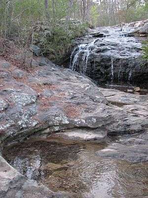
- Moss Rock Preserve
- Ross Park
- Russet Woods Park
- Star Lake Park
- Veterans Park
- Wildflower Park
Education
Primary and secondary schools
Hoover is served by Hoover City Schools. It has ten elementary schools, three middle schools, and two high schools, Spain Park High School and Hoover High School. Both schools have always been ranked highly in the country for excellent academics, being rated close to the top five-hundred schools in the country. The 2005-2006 school year saw 2,451 students enrolled in Hoover High School,[15] 1,400 in Spain Park High School,[16] with a total of 11,433 students in the Hoover City School system.[17] Spain Park received the National Blue Ribbon Award in 2008.[18]
Berry Middle School, which served as the city's first high school before the present Hoover High was constructed, was closed after the 2005-2006 academic year, with students moved to a new Berry Middle School constructed near the site of Spain Park High School. A poll of residents recently favored selling the school, possibly to the independent Shades Mountain Christian School."Joint offer made for Berry site". The Birmingham News. 2007. Retrieved 2007-11-09. Simmons Middle School and Bumpus Middle School are the city's other middle schools, whose students move on to Hoover High.
Before the 2004-2005 academic year, a few schools, most notably Trace Crossings Elementary, had almost, if not more than, 1,000 students, resulting in the building of Riverchase Elementary. After that, the case of overcrowding was resolved, with many students moving to the new school. However, a similar case has occurred with Bumpus Middle School, resulting in meetings at multiple district schools to discuss what to do about the case. For the 2011-2012 academic year, Bumpus Middle School and its students were moved to the former freshman center of Hoover High School, and the old Bumpus site became Brock's Gap Intermediate School, which serves 5th and 6th graders. Bumpus Middle School now serves 7th and 8th graders.
Colleges and universities
The Shelby-Hoover campus of the Jefferson State Community College is in Shelby County, is in Hoover, near Spain Park High School.[19][20] Faulkner University has a campus on Valleydale Road; The University of Alabama in Birmingham (UAB) in downtown Birmingham is only 8–10 miles away, and features the premier medical school of Alabama.
Miscellaneous education
The Birmingham Supplementary School Inc. (BSS, バーミングハム日本語補習校 Bāminguhamu Nihongo Hoshūkō), a part-time Japanese school, holds its classes at the Shelby-Hoover campus, while its office is at the Honda Manufacturing of Alabama, LLC facility in unincorporated Talladega County, near Lincoln. The school first opened on September 1, 2001.[21]
Media
Hoover has one television station, WBMA, branded as ABC 33/40, with its studio within the Hoover city limits, in the Riverchase office complex. The metro area has TV broadcasting stations that serve the Birmingham-Anniston-Tuscaloosa Designated Market Area (DMA) as defined by Nielsen Media Research. Charter Communications, Bright House Networks, and AT&T U-verse provide cable television service to specific communities in Hoover. DirecTV and Dish Network provide direct broadcast satellite television including both local and national channels to Hoover residents.
No radio stations operate from Hoover though numerous stations from the Birmingham market serve the city. (WERC-FM is licensed to Hoover but its studio is located in Birmingham.)
Three newspapers serve Hoover: The Birmingham News, a tri-weekly newspaper, the Over the Mountain Journal weekly newspapers, and the Hoover Sun, published monthly.
- See also List of television stations in Alabama
- See also List of radio stations in Alabama
Points of interest
- Aldridge Botanical Gardens
- Hoover Metropolitan Stadium (formerly Regions Park), home of the SEC baseball tournament
- Riverchase Galleria
- Ross Bridge Golf Resort and Spa, which boasts the third-longest golf course in the world
- Moss Rock Preserve
- The Library Theatre
References
- ↑ Vadie Honea. "A History of Hoover". City of Hoover, AL. Retrieved 2007-07-18. External link in
|publisher=(help) - ↑ Jonathan Stott. "33.3864°N 86.8047°W". EarthTools. Retrieved 2007-07-18.
- ↑ http://factfinder.census.gov/faces/tableservices/jsf/pages/productview.xhtml?src=CF. Retrieved 2016-06-06. Missing or empty
|title=(help) - ↑ http://factfinder.census.gov/faces/tableservices/jsf/pages/productview.xhtml?src=CF. Retrieved 2016-06-07. Missing or empty
|title=(help) - ↑ Bureau, U.S. Census. "American FactFinder - Community Facts". factfinder.census.gov. Retrieved 2016-06-07.
- ↑ "A History of Hoover". Retrieved 2014-11-15.
- ↑ "US Gazetteer files: 2010, 2000, and 1990". United States Census Bureau. 2011-02-12. Retrieved 2011-04-23.
- ↑ "Hoover Alabama Comprehensive Annual Financial Report (CAFR)". City of Hoover. Retrieved 26 July 2016.
- ↑ Kent, Dawn. (February 23, 2006) "Hoover's ethanol SUVs catch researchers' eye." Birmingham News.
- ↑ City of Hoover website
- ↑ "Annual Estimates of the Resident Population for Incorporated Places: April 1, 2010 to July 1, 2015". Retrieved July 2, 2016.
- ↑ "U.S. Decennial Census". Census.gov. Retrieved June 14, 2013.
- ↑ http://factfinder.census.gov/faces/tableservices/jsf/pages/productview.xhtml?src=CF. Retrieved June 7, 2016. Missing or empty
|title=(help) - ↑ Facebook page of trail
- ↑ "Hoover High School". schooldigger.com. 2007. Retrieved 2007-07-24.
- ↑ "Spain Park High School". schooldigger.com. 2007. Retrieved 2007-07-24.
- ↑ Hoover City Schools website
- ↑ "No Child Left Behind-Blue Ribbon Schools Program - 2008 Schools", U.S. Department of Education
- ↑ "2010 CENSUS - CENSUS BLOCK MAP: Hoover city, AL." (Archive). U.S. Census Bureau. Retrieved on May 11, 2014.
- ↑ "Shelby-Hoover Campus." Jefferson State Community College. Retrieved on May 11, 2014. Use the Google Maps function to see the buildings and where they are in relation to the city limits.
- ↑ "About Birmingham Supplementary School" (Archive). Birmingham Supplementary School. Retrieved on May 11, 2014. "Mailing Address 1800 Honda Drive Lincoln, AL 35096 c/o Honda Manufacturing of Alabama, LLC" and "Facility Jefferson State Community College, Shelby Campus 4600 Valleydale Road Birmingham, AL 35242 " Japanese page: "学校の概要" (Archive).
External links
- City of Hoover
- Hoover Alabama Chamber of Commerce
- Hoover Police Department
- Hoover City Schools
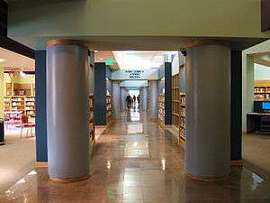
- Hoover Library
- Birmingham Barons
- Bluff Park Community
Municipalities and communities of Jefferson County, Alabama, United States | ||
|---|---|---|
| Cities |  | |
| Towns | ||
| CDPs | ||
| Unincorporated communities | ||
| Former towns | ||
| Footnotes | ‡This populated place also has portions in an adjacent county or counties | |
Municipalities and communities of Shelby County, Alabama, United States | ||
|---|---|---|
| Cities | 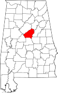 | |
| Towns | ||
| CDPs | ||
| Unincorporated communities | ||
| Footnotes | ‡This populated place also has portions in an adjacent county or counties | |