Hubbardton, Vermont
| Hubbardton, Vermont | |
|---|---|
| Town | |
|
Sign on Route 144 in Hubbardton | |
 Hubbardton, Vermont | |
| Coordinates: 43°43′23″N 73°11′15″W / 43.72306°N 73.18750°WCoordinates: 43°43′23″N 73°11′15″W / 43.72306°N 73.18750°W | |
| Country | United States |
| State | Vermont |
| County | Rutland |
| Area | |
| • Total | 28.9 sq mi (74.7 km2) |
| • Land | 27.5 sq mi (71.3 km2) |
| • Water | 1.3 sq mi (3.5 km2) |
| Elevation | 463 ft (141 m) |
| Population (2010) | |
| • Total | 706 |
| • Density | 24/sq mi (9.5/km2) |
| Time zone | Eastern (EST) (UTC-5) |
| • Summer (DST) | EDT (UTC-4) |
| ZIP code | Uses 05735 (Castleton) and 05743 (Fair Haven) |
| Area code(s) | 802 |
| FIPS code | 50-34450[1] |
| GNIS feature ID | 1462120[2] |

Hubbardton is a town in Rutland County, Vermont, United States. The town was named for Thomas Hubbard, a landholder.[3] The population was 706 at the 2010 census.[4]
The town was the site of the Battle of Hubbardton, where British forces attacked Americans during the Saratoga Campaign of 1777.
Geography
According to the United States Census Bureau, the town has a total area of 28.9 square miles (75 km2), of which 27.5 square miles (71 km2) is land and 1.3 square miles (3.4 km2), or 4.61%, is water. Lake Hortonia and Beebe Pond are two of the larger bodies of water in the town.
Demographics
| Historical population | |||
|---|---|---|---|
| Census | Pop. | %± | |
| 1790 | 404 | — | |
| 1800 | 641 | 58.7% | |
| 1810 | 724 | 12.9% | |
| 1820 | 810 | 11.9% | |
| 1830 | 865 | 6.8% | |
| 1840 | 719 | −16.9% | |
| 1850 | 701 | −2.5% | |
| 1860 | 606 | −13.6% | |
| 1870 | 606 | 0.0% | |
| 1880 | 533 | −12.0% | |
| 1890 | 506 | −5.1% | |
| 1900 | 488 | −3.6% | |
| 1910 | 455 | −6.8% | |
| 1920 | 328 | −27.9% | |
| 1930 | 307 | −6.4% | |
| 1940 | 346 | 12.7% | |
| 1950 | 332 | −4.0% | |
| 1960 | 238 | −28.3% | |
| 1970 | 228 | −4.2% | |
| 1980 | 490 | 114.9% | |
| 1990 | 576 | 17.6% | |
| 2000 | 752 | 30.6% | |
| 2010 | 706 | −6.1% | |
| Est. 2014 | 693 | [5] | −1.8% |
| U.S. Decennial Census[6] | |||
As of the census[1] of 2000, there were 752 people, 296 households, and 203 families residing in the town. The population density was 27.3 people per square mile (10.6/km2). There were 580 housing units at an average density of 21.1 per square mile (8.1/km2). The racial makeup of the town was 95.61% White, 1.33% African American, 0.40% Native American, 0.40% Asian, 0.13% Pacific Islander, 0.93% from other races, and 1.20% from two or more races. Hispanic or Latino of any race were 1.60% of the population.
There were 296 households out of which 29.4% had children under the age of 18 living with them, 57.1% were married couples living together, 5.7% had a female householder with no husband present, and 31.1% were non-families. 21.3% of all households were made up of individuals and 6.8% had someone living alone who was 65 years of age or older. The average household size was 2.54 and the average family size was 2.96.
In the town the population was spread out with 22.7% under the age of 18, 7.6% from 18 to 24, 27.4% from 25 to 44, 31.8% from 45 to 64, and 10.5% who were 65 years of age or older. The median age was 40 years. For every 100 females there were 106.6 males. For every 100 females age 18 and over, there were 106.8 males.
The median income for a household in the town was $37,647, and the median income for a family was $39,485. Males had a median income of $30,982 versus $19,583 for females. The per capita income for the town was $19,276. About 6.3% of families and 13.0% of the population were below the poverty line, including 16.7% of those under age 18 and 2.4% of those age 65 or over.
References
- 1 2 "American FactFinder". United States Census Bureau. Retrieved 2008-01-31.
- ↑ "US Board on Geographic Names". United States Geological Survey. 2007-10-25. Retrieved 2008-01-31.
- ↑ "Profile for Hubbardton, Vermont". ePodunk. Retrieved 2010-05-10.
- ↑ "Profile of General Population and Housing Characteristics: 2010 Demographic Profile Data (DP-1): Hubbardton town, Vermont". U.S. Census Bureau, American Factfinder. Retrieved November 3, 2011.
- ↑ "Annual Estimates of the Resident Population for Incorporated Places: April 1, 2010 to July 1, 2014". Retrieved June 4, 2015.
- ↑ "U.S. Decennial Census". United States Census Bureau. Retrieved May 16, 2015.
External links
Municipalities and communities of Rutland County, Vermont, United States | ||
|---|---|---|
| City | 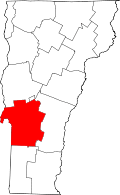 | |
| Towns | ||
| Village | ||
| CDPs | ||
| Other communities | ||