Illinois's 16th congressional district
| Illinois's 16th congressional district | ||
|---|---|---|
.tif.png) | ||
| Current Representative | Adam Kinzinger (R–Channahon) | |
| Area | 7,918 mi2 | |
| Distribution | 71.0% urban, 29.1% rural | |
| Population (2011 est.) | 713,840 | |
| Median income | $52,101 | |
| Ethnicity | 91.2% White, 4.2% Black, 1.2% Asian, 8.7% Hispanic, 0.1% Native American, 1.8% other | |
| Cook PVI | R+4[1][2] | |
The 16th Congressional District of Illinois is represented by Republican Adam Kinzinger.
2011 redistricting
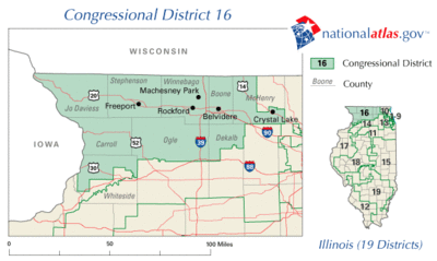
The congressional district covers parts of DeKalb, Ford, Stark, Will and Winnebago counties, and all of Boone, Bureau, Grundy, Iroquois, LaSalle, Lee, Livingston, Ogle and Putnam counties, as of the 2011 redistricting which followed the 2010 census. All or parts of Belvidere, Channahon, DeKalb, Dixon, Loves Park, Machesney Park, Ottawa, Morris, Pontiac, Rockford and Streator are included.[3] The representatives for these districts were elected in the 2012 primary and general elections, and the boundaries became effective on January 5, 2013.
History
Prominent past representatives from the 16th district have included Everett Dirksen, who went on to become the Republican leader in the United States Senate; John B. Anderson, who became the 3rd highest ranking Republican in the House and went on to run as a major independent candidate in the 1980 Presidential election; and Lynn Martin, who later served as United States Secretary of Labor.
For decades, the 16th district was the most geographically stable district in Illinois. For more than six decades, in comparison to the other districts in the state, it was almost stationary. While its shape fluctuated slightly after each census, in general it included the northwest corner of the state, extending just far enough to the east to include its largest city, Rockford.[4] By the 1990s, it extended eastward to include part of McHenry County, an outer suburb of Chicago. This geographic stability also contributed to electoral stability. It first became a Rockford-based district for the 1948 election, and from then until 2010 it was represented by just five people, all but one of whom was a Republican.
However, with the new map drawn for 2012, the familiar shape of the 16th was rendered unrecognizable. It was pushed well to the east to take in the extreme exurban region of the Chicago metropolitan area, and stretches from the Wisconsin border to the Indiana border. While it still included most of Rockford's suburbs, half of Rockford itself—essentially the more Democratic portion of the city—was shifted to the 17th district.
Elections
2012 election
Voting
| Election results from presidential races | ||
|---|---|---|
| Year | Office | Results |
| 2012 | President | Romney 53 - 45%[2] |
| 2008 | President | Obama 50 - 48%[2] |
| 2004 | President | Bush 55 - 44% |
| 2000 | President | Bush 54 - 43% |
List of representatives
| Representative | Party | Years | District home | Notes |
|---|---|---|---|---|
| District created | March 4, 1873 | |||
 James S. Martin James S. Martin |
Republican | March 4, 1873 – March 3, 1875 | ||
 William A. J. Sparks William A. J. Sparks |
Democratic | March 4, 1875 – March 3, 1883 | ||
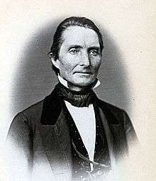 Aaron Shaw Aaron Shaw |
Democratic | March 4, 1883 – March 3, 1885 | ||
 Silas Z. Landes Silas Z. Landes |
Democratic | March 4, 1885 – March 3, 1889 | ||
 George W. Fithian George W. Fithian |
Democratic | March 4, 1889 – March 3, 1895 | ||
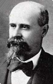 Finis E. Downing Finis E. Downing |
Democratic | March 4, 1895 – June 5, 1896 | Lost contested election | |
 John I. Rinaker John I. Rinaker |
Republican | June 5, 1896 – March 3, 1897 | Won contested election | |
 William H. Hinrichsen William H. Hinrichsen |
Democratic | March 4, 1897 – March 3, 1899 | ||
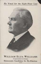 William E. Williams William E. Williams |
Democratic | March 4, 1899 – March 3, 1901 | ||
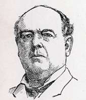 Thomas J. Selby Thomas J. Selby |
Democratic | March 4, 1901 – March 3, 1903 | ||
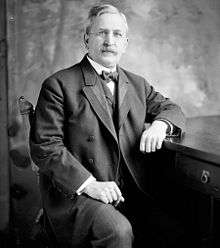 Joseph V. Graff Joseph V. Graff |
Republican | March 4, 1903 – March 3, 1911 | Redistricted from the 14th district | |
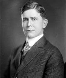 Claude U. Stone Claude U. Stone |
Democratic | March 4, 1911 – March 3, 1917 | ||
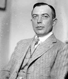 Clifford C. Ireland Clifford C. Ireland |
Republican | March 4, 1917 – March 3, 1923 | ||
 William E. Hull William E. Hull |
Republican | March 4, 1923 – March 3, 1933 | ||
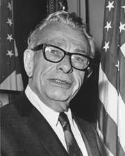 Everett Dirksen Everett Dirksen |
Republican | March 4, 1933 – January 3, 1949 | ||
 Leo E. Allen Leo E. Allen |
Republican | January 3, 1949 – January 3, 1961 | Redistricted from the 13th district | |
 John B. Anderson John B. Anderson |
Republican | January 3, 1961 – January 3, 1981 | ||
 Lynn Morley Martin Lynn Morley Martin |
Republican | January 3, 1981 – January 3, 1991 | ||
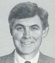 John W. Cox, Jr. John W. Cox, Jr. |
Democratic | January 3, 1991 – January 3, 1993 | ||
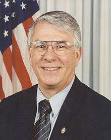 Donald A. Manzullo Donald A. Manzullo |
Republican | January 3, 1993 – January 3, 2013 | Lost contested primary | |
 Adam Kinzinger Adam Kinzinger |
Republican | January 3, 2013 – | Redistricted from the 11th district | |
Living former Members of the U.S. House of Representatives from Illinois's 16th congressional district
As of May 2015, four former members of the U.S. House of Representatives from Illinois's 16th congressional district are alive.
| Representative | Term in office | Date of birth (and age) |
|---|---|---|
| John B. Anderson | 1961 - 1981 | February 15, 1922 |
| Lynn Morley Martin | 1981 - 1991 | December 26, 1939 |
| John W. Cox, Jr. | 1991 - 1993 | July 10, 1947 |
| Don Manzullo | 1993 - 2013 | March 24, 1944 |
Historical district boundaries
See also
References
- ↑ "Partisan Voting Index Districts of the 113th Congress: 2004 & 2008" (PDF). The Cook Political Report. 2012. Retrieved 2013-01-10.
- 1 2 3 Barone, Michael; McCutcheon, Chuck (2013). The Almanac of American Politics 2014. Chicago: University of Chicago Press. pp. 591–593. ISBN 978-0-226-10544-4. Copyright National Journal.
- ↑ Illinois Congressional District 16, Illinois Board of Elections
- ↑ Sweeny, Chuck. "Manzullo gears up for primary with new map". Illinois Conservatives (Source: Rockford Register Star). Retrieved 2014-092-17. Check date values in:
|access-date=(help)
- Martis, Kenneth C. (1989). The Historical Atlas of Political Parties in the United States Congress. New York: Macmillan Publishing Company.
- Martis, Kenneth C. (1982). The Historical Atlas of United States Congressional Districts. New York: Macmillan Publishing Company.
- Congressional Biographical Directory of the United States 1774–present
External links
Coordinates: 41°23′29″N 88°47′58″W / 41.3914°N 88.7994°W