Indiana State Road 22
| ||||
|---|---|---|---|---|
 | ||||
| Route information | ||||
| Maintained by INDOT | ||||
| Length: | 50.6 mi[1] (81.4 km) | |||
| Existed: | October 1, 1926[2] – present | |||
| Major junctions | ||||
| West end: |
| |||
|
| ||||
| East end: |
| |||
| Location | ||||
| Counties: | Carroll, Howard, Grant | |||
| Highway system | ||||
| ||||

State Road 22 in the U.S. state of Indiana is a major thoroughfare from Kokomo to Interstate 69. The highway is concurrent with U.S. Route 35 from Kokomo to Interstate 69.
Route description
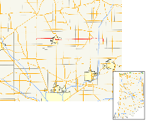
Indiana State Road 22 (SR 22) begins at SR 29 in Burlington. SR 22 heads due east to Kokomo where SR 22 has an intersection with U.S. Route 31 (US 31) and US 35 At this point US 35 turns east onto SR 22 heading due east. After 29.66 miles (47.73 km) US 35 leaves SR 22 at an interchange with Interstate 69 (I-69). Then after the I-69 interchange, SR 22 continues due east. Just east of SR 5, SR 22 turns due south. Right after turning north-south route SR 22 ends at SR 26.
Major intersections
| County | Location | mi[1] | km | Destinations | Notes |
|---|---|---|---|---|---|
| Carroll | Burlington | 0.00 | 0.00 | Western terminus of SR 22 | |
| Howard | Kokomo | Former US 31 | |||
| 16.15 | 25.99 | Western end of US 35 concurrency | |||
| Taylor Township | Western end of SR 19 concurrency | ||||
| Greentown | Northern terminus of SR 213 | ||||
| Jackson Township | Eastern end of SR 19 concurrency | ||||
| Grant | Sims Township | ||||
| Marion | |||||
| Jonesboro | Southern terminus of SR 15 | ||||
| Gas City | 45.81 | 73.72 | Eastern end of US 35 concurrency | ||
| Upland | 48.27 | 77.68 | Southern terminus of SR 5 | ||
| 50.57 | 81.38 | Eastern terminus of SR 22 | |||
1.000 mi = 1.609 km; 1.000 km = 0.621 mi
| |||||
References
- 1 2 "INDOT Roadway Referencing System" (PDF).
- ↑ "Road Numbers to Be Changed". The Hancock-Democrat. The Indianapolis News. September 30, 1926. Retrieved June 9, 2016 – via Newspapers.com.

External links
This article is issued from Wikipedia - version of the 11/29/2016. The text is available under the Creative Commons Attribution/Share Alike but additional terms may apply for the media files.