Greentown, Indiana
| Greentown, Indiana | |
|---|---|
| Town | |
|
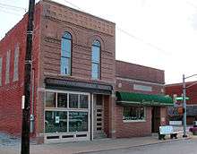
Downtown Greentown in the winter. Showing the light, and the corner which Subway sits. | |
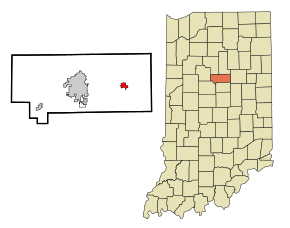 Location in the state of Indiana | |
| Coordinates: 40°28′43″N 85°57′53″W / 40.47861°N 85.96472°WCoordinates: 40°28′43″N 85°57′53″W / 40.47861°N 85.96472°W | |
| Country | United States |
| State | Indiana |
| County | Howard |
| Township | Liberty |
| Area[1] | |
| • Total | 1.37 sq mi (3.55 km2) |
| • Land | 1.37 sq mi (3.55 km2) |
| • Water | 0 sq mi (0 km2) |
| Elevation | 840 ft (256 m) |
| Population (2010)[2] | |
| • Total | 2,415 |
| • Estimate (2013[3]) | 2,397 |
| • Density | 1,762.8/sq mi (680.6/km2) |
| Time zone | EST (UTC-5) |
| • Summer (DST) | EST (UTC-5) |
| ZIP code | 46936 |
| Area code(s) | 765 |
| FIPS code | 18-29772[4] |
| GNIS feature ID | 0435455[5] |

Greentown is a town in Liberty Township, Howard County, Indiana, United States. Located approximately 9 miles east of Kokomo on State Road 22 / US 35, it is home to the Howard County Fair Grounds. The town was platted in 1848, and incorporated as a town in 1873.[6] Known for its collectible glassware made for only a few years by a local factory destroyed in 1903,[7] it is home to the Greentown Glass Museum. As of the 2010 census, the town's population was 2,415.[2]
Geography
Greentown is located at 40°28′43″N 85°57′53″W / 40.47861°N 85.96472°W (40.478556, -85.964683).[8]
According to the 2010 census, Greentown has a total area of 1.37 square miles (3.55 km2), all land.[1] It was the nearest town to the epicenter of the magnitude 3.8 Indiana earthquake of December 30, 2010.
History of Greentown
Greentown was laid out in 1848 on the site of a former Native American village. Its inception was largely due to the need for a nearby trading post by people living in the area. First was a merchant, L. W. Bacon who built a log house on the northeast corner of Main and Merdian. Next was C. O. Fry who built on the southwest corner of the intersection. Just prior to the establishment of these local stores, around 1840 the Miami tribe of the Algonquin native peoples had a population in Howard county of about two hundred. There was an established village where South Kokomo is located, as well as villages south of present-day Cassville and Greentown. The frequently traveling paths were from Kokomo to Peru by way of the village of Cassville, and from Kokomo to Meshingomesia by way of a village south of Greentown.[9]
There are a few different versions of how Greentown received its name. One of the more obvious versions would be that Greentown was an area of luscious green grass.[10] Another version deals with the fact that before the town was incorporated that land was a part of a former township named Green Township. Green Township formed into both Liberty, and Union Townships in 1860, and so even though Greentown wasn't incorporated until the 1870s people were still living there when it was Green Township, and may have possibly all opted to preserve Green Township in some way by naming their town after it. One other version is based on the idea of Greentown being an Indian settlement named after a Native American chief called Green.[10]
Greentown was incorporated some time between 1870 and 1880 as it first appeared on the US census in 1880. The population started out at just over 200, and quickly reached a thousand. Over the years ever since Greentown's population numbers have seen huge gains every couple census' followed by tiny drops between those which has been enough for the town to slowly grow over time, and has near 2,500 people since the 1990s. Greentown is expected to annex more land when the sewage treatment plant is fixed which is expected to bring forth another gain again soon.[11]
The Hy-Red Gasoline Station was listed on the National Register of Historic Places in 1983.[12]
Notable People
Micah Marx (Mayor of Greentown)
Greentown Glass
Greentown’s first natural gas well came in 1877, and was located near the railroad on the west side of town. In years later to come, D.C Jenkins founded the glass manufacturing plant, Indiana Tumbler and Goblet Factory. The company was sold in 1899 to the National Glass Company. This company was fully operation up until 1903 when a fire took the building. The National Glass Company created glassware which is highly desirable today. The glass factory brought many jobs to the area and marked the town’s main period of industrial activity. When the factory burned down and the natural gas supply drastically declined, Greentown’s population dropped by about ten percent and the town as a whole suffered severe loss of revenue. However, the town has since doubled in size of its industrial peak.
Greentown Libraries
Greentown is home to two public libraries, one in the elementary building and the other in the local high school. The libraries host many events in the community to get Greentown residents involved and interested in reading.
Transportation
Roads
Following the passage of a law that permitted the seizure of lands for the purpose of building public roads, in 1869 the citizens undertook the building of two toll roads: the Kokomo and Greentown Gravel Road mostly on the south side of the Wildcat Creek finished in 1874 (today's 50 North), and the Kokomo Greentown Jerome Gravel Road on the north finished in 1871 (today's Sycamore Road). These two roads joined on 50 North and 780 East and came together into Greentown. By the early 1900s the toll gates were retired.[9]
In modern times there is Main Street that doubles as several highways, Meridian Street as the main north and south road. That is where historic downtown Greentown is centered, and the Howard County Fair is down Meridian Street just north of Greentown. Walnut Street is the street the Elementary School is on, and Harrison Street is the street Eastern Junior & Senior High School is on, the football stadium is on the corner of Walnut Street, and Harrison Street.
Rail
The Interurban Railroad entered Greentown in 1902 and served the area until 1930. It offered rail transportation to the citizens of Kokomo, Greentown, and Marion in neighboring Grant County. While the Interurban was running many workers from Kokomo and Marion settled in Greentown for a more rural living with urban jobs, and transformed Greentown into a suburban community and small business center. However following the departure of the Interurban Greentown has not again seen modern public transportation.
Highways
-
 US-35 to Logansport (North) and Muncie (South)
 -
 IN-19 to Converse (North) and Tipton (South)
 -
 IN-22 to Burlington and Kokomo (West) and Gas City and Hartford City (East)
 -
 IN-213 from Greentown (North) to near Noblesville (South)
Walking Trails
- Comet Trail - a trail that is a mile long. It is named after the local high school mascot.
- Historic Downtown Walking Trail - a trail that also allows you to learn more history about the area as well if you choose.
Demographics
| Historical population | |||
|---|---|---|---|
| Census | Pop. | %± | |
| 1880 | 236 | — | |
| 1890 | 731 | 209.7% | |
| 1900 | 1,287 | 76.1% | |
| 1910 | 1,156 | −10.2% | |
| 1920 | 1,163 | 0.6% | |
| 1930 | 1,081 | −7.1% | |
| 1940 | 1,080 | −0.1% | |
| 1950 | 1,180 | 9.3% | |
| 1960 | 1,266 | 7.3% | |
| 1970 | 1,870 | 47.7% | |
| 1980 | 2,265 | 21.1% | |
| 1990 | 2,172 | −4.1% | |
| 2000 | 2,546 | 17.2% | |
| 2010 | 2,415 | −5.1% | |
| Est. 2015 | 2,399 | [13] | −0.7% |
| U.S. Decennial Census[14] 2013 Estimate[15] | |||
Greentown first appeared on the census in 1880. In 1870 the only three towns listed in Howard County were Kokomo, Russiaville, and New London. In 1880 New London vanished and Greentown was listed instead. Soon after Greentown being incorporated its population was instantly double that of Russiavilles', and the population quickly exploded to over a thousand people in just twenty years
2010 census
As of the census[2] of 2010, there were 2,415 people, 964 households, and 645 families residing in the town. The population density was 1,762.8 inhabitants per square mile (680.6/km2). There were 1,069 housing units at an average density of 780.3 per square mile (301.3/km2). The racial makeup of the town was 97.1% White, 0.6% African American, 0.2% Native American, 1.0% Asian, 0.4% from other races, and 0.7% from two or more races. Hispanic or Latino of any race were 1.5% of the population.
There were 964 households of which 34.4% had children under the age of 18 living with them, 49.5% were married couples living together, 14.3% had a female householder with no husband present, 3.1% had a male householder with no wife present, and 33.1% were non-families. 29.9% of all households were made up of individuals and 14.1% had someone living alone who was 65 years of age or older. The average household size was 2.40 and the average family size was 2.97.
The median age in the town was 41.4 years. 25.1% of residents were under the age of 18; 7% were between the ages of 18 and 24; 22.5% were from 25 to 44; 25.3% were from 45 to 64; and 20.1% were 65 years of age or older. The gender makeup of the town was 46.0% male and 54.0% female.
2000 census
As of the census[4] of 2000, there were 2,546 people, 995 households, and 703 families residing in the town. The population density was 2,534.8 people per square mile (983.0/km²). There were 1,050 housing units at an average density of 1,045.4 per square mile (405.4/km²). The racial makeup of the town was 97.92% White, 0.47% African American, 0.31% Native American, 0.31% Asian, 0.27% from other races, and 0.71% from two or more races. Hispanic or Latino of any race were 0.98% of the population.
There were 995 households out of which 37.1% had children under the age of 18 living with them, 56.0% were married couples living together, 11.7% had a female householder with no husband present, and 29.3% were non-families. 27.5% of all households were made up of individuals and 14.0% had someone living alone who was 65 years of age or older. The average household size was 2.49 and the average family size was 3.02.
In the town the population was spread out with 28.1% under the age of 18, 6.7% from 18 to 24, 27.8% from 25 to 44, 21.1% from 45 to 64, and 16.2% who were 65 years of age or older. The median age was 37 years. For every 100 females there were 85.6 males. For every 100 females age 18 and over, there were 80.6 males.
The median income for a household in the town was $43,750, and the median income for a family was $52,310. Males had a median income of $42,132 versus $27,000 for females. The per capita income for the town was $20,057. About 6.5% of families and 9.2% of the population were below the poverty line, including 12.4% of those under age 18 and 3.2% of those age 65 or over.
Education
School Districts
Eastern High School competes in the Hoosier Heartland Conference (HHC) for athletics. Eastern's colors are green and gold. Eastern High School is home of the Mighty Comets.
Local media
Newspapers
- Greentown Grapevine, monthly newspaper
References
- 1 2 "G001 - Geographic Identifiers - 2010 Census Summary File 1". United States Census Bureau. Retrieved 2015-07-16.
- 1 2 3 "American FactFinder". United States Census Bureau. Retrieved 2012-12-11.
- ↑ US Census. US Census http://factfinder.census.gov/faces/tableservices/jsf/pages/productview.xhtml?src=bkmk. Missing or empty
|title=(help) - 1 2 "American FactFinder". United States Census Bureau. Retrieved 2008-01-31.
- ↑ "US Board on Geographic Names". United States Geological Survey. 2007-10-25. Retrieved 2008-01-31.
- ↑ Greentown Historical Society http://greentownhistory.org/Page4.html. Retrieved 23 April 2015. Missing or empty
|title=(help) - ↑ "Greentown history". Retrieved March 1, 2014.
- ↑ "US Gazetteer files: 2010, 2000, and 1990". United States Census Bureau. 2011-02-12. Retrieved 2011-04-23.
- 1 2 Morrow, Jackson (1909). History of Howard County, Indiana, Vol.1. B. F. Bowen & Company, Indianapolis, Indiana. pp. 48,105,204. Retrieved 26 Apr 2015.
- 1 2 "A Look Back as We Move Forward". The Kokomo Tribune. March 28, 1999. p. 58. Retrieved August 16, 2014 – via Newspapers.com.

- ↑ "US Census of Population and Housing". United States Census. Retrieved 1 March 2014.
- ↑ National Park Service (2010-07-09). "National Register Information System". National Register of Historic Places. National Park Service.
- ↑ "Annual Estimates of the Resident Population for Incorporated Places: April 1, 2010 to July 1, 2015". Retrieved July 2, 2016.
- ↑ "U.S. Decennial Census". Census.gov. Retrieved June 6, 2013.
- ↑ US Census. US Census http://factfinder.census.gov/faces/tableservices/jsf/pages/productview.xhtml?src=bkmk. Retrieved 23 April 2015. Missing or empty
|title=(help)
External links
- Greentown Historical Society
- Greentown Library
- Greentown's website
- Howard County 4-H Fair
- National Greentown Glass Association
Municipalities and communities of Howard County, Indiana, United States | ||
|---|---|---|
| City | ||
| Towns | ||
| Townships | ||
| Other unincorporated communities |
| |
