Warren, Indiana
| Warren, Indiana | |
|---|---|
| Town | |
| Town of Warren | |
|
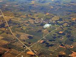
Aerial view of Warren facing northeast | |
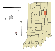 Location in the state of Indiana | |
| Coordinates: 40°41′6″N 85°25′24″W / 40.68500°N 85.42333°WCoordinates: 40°41′6″N 85°25′24″W / 40.68500°N 85.42333°W | |
| Country | United States |
| State | Indiana |
| County | Huntington |
| Township | Salamonie |
| Area[1] | |
| • Total | 1.15 sq mi (2.98 km2) |
| • Land | 1.14 sq mi (2.95 km2) |
| • Water | 0.01 sq mi (0.03 km2) |
| Elevation | 823 ft (251 m) |
| Population (2010)[2] | |
| • Total | 1,239 |
| • Estimate (2012[3]) | 1,241 |
| • Density | 1,086.8/sq mi (419.6/km2) |
| Time zone | Eastern (EST) (UTC-5) |
| • Summer (DST) | EDT (UTC-4) |
| ZIP code | 46792 |
| Area code(s) | 260 |
| FIPS code | 18-80108[4] |
| GNIS feature ID | 0445479[5] |
| Website | http://www.warrenindiana.com/index.html |
Warren is a town in Salamonie Township, Huntington County, Indiana, United States. The population of Warren at the 2010 census was 1,239.
Geography
Warren is located at 40°41′6″N 85°25′24″W / 40.68500°N 85.42333°W (40.685112, -85.423446),[6] along the Salamonie River.[7] The town lies just southeast of Interstate 69 between exits 273 and 278.
According to the 2010 census, Warren has a total area of 1.145 square miles (2.97 km2), of which 1.14 square miles (2.95 km2) (or 99.56%) is land and 0.005 square miles (0.01 km2) (or 0.44%) is water.[1]
Demographics
| Historical population | |||
|---|---|---|---|
| Census | Pop. | %± | |
| 1880 | 503 | — | |
| 1890 | 1,120 | 122.7% | |
| 1900 | 1,523 | 36.0% | |
| 1910 | 1,189 | −21.9% | |
| 1920 | 1,520 | 27.8% | |
| 1930 | 1,177 | −22.6% | |
| 1940 | 1,388 | 17.9% | |
| 1950 | 1,247 | −10.2% | |
| 1960 | 1,241 | −0.5% | |
| 1970 | 1,229 | −1.0% | |
| 1980 | 1,254 | 2.0% | |
| 1990 | 1,185 | −5.5% | |
| 2000 | 1,272 | 7.3% | |
| 2010 | 1,239 | −2.6% | |
| Est. 2015 | 1,223 | [8] | −1.3% |
2010 census
As of the census[2] of 2010, there were 1,239 people, 515 households, and 341 families residing in the town. The population density was 1,086.8 inhabitants per square mile (419.6/km2). There were 600 housing units at an average density of 526.3 per square mile (203.2/km2). The racial makeup of the town was 98.8% White, 0.1% African American, 0.1% Native American, 0.2% Asian, 0.1% from other races, and 0.8% from two or more races. Hispanic or Latino of any race were 0.4% of the population.
There were 515 households of which 29.5% had children under the age of 18 living with them, 52.2% were married couples living together, 11.3% had a female householder with no husband present, 2.7% had a male householder with no wife present, and 33.8% were non-families. 29.5% of all households were made up of individuals and 11.6% had someone living alone who was 65 years of age or older. The average household size was 2.41 and the average family size was 2.96.
The median age in the town was 40.1 years. 24.9% of residents were under the age of 18; 8.2% were between the ages of 18 and 24; 22.6% were from 25 to 44; 25.5% were from 45 to 64; and 19% were 65 years of age or older. The gender makeup of the town was 49.4% male and 50.6% female.
2000 census
As of the census[4] of 2000, there were 1,272 people, 507 households, and 354 families residing in the town. The population density was 1,395.1 people per square mile (539.7/km²). There were 558 housing units at an average density of 612.0 per square mile (236.8/km²). The racial makeup of the town was 98.82% White, 0.31% African American, 0.16% Native American, 0.08% Asian, 0.39% from other races, and 0.24% from two or more races. Hispanic or Latino of any race were 0.79% of the population.
There were 507 households out of which 36.3% had children under the age of 18 living with them, 58.6% were married couples living together, 7.9% had a female householder with no husband present, and 30.0% were non-families. 25.8% of all households were made up of individuals and 11.4% had someone living alone who was 65 years of age or older. The average household size was 2.51 and the average family size was 3.03.
In the town the population was spread out with 28.4% under the age of 18, 6.4% from 18 to 24, 28.6% from 25 to 44, 21.7% from 45 to 64, and 14.9% who were 65 years of age or older. The median age was 37 years. For every 100 females there were 92.4 males. For every 100 females age 18 and over, there were 90.2 males.
The median income for a household in the town was $38,550, and the median income for a family was $41,917. Males had a median income of $33,229 versus $21,821 for females. The per capita income for the town was $17,145. About 2.0% of families and 3.1% of the population were below the poverty line, including 2.3% of those under age 18 and 8.1% of those age 65 or over.
Education
The Huntington County Community School Corporation operates Salamonie School, a K-5 school which is the only remaining school in Warren. The former Salamonie Township High School was consolidated into Huntington County Community High School, now known as Huntington North High School, in 1966.[10] Warren Elementary School operated in the old high school building for many years, its basketball team having adopted the old high school's nickname; "Lightning 5." However, the school was eventually closed and the nickname retired. The building served as the Knight Civic Center until the name was changed to its current name the "Knight Bergman Center".
History
Warren, originally known as "Jonesboro," was platted in 1833 near the Indianapolis & Ft. Wayne Road. In 1837, founder Samuel Jones sold his first lot. The name was later changed due to there being another town of Jonesboro nearby, south of Marion. The town experienced growth in 1878 when a new railroad line was built through the neighborhood.[11]
Notable people
- Phyllis Pond, American educator and politician was born in Warren.
- John C. Rule, American educator and historian was born in Warren.
Transportation
Important highways in Warren:
Points of interest
- Heritage Pointe
- Pulse Opera House
- Knight Civic Center
- USS Salamonie Museum
- Salamonie Valley Museum
References
- 1 2 "G001 - Geographic Identifiers - 2010 Census Summary File 1". United States Census Bureau. Retrieved 2015-07-25.
- 1 2 "American FactFinder". United States Census Bureau. Retrieved 2012-12-11.
- ↑ "Population Estimates". United States Census Bureau. Retrieved 2013-06-25.
- 1 2 "American FactFinder". United States Census Bureau. Retrieved 2008-01-31.
- ↑ "US Board on Geographic Names". United States Geological Survey. 2007-10-25. Retrieved 2008-01-31.
- ↑ "US Gazetteer files: 2010, 2000, and 1990". United States Census Bureau. 2011-02-12. Retrieved 2011-04-23.
- ↑ DeLorme (1998). Indiana Atlas & Gazetteer. Yarmouth, Maine: DeLorme. ISBN 0-89933-211-0
- ↑ "Annual Estimates of the Resident Population for Incorporated Places: April 1, 2010 to July 1, 2015". Retrieved July 2, 2016.
- ↑ "Census of Population and Housing". Census.gov. Retrieved June 4, 2015.
- ↑ Huntington North High School.
- ↑ History of Huntington County, Indiana: From the Earliest Time to the Present. Brant & Fuller. 1887. p. 795.
External links
Municipalities and communities of Huntington County, Indiana, United States | ||
|---|---|---|
| City | ||
| Towns | ||
| Townships | ||
| Unincorporated communities | ||
| Footnotes | ‡This populated place also has portions in an adjacent county or counties | |
| Counties |  | |
|---|---|---|
| Municipalities with population over 10,000 in 2010 | ||
| Municipalities with population 1,000-10,000 in 2010 | ||
| Municipalities with population under 1,000 in 2010 | ||
| CDPs | ||