Interstate 49 in Arkansas
| ||||
|---|---|---|---|---|
|
Open sections of I-49 in red as of June 2015 | ||||
| Route information | ||||
| Existed: | March 28, 2014 – present | |||
| Southern Arkansas segment | ||||
| South end: |
| |||
| Major junctions: | ||||
| North end: |
| |||
| Northern Arkansas segment | ||||
| South end: |
| |||
| Major junctions: |
| |||
| North end: |
| |||
| Fort Smith Area segment | ||||
| South end: |
| |||
| North end: |
| |||
| Highway system | ||||
| ||||
.svg.png)
_map_(2015).svg.png)
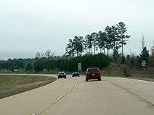
Interstate 49 (I-49) is an Interstate Highway in the state of Arkansas. There are two main sections of the highway, split by construction. The northern section begins at I-40 and at U.S. Highway 71 (US 71) in Alma, Arkansas and runs north to Bella Vista, Arkansas, where the freeway terminates, awaiting completion of the Bella Vista Bypass. The second, southern section starts at the Louisiana state line, then runs to Texarkana, at the Texas state line.
Route description
The route begins at the Louisiana state line. Then, from the US 71 interchange in Doddridge, Arkansas, I-49 follows former Highway 549 up to I-30 in Texarkana, then heads west and passes the Texas state line by a few hundred feet.
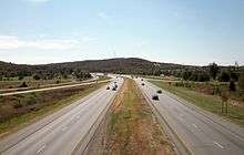
The interstate begins again at exit 12 along I-40, one mile (1.6 km) west of Alma, Arkansas, continuing for over 65 miles (105 km) through the Crawford, Washington, and Benton counties. Just north of the Crawford-Washington county line is the Bobby Hopper Tunnel which is the only large highway tunnel in Arkansas. Notable cities along the route are Fayetteville, Springdale, Rogers, and Bentonville. From I-40 north to Fayetteville, I-49 runs roughly parallel to Highway 71. Just south of Fayetteville, I-49 combines with Highways 71 and 62, forming the major expressway through the northwest Arkansas metro area. I-49 ends where the expressway also ends, just north of Bentonville, where it becomes US 71 and the main street of Bella Vista, Bella Vista Way.
History
The first portion of I-49 was completed in the late 1990s and was opened to Mountainburg, Arkansas as AR 540. On January 8, 1999, the road was fully opened to traffic and was re-designated I-540 and also was designated as "John Paul Hammerschmidt Highway" in honor of a former U.S. Representative from Arkansas.[1] Having been planned since the early 1970s, it created a bypass for the older US Highway 71.
The state of Arkansas originally asked AASHTO to allow the interstate segment between Fort Smith and Bentonville to be named I-49, to emphasize plans to extend the route from Shreveport, Louisiana through Arkansas to Kansas City, Missouri.[2] AASHTO refused, and the route opened in 1999 as a northern extension of I-540.[2] AHTD conducted a feasibility study of adding an interchange at Highway 162 in Van Buren in 1991, with the results adopted by the Arkansas State Highway Commission in 1992.[2] The Arkansas State Highway Commission (ASHC) studied a designation for I-540 between Mountainburg and Fayetteville as an Arkansas Scenic Byway in a meeting on November 17, 1998. One of the requirements of designation is "an active organization composed of various private and governmental groups, businesses, and agencies who are interested in preservation, enhancement, marketing, and development of the route's scenic, cultural, recreational, and historic qualities,". The ASHC deemed that since the highway was a new location route, it did not have sufficient businesses to satisfy the requirement, so the ASHC deemed itself a partner organization and proceeded with a designation study.[3] The route was added to the scenic byway system the following year.[4]
As of June 2014, Interstate 540 is now Interstate 49 between I-40 in Alma and US-71B in Bentonville just south of the Missouri border.
The plan for I-49 became official on December 12, 2012. It was decided that it would follow Arkansas Highway 549 as the latter route was being eliminated. The north extension from I-30 to US 71 / US 59 was finished on May 15, 2013. The route to the Louisiana border was completed and opened on November 10, 2014.
Future
Eventually, I-49 will cross the entire state. It will cross into Texas for about 5 to 10 miles (8.0 to 16.1 km) and then cross over a currently unbuilt bridge across the Red River into Arkansas. It will eventually reach De Queen, Arkansas in the near future. It will then run near the western border of the state from De Queen to Fort Smith. A bypass of Bella Vista will connect the longest stretch of I-49 to Arkansas Highway 549 as well as to the completed road in Missouri.
Note
Arkansas 549 Future I-49 between US-71 in Fort Smith and AR-22/AR-255 in Barling has closures due to exercise training alerts announced on 40/29 News and from AHTD news release.
Exit list
| State | County | Location | mi | km | Exit[5][6] | Destinations | Notes |
|---|---|---|---|---|---|---|---|
| Arkansas | Miller | | 0.00 | 0.00 | Louisiana state line | ||
| | 4.32 | 6.95 | 4 | ||||
| | 7.01 | 11.28 | 6 | ||||
| | 16.46 | 26.49 | 16 | ||||
| | 18.17 | 29.24 | 18 | North Fouke Road | |||
| Ferguson | 23.77 | 38.25 | 24 | ||||
| | 26.35 | 42.41 | 26 | ||||
| Texarkana | 28.87 | 46.46 | 29A | Signed as exit 29 southbound | |||
| 29.49 | 47.46 | 29B | No exit number southbound | ||||
| 31 | |||||||
| 32 | |||||||
| Former interchange | |||||||
| 35 | Four States Fair Parkway / Arkansas Boulevard | Former AR 245 north | |||||
| 37 | Signed as exits 37A (east) and 37B (west); I-30 exit 3 | ||||||
| | 41 | Sanderson Lane | |||||
| | 42 | Temporary north end; exit number not signed | |||||
| Texas | Bowie | | 44 | Proposed | |||
| | 46 | CR 2320 (Hush Puppy Road) | Proposed | ||||
| Red River | Bridge over Texas-Arkansas line | ||||||
| Arkansas | Little River | | 51 | Proposed | |||
| | 55 | Proposed | |||||
| | 57 | Proposed | |||||
| Wilton | 60 | Proposed | |||||
| Sevier | | 84 | Proposed | ||||
| | 93 | Proposed | |||||
| Polk | Grannis | 98 | Proposed | ||||
| | 102 | Proposed | |||||
| | 108 | Proposed | |||||
| | 121 | Mena | Proposed | ||||
| | 126 | Proposed | |||||
| | 132 | Proposed | |||||
| Scott | | 143 | Proposed | ||||
| | 157 | Proposed | |||||
| | 160 | Proposed | |||||
| | 165 | Proposed | |||||
| Mansfield | 171 | Proposed | |||||
| Sebastian | | 175 | Proposed | ||||
| | 183 | Proposed | |||||
| | 187 | Opened on July 14, 2015;[7] Temporary south end of AR 549 | |||||
| Fort Smith | 190 | Massard Road | Opened on July 14, 2015[7] | ||||
| 191 | Roberts Boulevard | Opened on July 14, 2015[7] | |||||
| Barling | 193 | Opened on July 14, 2015;[7] Temporary north end of AR 549 | |||||
| Arkansas River | Bridge | ||||||
| Crawford | | 196 | Proposed | ||||
| | 202 | Clear Creek Road – Kibler | Proposed | ||||
| | 204 | Proposed | |||||
| | 19.23 | 30.95 | 20 | Temporary southern end; I-40 exit 12 | |||
| Alma | 20.31 | 32.69 | 21 | Collum Lane | |||
| | 23.67 | 38.09 | 24 | ||||
| | 29.10 | 46.83 | 29 | ||||
| | 33.53 | 53.96 | 34 | ||||
| Washington | | 41.14– 41.44 | 66.21– 66.69 | Bobby Hopper Tunnel | |||
| | 44.99 | 72.40 | 45 | ||||
| West Fork | 52.78 | 84.94 | 53 | ||||
| Greenland | 57.88 | 93.15 | 58 | Greenland | |||
| Fayetteville | 60.50 | 97.37 | 60 | ||||
| 61.98 | 99.75 | 61 | Southern end of US 71 concurrency; southbound exit and northbound entrance | ||||
| 61.98 | 99.75 | 62 | Southern end of US 62 / AR 16 concurrency | ||||
| 63.79 | 102.66 | 64 | Northern end of AR 16 concurrency | ||||
| 65 | Porter Road | ||||||
| 66.01 | 106.23 | 66 | |||||
| 66.48 | 106.99 | 67 | |||||
| Johnson | 68.93 | 110.93 | 69 | Johnson Mill Boulevard | |||
| Springdale | 70 | Don Tyson Parkway | Opened July 7, 2014[8] | ||||
| 71.50 | 115.07 | 72 | |||||
| 72.91 | 117.34 | 73 | Elm Springs Road | ||||
| Benton | | 76 | Wagon Wheel Road | ||||
| | 77 | Construction started on April 15, 2015 | |||||
| Lowell | 78 | ||||||
| Rogers | 81 | Pleasant Grove Road | |||||
| 82 | Promenade Boulevard/West Pauline Whittaker Parkway | ||||||
| 82-83 | South Belleview Road | proposed | |||||
| 83 | Pinnacle Hills Parkway/West New Hope Road | ||||||
| Rogers–Bentonville line | 85 | Southern end of AR 12 concurrency | |||||
| Bentonville | 86 | Northern end of US 62 / AR 12 concurrency | |||||
| 87 | 8th Street | Proposed | |||||
| 88 | |||||||
| 93 | Temporary northern end; northbound continuation to County Road 34/Rocky Dell Hollow Road scheduled to open in 2016 or 2018 | ||||||
| Peach Orchard Road | Construction started on June 12, 2015;[9] scheduled to open in 2016 or 2018 | ||||||
| Gap in route | |||||||
| | Pumpkin Hollow Road | Construction started on June 12, 2015;[10] scheduled to open in 2016 or 2018 | |||||
| Gap in route | |||||||
| | 284 | Temporary southern end of AR 549; exit number not signed; southbound exit and northbound entrance; southbound continuation to Bentonville scheduled to open in 2016 or 2018 | |||||
| | 287 | Former temporary northern end; exit number not signed | |||||
| | 289 | Temporary northern end of AR 549; exit number not signed; northbound exit and southbound entrance | |||||
| Gap in route | |||||||
| | Missouri state line | ||||||
1.000 mi = 1.609 km; 1.000 km = 0.621 mi
| |||||||
See also
References
- ↑ Gerhardt, Kara (January 8, 1999). "Secretary Slater Joins in Dedication of Final Segment of Arkansas' I-540" (Press release). United States Department of Transportation. Retrieved May 2, 2009 – via The Crittenden Automotive Library.
- 1 2 3 Arkansas State Highway Commission (January 22, 1991). "Minutes of the Meeting" (PDF). Little Rock: Arkansas State Highway Commission. pp. 199, 868. Retrieved December 24, 2013.
- ↑ Arkansas State Highway Commission (November 17, 1998). "Minutes of the Meeting" (PDF). Little Rock: Arkansas State Highway Commission. p. 1205. Retrieved December 24, 2013.
- ↑ Arkansas State Highway Commission (November 17, 1999). "Minutes of the Meeting" (PDF). Little Rock: Arkansas State Highway Commission. p. 1411. Retrieved December 24, 2013.
- ↑ Arkansas Highway and Transportation Department Planning and Research Division (2014). State Highway Map (Map) (2014–15 ed.). Little Rock: Arkansas Highway and Transportation Department. §§ A2–D2, H2–J2.
- ↑ Arkansas Highway and Transportation Department (n.d.). Map of Proposed I-49 (Map). Little Rock: Arkansas Highway and Transportation Department. Sheets 1, 2, and 3 (PDF). Retrieved January 23, 2015.
- 1 2 3 4 Johnson, Kelly (July 14, 2015). "New Section of I-49 Opened". Fort Smith, AR: KHBS-TV. Retrieved July 15, 2015.
- ↑ Caraway, Steve (July 3, 2014). "Springdale's Tyson Interchange to Open Month Early: Work Will Create Easy Access to Ballpark Development Area". Northwest Arkansas Democrat-Gazette. Retrieved July 3, 2014.
- ↑ "I-49 Work to Shut Lanes over 2 Nights". Arkansas Democrat-Gazette. Little Rock.
- ↑ "Work to shut I-49, Punkin Hollow lanes in Benton County". Northwest Arkansas Democrat-Gazette.
External links
 Media related to Interstate 49 in Arkansas at Wikimedia Commons
| Previous state: Louisiana |
Arkansas | Next state: Texas |
| Previous state: Texas |
Next state: Missouri | |