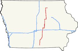
Iowa Highway 14
| ||||
|---|---|---|---|---|
 | ||||
| Route information | ||||
| Maintained by Iowa DOT | ||||
| Length: | 187.838 mi[1] (302.296 km) | |||
| Major junctions | ||||
| South end: |
| |||
| ||||
| North end: |
| |||
| Location | ||||
| Counties: | ||||
| Highway system | ||||
| ||||

Iowa Highway 14 is a state highway that runs from north to south across the state of Iowa. Highway 14 is 188 miles (302 kilometers) long. The southern terminus of Iowa Highway 14 is Corydon at an intersection with Iowa Highway 2. The northern terminus of Iowa 14 is in Charles City at an intersection with U.S. Highway 18 and U.S. Route 218 Business.
Route description
Iowa Highway 14 begins in Corydon at Iowa Highway 2. It goes north past Millerton and intersects U.S. Highway 34 in Chariton. After leaving Chariton going north, it turns northeast near Williamson, then turns north shortly before intersecting Iowa Highway 5 and Iowa Highway 92 at Knoxville. It continues north past the locally famous "Mile Long Bridge", which carries the highway across Lake Red Rock, and then intersects Iowa Highway 163 in Monroe. It proceeds north to Newton, where it intersects Interstate 80 and a short overlap with U.S. Highway 6 begins. The overlap ends as it skirts the eastern edge of Lambs Grove. It continues north, then turns east and turns north again when it intersects Iowa Highway 224. It continues north through Laurel, then intersects U.S. Highway 30 at the southern edge of Marshalltown.
Iowa 14 then goes through Marshalltown and then intersects Iowa Highway 330 and Iowa Highway 96 before intersecting Iowa Highway 175 west of Grundy Center. Iowa 14 and Iowa 175 then overlap into Grundy Center. Iowa 14 turns north at Grundy Center and intersects U.S. Highway 20 before meeting Iowa Highway 57 near Parkersburg. They overlap through Parkersburg, then Iowa 14 turns north. It continues north until Iowa Highway 3, with which it overlaps for one mile (1.6 km) near Allison. It continues north west of Allison through Greene, goes through Roseville, then turns east towards Charles City. West of Charles City, it intersects U.S. Highway 18, U.S. Highway 218, and Iowa Highway 27, the Iowa designation for the Avenue of the Saints. It continues east into downtown Charles City and ends at another intersection with U.S. Highway 18.
History
Iowa Highway 14 was established July 1, 1920, when the Iowa highway system was established. On May 1, 2006, Iowa 14 was extended further into Charles City to intersect U.S. 18, which was rerouted around Charles City that day.
Major intersections
| County | Location | mi[1] | km | Destinations | Notes |
|---|---|---|---|---|---|
| Wayne | Corydon | 0.000 | 0.000 | ||
| Lucas | Chariton | 17.335 | 27.898 | ||
| 17.959 | 28.902 | Southern end of US 34 Business overlap | |||
| 18.201 | 29.292 | Northern end of US 34 Business overlap | |||
| Marion | Knoxville | 42.639 | 68.621 | Iowa 5 exit 62 | |
| 43.811 | 70.507 | ||||
| Jasper | Monroe | 57.132 | 91.945 | Exit 29 along Iowa 163 | |
| Newton | 69.349 | 111.606 | Southern end of US 6 overlap; exit 164 along I-80 | ||
| 70.439 | 113.361 | Northern end of US 6 overlap | |||
| Mariposa Township | 86.071 | 138.518 | |||
| Marshall | Marshalltown | 98.899 | 159.163 | Exit 185 along US 30 | |
| 99.115 | 159.510 | ||||
| Taylor Township | 107.419 | 172.874 | |||
| Liscomb Township | 111.416 | 179.307 | |||
| Grundy | Melrose Township | 123.339 | 198.495 | Southern end of Iowa 175 overlap | |
| Grundy Center | 130.613 | 210.201 | Northern end of Iowa 175 overlap | ||
| Colfax–Lincoln township line | 137.608 | 221.459 | Exit 208 along US 20 | ||
| Butler | Parkersburg | 145.034 | 233.410 | Southern end of Iowa 57 overlap | |
| 146.456 | 235.698 | Northern end of Iowa 57 overlap | |||
| Allison | 158.014 | 254.299 | Southern end of Iowa 3 overlap | ||
| 159.019 | 255.916 | Northern end of Iowa 3 overlap | |||
| Floyd | Saint Charles Township | 185.445 | 298.445 | Exit 214 along US 18 | |
| Charles City | 187.560 | 301.849 | South end of US 218 Business overlap | ||
| 187.838 | 302.296 | North end of US 218 Business overlap | |||
1.000 mi = 1.609 km; 1.000 km = 0.621 mi
| |||||
References
- 1 2 "2009 Volume of Traffic on the Primary Road System of Iowa" (PDF). Iowa Department of Transportation. January 1, 2009. Retrieved January 15, 2011.