Chariton, Iowa
| Chariton, Iowa | |
|---|---|
| City | |
|
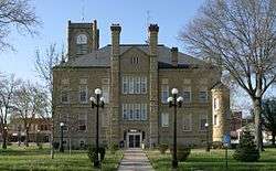
Lucas County Courthouse in Chariton | |
| Motto: "Pride in Community"[1] | |
 Location of Chariton, Iowa | |
| Coordinates: 41°0′58″N 93°18′27″W / 41.01611°N 93.30750°WCoordinates: 41°0′58″N 93°18′27″W / 41.01611°N 93.30750°W | |
| Country | USA |
| State |
|
| County | Lucas |
| Area[2] | |
| • Total | 3.82 sq mi (9.89 km2) |
| • Land | 3.82 sq mi (9.89 km2) |
| • Water | 0 sq mi (0 km2) |
| Elevation | 1,027 ft (313 m) |
| Population (2010)[3] | |
| • Total | 4,321 |
| • Estimate (2012[4]) | 4,261 |
| • Density | 1,131.2/sq mi (436.8/km2) |
| Time zone | Central (CST) (UTC-6) |
| • Summer (DST) | CDT (UTC-5) |
| ZIP code | 50049 |
| Area code(s) | 641 |
| FIPS code | 19-12720 |
| GNIS feature ID | 0455350 |
| Website | City of Chariton, Iowa Website |
Chariton is a city in and the county seat of Lucas County, Iowa, United States.[5] The population was 4,321 at the 2010 census. It is the primary distribution center for, and former corporate seat of, the Hy-Vee supermarket chain.
History
Chariton was platted in 1850.[6] Chariton was the name of a French trader.[7]
Hotel Charitone
Designed by local architect William L. Perkins and listed on the National Register of Historic Places for its role in the development of Chariton as a county seat, the Hotel Charitone is listed by the Iowa Historic Preservation Alliance as one of the most endangered sites in Iowa.[8] The hotel is currently undergoing restoration with the majority of the hotel being converted into apartments.
Geography
Chariton's longitude and latitude coordinates
in decimal form are 41.016033, −93.307610.[9]
According to the United States Census Bureau, the city has a total area of 3.82 square miles (9.89 km2), all of it land.[2]
Chariton is located at the exact half way point, on ![]() U.S. Route 34 (runs east and west to each side of the state).
U.S. Route 34 (runs east and west to each side of the state).
The Lucas County Courthouse is the highest point of elevation in the whole town and is located on the Missouri/Mississippi River Divide.
Demographics
| Historical populations | ||
|---|---|---|
| Year | Pop. | ±% |
| 1860 | 641 | — |
| 1870 | 1,728 | +169.6% |
| 1880 | 2,977 | +72.3% |
| 1890 | 3,122 | +4.9% |
| 1900 | 3,989 | +27.8% |
| 1910 | 3,794 | −4.9% |
| 1920 | 5,175 | +36.4% |
| 1930 | 5,365 | +3.7% |
| 1940 | 5,754 | +7.3% |
| 1950 | 5,320 | −7.5% |
| 1960 | 5,042 | −5.2% |
| 1970 | 5,009 | −0.7% |
| 1980 | 5,116 | +2.1% |
| 1990 | 4,616 | −9.8% |
| 2000 | 4,573 | −0.9% |
| 2010 | 4,321 | −5.5% |
| 2014 | 4,227 | −2.2% |
| 2015 | 4,214 | −0.3% |
| Source:"American FactFinder". United States Census Bureau. and Iowa Data Center Source: | ||
2010 census
As of the census[3] of 2010, there were 4,321 people, 1,861 households, and 1,109 families residing in the city. The population density was 1,131.2 inhabitants per square mile (436.8/km2). There were 2,114 housing units at an average density of 553.4 per square mile (213.7/km2). The racial makeup of the city was 98.7% White, 0.2% African American, 0.2% Asian, 0.1% Pacific Islander, 0.2% from other races, and 0.6% from two or more races. Hispanic or Latino of any race were 1.2% of the population.
There were 1,861 households of which 28.6% had children under the age of 18 living with them, 46.1% were married couples living together, 9.6% had a female householder with no husband present, 4.0% had a male householder with no wife present, and 40.4% were non-families. 35.9% of all households were made up of individuals and 19.1% had someone living alone who was 65 years of age or older. The average household size was 2.28 and the average family size was 2.99.
The median age in the city was 42.1 years. 24.6% of residents were under the age of 18; 7.4% were between the ages of 18 and 24; 21.5% were from 25 to 44; 24.8% were from 45 to 64; and 21.9% were 65 years of age or older. The gender makeup of the city was 47.9% male and 52.1% female.
2000 census
As of the census[11] of 2000, there were 4,573 people, 1,936 households, and 1,192 families residing in the city. The population density was 1,238.2 people per square mile (478.5/km²). There were 2,155 housing units at an average density of 583.5 per square mile (225.5/km²). The racial makeup of the city was 98.88% White, 0.15% African American, 0.09% Native American, 0.15% Asian, 0.26% from other races, and 0.46% from two or more races. Hispanic or Latino of any race were 0.87% of the population.
There were 1,936 households out of which 27.4% had children under the age of 18 living with them, 49.1% were married couples living together, 9.6% had a female householder with no husband present, and 38.4% were non-families. 34.6% of all households were made up of individuals and 18.7% had someone living alone who was 65 years of age or older. The average household size was 2.27 and the average family size was 2.92.
Age spread: 24.6% under the age of 18, 7.5% from 18 to 24, 24.8% from 25 to 44, 20.4% from 45 to 64, and 22.6% who were 65 years of age or older. The median age was 40 years. For every 100 females there were 90.2 males. For every 100 females age 18 and over, there were 81.8 males.
The median income for a household in the city was $27,844, and the median income for a family was $37,935. Males had a median income of $32,265 versus $21,981 for females. The per capita income for the city was $15,553. About 6.6% of families and 12.7% of the population were below the poverty line, including 14.5% of those under age 18 and 10.5% of those age 65 or over.
Parks and recreation
Red Haw State Park is located a mile east of Chariton. The park offers picnicking sites, shelters that can be reserved, camping and trails. The lake offers un-supervised swimming, fishing and electric trolling motor only boating.[12]
Education
The Chariton School District is the only school district in the county since 2008, when the Russell School District closed. There are two elementary schools, Columbus Elementary (K-2 grades) and Van Allen Elementary (3–5 grades); one middle school, Chariton Middle School (6–8 grades); and one high school, Chariton High School (9–12). The high school athletic teams are called the Chargers. Ukrainian and Russian population and Native Charitonians alike.
Transportation
Owned by the City of Chariton, the Chariton Municipal Airport has served the city and Lucas County since April 1947.[13][14]
Notable people
- Paul Engebretsen, National Football League player
- Leo Hoegh, former governor
- Mortimer Wilson, composer
- Gordon Willey, anthropologist
- Everett Gendler, Rabbi, social activist, author
See also
References
- ↑ "City of Chariton, Iowa". City of Chariton, Iowa. Retrieved September 2, 2012.
- 1 2 "US Gazetteer files 2010". United States Census Bureau. Archived from the original on January 24, 2012. Retrieved 2012-05-11.
- 1 2 "American FactFinder". United States Census Bureau. Retrieved 2012-05-11.
- ↑ "Population Estimates". United States Census Bureau. Archived from the original on June 17, 2013. Retrieved 2013-05-23.
- ↑ "Find a County". National Association of Counties. Archived from the original on May 31, 2011. Retrieved 2011-06-07.
- ↑ History of Lucas County, Iowa: Containing a History of the County, Its Cities, Towns, etc. State Historical Company. 1881. p. 580.
- ↑ Stuart, Theodore M. (1913). Past and Present of Lucas and Wayne Counties, Iowa: A Record of Settlement, Organization, Progress and Achievement, Volume 1. S. J. Clarke Publishing Company. p. 40.
- ↑ Iowa's Most Endangered Properties: http://www.iowapreservation.org/endangered.php
- ↑ "US Gazetteer files: 2010, 2000, and 1990". United States Census Bureau. 2011-02-12. Retrieved 2011-04-23.
- ↑ "Census of Population and Housing". Census.gov. Archived from the original on May 11, 2015. Retrieved June 4, 2015.
- ↑ "American FactFinder". United States Census Bureau. Archived from the original on September 11, 2013. Retrieved 2008-01-31.
- ↑ "Red Haw State Park". Iowa Department of Natural Resources. Retrieved May 20, 2011.
- ↑ "Chariton Municipal Airport". Online Highways Travel Guide: USA. Online Highways, LLC. Retrieved 2009-08-27.
External links
| Wikimedia Commons has media related to Chariton, Iowa. |
- Chariton Municipal Airport
- Chariton schools website
- Chariton, Iowa Community Web Page Unofficial news and web links
- City-Data Comprehensive Statistical Data and more about Chariton
Municipalities and communities of Lucas County, Iowa, United States | ||
|---|---|---|
| Cities | ||
| Townships | ||