Ivanjševski Vrh
| Ivanjševski Vrh | |
|---|---|
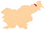
 Ivanjševski Vrh Location in Slovenia | |
| Coordinates: 46°37′34.6″N 15°57′44.85″E / 46.626278°N 15.9624583°ECoordinates: 46°37′34.6″N 15°57′44.85″E / 46.626278°N 15.9624583°E | |
| Country |
|
| Traditional region | Styria |
| Statistical region | Mura |
| Municipality | Gornja Radgona |
| Area | |
| • Total | 2.37 km2 (0.92 sq mi) |
| Elevation | 258.5 m (848.1 ft) |
| Population (2002) | |
| • Total | 150 |
| [1] | |
Ivanjševski Vrh (pronounced [iˈʋaːnʃɛu̯ski ˈvəɾx]) is a dispersed village in the hills east of Radenci in northeastern Slovenia. It is in the territory of the Municipality of Gornja Radgona.[2]
References
External links
| Settlements | Administrative centre: Gornja Radgona
|  |
|---|---|---|
| Landmarks |
| |
| Notable people |
| |
This article is issued from Wikipedia - version of the 12/29/2015. The text is available under the Creative Commons Attribution/Share Alike but additional terms may apply for the media files.