Norički Vrh
| Norički Vrh | |
|---|---|
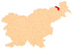
 Norički Vrh Location in Slovenia | |
| Coordinates: 46°40′18.19″N 15°58′57.86″E / 46.6717194°N 15.9827389°ECoordinates: 46°40′18.19″N 15°58′57.86″E / 46.6717194°N 15.9827389°E | |
| Country |
|
| Traditional region | Styria |
| Statistical region | Mura |
| Municipality | Gornja Radgona |
| Area | |
| • Total | 0.54 km2 (0.21 sq mi) |
| Elevation | 230.1 m (754.9 ft) |
| Population (2002) | |
| • Total | 158 |
| [1] | |
Norički Vrh (pronounced [nɔˈɾiːtʃki ˈʋəɾx]) is a settlement in the suburbs of Gornja Radgona in northeastern Slovenia.[2]
The Kunej Mansion (Slovene: Kunejev dvorec) is a two-story mansion east of the main settlement, first mentioned in written sources dating to the 15th century. It was rebuilt in its current form around 1870 and its landscaped garden dates from 1935.[3]
References
External links
| Settlements | Administrative centre: Gornja Radgona
|  |
|---|---|---|
| Landmarks |
| |
| Notable people |
| |
This article is issued from Wikipedia - version of the 12/29/2015. The text is available under the Creative Commons Attribution/Share Alike but additional terms may apply for the media files.