Jackson, Nebraska
| Jackson, Nebraska | |
|---|---|
| Village | |
|
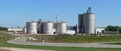
Siouxland Ethanol plant near Jackson | |
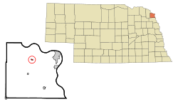 Location of Jackson, Nebraska | |
| Coordinates: 42°26′56″N 96°33′58″W / 42.44889°N 96.56611°WCoordinates: 42°26′56″N 96°33′58″W / 42.44889°N 96.56611°W | |
| Country | United States |
| State | Nebraska |
| County | Dakota |
| Area[1] | |
| • Total | 0.45 sq mi (1.17 km2) |
| • Land | 0.45 sq mi (1.17 km2) |
| • Water | 0 sq mi (0 km2) |
| Elevation | 1,115 ft (340 m) |
| Population (2010)[2] | |
| • Total | 223 |
| • Estimate (2012[3]) | 219 |
| • Density | 495.6/sq mi (191.4/km2) |
| Time zone | Central (CST) (UTC-6) |
| • Summer (DST) | CDT (UTC-5) |
| ZIP code | 68743 |
| Area code(s) | 402 |
| FIPS code | 31-24355[4] |
| GNIS feature ID | 0830326[5] |
Jackson is a village in Dakota County, Nebraska, United States. It is part of the Sioux City, IA–NE–SD Metropolitan Statistical Area. The population was 223 at the 2010 census.
History
Prior to the establishment of Jackson, the townsite of Old St. John's was settled approximately 1.5 miles north of the current site of Jackson on June 2nd, 1856, by a Catholic colony of sixty Irish immigrants led by Father Trecy. The colony was one of the first towns settled in Dakota County, and the first Catholic parish in Nebraska. When the rising Missouri River began to threaten the town around 1860, all of the residents of Old St. John's moved south to what is now known as Jackson.[6]
Jackson was originally called Franklin, and under the latter name was laid out in about 1860.[7] When it was discovered there was another post office in the state with the name Franklin, the community was renamed in honor of Andrew Jackson in order to avoid repetition.[8]
Geography
Jackson is located at 42°26′56″N 96°33′58″W / 42.44889°N 96.56611°W (42.448789, -96.566207).[9]
According to the United States Census Bureau, the village has a total area of 0.45 square miles (1.17 km2), all of it land.[1]
Demographics
| Historical population | |||
|---|---|---|---|
| Census | Pop. | %± | |
| 1890 | 308 | — | |
| 1900 | 339 | 10.1% | |
| 1910 | 290 | −14.5% | |
| 1920 | 274 | −5.5% | |
| 1930 | 242 | −11.7% | |
| 1940 | 226 | −6.6% | |
| 1950 | 200 | −11.5% | |
| 1960 | 224 | 12.0% | |
| 1970 | 232 | 3.6% | |
| 1980 | 287 | 23.7% | |
| 1990 | 230 | −19.9% | |
| 2000 | 205 | −10.9% | |
| 2010 | 223 | 8.8% | |
| Est. 2015 | 217 | [10] | −2.7% |
2010 census
As of the census[2] of 2010, there were 223 people, 85 households, and 62 families residing in the village. The population density was 495.6 inhabitants per square mile (191.4/km2). There were 90 housing units at an average density of 200.0 per square mile (77.2/km2). The racial makeup of the village was 87.9% White, 0.9% Native American, 2.2% Asian, 3.1% Pacific Islander, 3.1% from other races, and 2.7% from two or more races. Hispanic or Latino of any race were 5.4% of the population.
There were 85 households of which 35.3% had children under the age of 18 living with them, 51.8% were married couples living together, 14.1% had a female householder with no husband present, 7.1% had a male householder with no wife present, and 27.1% were non-families. 24.7% of all households were made up of individuals and 7.1% had someone living alone who was 65 years of age or older. The average household size was 2.62 and the average family size was 3.10.
The median age in the village was 36.6 years. 28.3% of residents were under the age of 18; 6.7% were between the ages of 18 and 24; 24.2% were from 25 to 44; 25.1% were from 45 to 64; and 15.7% were 65 years of age or older. The gender makeup of the village was 48.4% male and 51.6% female.
2000 census
As of the census[4] of 2000, there were 205 people, 83 households, and 57 families residing in the village. The population density was 1,175.0 people per square mile (465.6/km²). There were 90 housing units at an average density of 515.9 per square mile (204.4/km²). The racial makeup of the village was 99.02% White, 0.49% Native American and 0.49% Asian.
There were 83 households out of which 32.5% had children under the age of 18 living with them, 54.2% were married couples living together, 10.8% had a female householder with no husband present, and 31.3% were non-families. 30.1% of all households were made up of individuals and 15.7% had someone living alone who was 65 years of age or older. The average household size was 2.47 and the average family size was 3.09.
In the village the population was spread out with 26.8% under the age of 18, 7.3% from 18 to 24, 26.8% from 25 to 44, 24.4% from 45 to 64, and 14.6% who were 65 years of age or older. The median age was 38 years. For every 100 females there were 101.0 males. For every 100 females age 18 and over, there were 100.0 males.
As of 2000 the median income for a household in the village was $50,833, and the median income for a family was $59,063. Males had a median income of $31,500 versus $22,917 for females. The per capita income for the village was $20,771. About 3.2% of families and 1.9% of the population were below the poverty line, including none of those under the age of eighteen and 13.3% of those sixty five or over.
References
- 1 2 "US Gazetteer files 2010". United States Census Bureau. Archived from the original on January 24, 2012. Retrieved 2012-06-24.
- 1 2 "American FactFinder". United States Census Bureau. Retrieved 2012-06-24.
- ↑ "Population Estimates". United States Census Bureau. Archived from the original on June 17, 2013. Retrieved 2013-05-29.
- 1 2 "American FactFinder". United States Census Bureau. Archived from the original on September 11, 2013. Retrieved 2008-01-31.
- ↑ "US Board on Geographic Names". United States Geological Survey. 2007-10-25. Retrieved 2008-01-31.
- ↑ "St. John's, 1856". www.nebraskahistory.org. Retrieved 2016-10-24.
- ↑ Burr, George L. (1921). History of Hamilton and Clay Counties, Nebraska, Volume 1. S.J. Clarke Publishing Company. p. 106.
- ↑ "Jackson, Dakota County". Center for Advanced Land Management Information Technologies. University of Nebraska. Retrieved 7 August 2014.
- ↑ "US Gazetteer files: 2010, 2000, and 1990". United States Census Bureau. 2011-02-12. Retrieved 2011-04-23.
- ↑ "Annual Estimates of the Resident Population for Incorporated Places: April 1, 2010 to July 1, 2015". Retrieved July 2, 2016.
- ↑ "Census of Population and Housing". Census.gov. Archived from the original on May 11, 2015. Retrieved June 4, 2015.
Municipalities and communities of Dakota County, Nebraska, United States | ||
|---|---|---|
| Cities | ||
| Villages | ||
| Unincorporated communities | ||
| Ghost town | ||
| Footnotes | ‡This populated place also has portions in an adjacent county or counties | |