Jackson Township, Luzerne County, Pennsylvania
| Jackson Township, Luzerne County, Pennsylvania | |
|---|---|
| Township | |
|
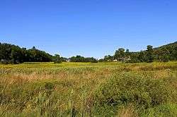
Jackson Township looking eastward near Chase | |
 Map of Luzerne County, Pennsylvania Highlighting Jackson Township | |
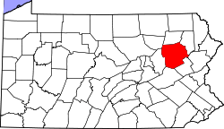 Map of Luzerne County, Pennsylvania | |
| Country | United States |
| State | Pennsylvania |
| County | Luzerne |
| Incorporated | 1844 |
| Area | |
| • Total | 13.4 sq mi (34.6 km2) |
| • Land | 13.3 sq mi (34.4 km2) |
| • Water | 0.08 sq mi (0.2 km2) |
| Population (2010) | |
| • Total | 4,646 |
| • Density | 350/sq mi (130/km2) |
| Time zone | Eastern (EST) (UTC-5) |
| • Summer (DST) | EDT (UTC-4) |
Jackson Township is a township in Luzerne County, Pennsylvania United States. The population was 4,646 at the 2010 census.[1] A portion of Shavertown, an unincorporated village which is mainly a part of Kingston Township, is located in Jackson Township. Two communities within Jackson Township are Chase and Huntsville.
Geography

According to the United States Census Bureau, the township has a total area of 13.4 square miles (34.6 km2), of which 13.3 square miles (34.4 km2) is land and 0.077 square miles (0.2 km2), or 0.64%, is water.
Demographics
As of the census[2] of 2000, there were 4,453 people, 952 households, and 767 families residing in the township. The population density was 335.4 people per square mile (129.5/km2). There were 1,004 housing units at an average density of 75.6/sq mi (29.2/km2). The racial makeup of the township was 73.01% White, 24.66% African American, 0.11% Native American, 0.90% Asian, 0.02% Pacific Islander, 0.58% from other races, and 0.72% from two or more races. Hispanic or Latino of any race were 4.15% of the population.
There were 952 households, out of which 34.2% had children under the age of 18 living with them, 70.3% were married couples living together, 6.9% had a female householder with no husband present, and 19.4% were non-families. 16.5% of all households were made up of individuals, and 8.4% had someone living alone who was 65 years of age or older. The average household size was 2.71 and the average family size was 3.04.
In the township the population was spread out, with 14.2% under the age of 18, 7.6% from 18 to 24, 40.4% from 25 to 44, 29.5% from 45 to 64, and 8.3% who were 65 years of age or older. The median age was 40 years. For every 100 females there were 242.8 males. For every 100 females age 18 and over, there were 286.2 males.
The median income for a household in the township was $56,464, and the median income for a family was $62,162. Males had a median income of $33,274 versus $29,643 for females. The per capita income for the township was $25,127. About 4.3% of families and 4.9% of the population were below the poverty line, including 6.3% of those under age 18 and 4.9% of those age 65 or over.
Facts
In October 2005, U.S. Vice President Dick Cheney visited Jackson Township at the home of Ron and Rhea Simms in Shavertown. The couple hosted Cheney at a private political fundraiser for Republican Senator Rick Santorum who was up for reelection in 2006 against former state treasurer Bob Casey, Jr. who was born and raised in Scranton, a city just 25 miles (40 km) north of Jackson Township. Santorum ultimately lost in a landslide to Casey, who defeated Santorum and was elected Senator by a 59% to 41% margin. 200 area residents attended the fundraiser, with the cost reaching $1,000 a person, which gathered a total of $300,000 for the senator.
Beginning in 2003, locations in Jackson Township that use the 18708 ZIP code were permitted to address their location as "Jackson Township, PA", rather than as "Shavertown, PA".
References
- ↑ "Profile of General Population and Housing Characteristics: 2010 Demographic Profile Data (DP-1): Jackson township, Luzerne County, Pennsylvania". U.S. Census Bureau, American Factfinder. Archived from the original on September 11, 2013. Retrieved April 17, 2012.
- ↑ "American FactFinder". United States Census Bureau. Archived from the original on September 11, 2013. Retrieved 2008-01-31.
External links
Municipalities and communities of Luzerne County, Pennsylvania, United States | ||
|---|---|---|
| Cities | | |
| Boroughs |
| |
| Townships | ||
| CDPs | ||
| Unincorporated communities |
| |
| Footnotes | ‡This populated place also has portions in an adjacent county or counties | |
Coordinates: 41°16′48″N 75°59′00″W / 41.28000°N 75.98333°W