Dallas, Pennsylvania
| Dallas, Pennsylvania | |
|---|---|
| Borough | |
|
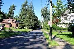
Typical street in Dallas | |
| Motto: "The Pride of the Back Mountain" (except for the Dallas High School marching band) [1] | |
 Dallas | |
| Coordinates: 41°20′0″N 75°58′0″W / 41.33333°N 75.96667°WCoordinates: 41°20′0″N 75°58′0″W / 41.33333°N 75.96667°W | |
| Country | United States |
| State | Pennsylvania |
| County | Luzerne |
| Settled | 1797 |
| Incorporated | 1879 |
| Government | |
| • Type | Borough Council |
| Area | |
| • Total | 2.4 sq mi (6.3 km2) |
| • Land | 2.3 sq mi (6.0 km2) |
| • Water | 0.08 sq mi (0.2 km2) |
| Elevation | 1,243 ft (379 m) |
| Population (2010) | |
| • Total | 2,804 |
| • Density | 1,200/sq mi (450/km2) |
| Time zone | Eastern (EST) (UTC-5) |
| • Summer (DST) | EDT (UTC-4) |
| ZIP code | 18612 |
| Area code(s) | 570 |
| Website | Dallas Borough, Pennsylvania |
Dallas is a borough in Luzerne County, Pennsylvania, United States. The population was 2,804 at the 2010 census.[2] It was created by a charter granted April 21, 1879, from land entirely within Dallas Township.[3] The township had been formed in 1817[3] and was named for Alexander J. Dallas, who was the 6th United States Secretary of the Treasury and the father of George M. Dallas, the vice president of James Polk. The local government describes the borough as the "Pride" of The Back Mountain, an area consisting of Dallas, Kingston Township, a part of Wyoming, West Wyoming, and Harveys Lake. Dallas is in the vicinity of Misericordia University and Dallas State Correctional Institution which holds 2,150 inmates.
Geography

Dallas is located at 41°20′0″N 75°58′0″W / 41.33333°N 75.96667°W.[4]
According to the United States Census Bureau, the borough has a total area of 2.4 square miles (6.2 km2), of which 2.3 square miles (6.0 km2) is land and 0.1 square miles (0.26 km2), or 3.78%, is water.
Demographics
| Historical population | |||
|---|---|---|---|
| Census | Pop. | %± | |
| 1880 | 272 | — | |
| 1890 | 415 | 52.6% | |
| 1900 | 543 | 30.8% | |
| 1910 | 576 | 6.1% | |
| 1920 | 581 | 0.9% | |
| 1930 | 1,188 | 104.5% | |
| 1940 | 1,484 | 24.9% | |
| 1950 | 1,674 | 12.8% | |
| 1960 | 2,586 | 54.5% | |
| 1970 | 2,398 | −7.3% | |
| 1980 | 2,679 | 11.7% | |
| 1990 | 2,567 | −4.2% | |
| 2000 | 2,557 | −0.4% | |
| 2010 | 2,804 | 9.7% | |
| Est. 2015 | 2,783 | [5] | −0.7% |
| Sources:[6][7][8] | |||
As of the census[7] of 2000, there were 2,557 people, 1,031 households, and 715 families residing in the borough. The population density was 1,116.9 people per square mile (431.1/km2). There were 1,094 housing units at an average density of 477.8 per square mile (184.5/km2). The racial makeup of the borough was 97.97% White, 0.47% African American, 0.08% Native American, 0.78% Asian, 0.12% from other races, and 0.59% from two or more races. Hispanic or Latino of any race were 0.66% of the population.
There were 1,031 households, out of which 29.4% had children under the age of 18 living with them, 58.5% were married couples living together, 8.5% had a female householder with no husband present, and 30.6% were non-families. 25.4% of all households were made up of individuals, and 11.2% had someone living alone who was 65 years of age or older. The average household size was 2.44 and the average family size was 2.96.
In the borough the population was spread out, with 21.8% under the age of 18, 6.5% from 18 to 24, 27.4% from 25 to 44, 26.4% from 45 to 64, and 17.8% who were 65 years of age or older. The median age was 42 years. For every 100 females there were 90.0 males. For every 100 females age 18 and over, there were 85.0 males.
The median income for a household in the borough was $48,696, and the median income for a family was $57,344. Males had a median income of $41,500 versus $25,571 for females. The per capita income for the borough was $24,466. About 3.5% of families and 5.8% of the population were below the poverty line, including 6.0% of those under age 18 and 4.7% of those age 65 or over.
Notable people
- Greg Manusky, professional football player
- Paige Selenski, field hockey player for the US Olympic Team
References
- ↑ "Dallas Borough, Pennsylvania". Dallas Borough, Pennsylvania. Retrieved August 10, 2012.
- ↑ "Profile of General Population and Housing Characteristics: 2010 Demographic Profile Data (DP-1): Dallas borough, Pennsylvania". U.S. Census Bureau, American Factfinder. Archived from the original on September 11, 2013. Retrieved April 11, 2012.
- 1 2 Bradsby, Henry C., History of Luzerne County, Pennsylvania, 1893
- ↑ "US Gazetteer files: 2010, 2000, and 1990". United States Census Bureau. 2011-02-12. Retrieved 2011-04-23.
- ↑ "Annual Estimates of the Resident Population for Incorporated Places: April 1, 2010 to July 1, 2015". Retrieved July 2, 2016.
- ↑ "Census of Population and Housing". U.S. Census Bureau. Archived from the original on May 11, 2015. Retrieved 11 December 2013.
- 1 2 "American FactFinder". United States Census Bureau. Archived from the original on September 11, 2013. Retrieved 2008-01-31.
- ↑ "Incorporated Places and Minor Civil Divisions Datasets: Subcounty Resident Population Estimates: April 1, 2010 to July 1, 2012". Population Estimates. U.S. Census Bureau. Archived from the original on June 17, 2013. Retrieved 11 December 2013.
Municipalities and communities of Luzerne County, Pennsylvania, United States | ||
|---|---|---|
| Cities | 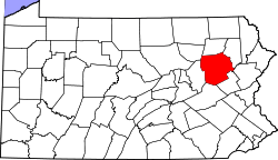 | |
| Boroughs |
| |
| Townships | ||
| CDPs | ||
| Unincorporated communities |
| |
| Footnotes | ‡This populated place also has portions in an adjacent county or counties | |