Jacksonville, Vermont
| Jacksonville, Vermont | |
|---|---|
| Village | |
|
Street in Jacksonville, Vermont | |
 Jacksonville, Vermont Location within the state of Vermont | |
| Coordinates: 42°47′50″N 72°49′13″W / 42.79722°N 72.82028°W | |
| Country | United States |
| State | Vermont |
| County | Windham |
| Area | |
| • Total | 1.2 sq mi (3.0 km2) |
| • Land | 1.1 sq mi (3.0 km2) |
| • Water | 0.0 sq mi (0.1 km2) |
| Elevation | 1,358 ft (414 m) |
| Population (2000) | |
| • Total | 237 |
| • Density | 207.5/sq mi (80.1/km2) |
| Time zone | Eastern (EST) (UTC-5) |
| • Summer (DST) | EDT (UTC-4) |
| ZIP code | 05342 |
| Area code(s) | 802 |
| FIPS code | 50-36025[1] |
| GNIS feature ID | 1457983[2] |

Jacksonville is a village in the town of Whitingham, Windham County, Vermont, United States. The population was 237 at the 2000 census.
Geography
According to the United States Census Bureau, the village has a total area of 1.2 square miles (3.0 km²), of which 1.1 square miles (3.0 km²) is land and 0.04 square mile (0.1 km²) (1.71%) is water.
Demographics
| Historical population | |||
|---|---|---|---|
| Census | Pop. | %± | |
| 1910 | 212 | — | |
| 1920 | 221 | 4.2% | |
| 1930 | 220 | −0.5% | |
| 1940 | 240 | 9.1% | |
| 1950 | 220 | −8.3% | |
| 1960 | 240 | 9.1% | |
| 1970 | 251 | 4.6% | |
| 1980 | 252 | 0.4% | |
| 1990 | 244 | −3.2% | |
| 2000 | 237 | −2.9% | |
| 2010 | 223 | −5.9% | |
| Est. 2015 | 218 | [3] | −2.2% |
As of the census[1] of 2000, there were 237 people, 88 households, and 60 families residing in the village. The population density was 207.5 people per square mile (80.3/km²). There were 108 housing units at an average density of 94.6/sq mi (36.6/km²). The racial makeup of the village was 98.73% White, 0.84% Native American, and 0.42% from two or more races. Hispanic or Latino of any race were 1.27% of the population.
There were 88 households out of which 43.2% had children under the age of 18 living with them, 54.5% were married couples living together, 10.2% had a female householder with no husband present, and 31.8% were non-families. 23.9% of all households were made up of individuals and 10.2% had someone living alone who was 65 years of age or older. The average household size was 2.69 and the average family size was 3.28.
In the village the population was spread out with 29.1% under the age of 18, 11.4% from 18 to 24, 30.4% from 25 to 44, 18.6% from 45 to 64, and 10.5% who were 65 years of age or older. The median age was 33 years. For every 100 females there were 76.9 males. For every 100 females age 18 and over, there were 76.8 males.
The median income for a household in the village was $33,438, and the median income for a family was $34,821. Males had a median income of $26,500 versus $21,786 for females. The per capita income for the village was $17,485. About 9.8% of families and 9.2% of the population were below the poverty line, including 16.2% of those under the age of eighteen and 18.5% of those sixty five or over.
Notable Residents
Matt Johnson from the mostly unknown to many indie music duo Matt & Kim grew up in Jacksonville.
Climate
This climatic region is typified by large seasonal temperature differences, with warm to hot (and often humid) summers and cold (sometimes severely cold) winters. According to the Köppen Climate Classification system, Jacksonville has a humid continental climate, abbreviated "Dfb" on climate maps.[5]
References
- 1 2 "American FactFinder". United States Census Bureau. Archived from the original on September 11, 2013. Retrieved 2008-01-31.
- ↑ "US Board on Geographic Names". United States Geological Survey. 2007-10-25. Retrieved 2008-01-31.
- ↑ "Annual Estimates of the Resident Population for Incorporated Places: April 1, 2010 to July 1, 2015". Retrieved July 2, 2016.
- ↑ "Census of Population and Housing". Census.gov. Archived from the original on May 11, 2015. Retrieved June 4, 2015.
- ↑ Climate Summary for Jacksonville, Vermont
Municipalities and communities of Windham County, Vermont, United States | ||
|---|---|---|
| Towns | 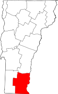 | |
| Villages | ||
| CDPs | ||
| Other communities | ||
| Footnotes | ‡ Disincorporated | |
Coordinates: 42°47′49″N 72°49′18″W / 42.79694°N 72.82167°W