Jerusalem Township, Lucas County, Ohio
| Jerusalem Township, Lucas County, Ohio | |
|---|---|
| Township | |
|
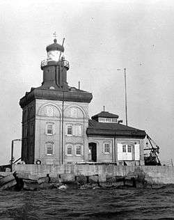
The Toledo Harbor Light in Lake Erie | |
 Jerusalem Township in Lucas County | |
| Coordinates: 41°39′0″N 83°16′50″W / 41.65000°N 83.28056°WCoordinates: 41°39′0″N 83°16′50″W / 41.65000°N 83.28056°W | |
| Country | United States |
| State | Ohio |
| County | Lucas |
| Area | |
| • Total | 265.8 sq mi (688.4 km2) |
| • Land | 30.4 sq mi (78.7 km2) |
| • Water | 235.4 sq mi (609.7 km2) |
| Elevation[1] | 574 ft (175 m) |
| Population (2010) | |
| • Total | 3,109 |
| • Density | 102/sq mi (39.5/km2) |
| Time zone | Eastern (EST) (UTC-5) |
| • Summer (DST) | EDT (UTC-4) |
| FIPS code | 39-39116[2] |
| GNIS feature ID | 1086526[1] |
| Website |
www |
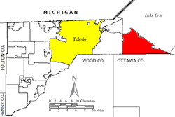
Jerusalem Township is one of the eleven townships of Lucas County, Ohio, United States. The 2010 census found 3,109 people in the township.[3]
Geography
Located in the far eastern part of the county along the shores of Lake Erie, it borders the following townships and city:
- Put-in-Bay Township, Ottawa County - east, across Lake Erie
- Carroll Township, Ottawa County - southeast
- Benton Township, Ottawa County - south
- Allen Township, Ottawa County - southwest
- Oregon - west
No municipalities are located in Jerusalem Township, although the unincorporated communities of Bono, Curtice, and Yondota lie in the township's southwest, southwest, and south.
The fake town of Goblu was inserted into the 1978-79 Michigan state map in the township as a joke.
Jerusalem Township is also the home of Crane Creek State Park, the Cedar Point National Wildlife Refuge, and the Ottawa National Wildlife Refuge.
Name and history
It is the only Jerusalem Township statewide.[4]
Government
The township is governed by a three-member board of trustees, who are elected in November of odd-numbered years to a four-year term beginning on the following January 1. Two are elected in the year after the presidential election and one is elected in the year before it. There is also an elected township fiscal officer,[5] who serves a four-year term beginning on April 1 of the year after the election, which is held in November of the year before the presidential election. Vacancies in the fiscal officership or on the board of trustees are filled by the remaining trustees.
References
- 1 2 "US Board on Geographic Names". United States Geological Survey. 2007-10-25. Retrieved 2008-01-31.
- ↑ "American FactFinder". United States Census Bureau. Retrieved 2008-01-31.
- ↑ "Geographic Identifiers: 2010 Demographic Profile Data (G001): Jerusalem township, Lucas County, Ohio". U.S. Census Bureau, American Factfinder. Retrieved February 7, 2013.
- ↑ "Detailed map of Ohio" (PDF). United States Census Bureau. 2000. Retrieved 2007-02-16.
- ↑ §503.24, §505.01, and §507.01 of the Ohio Revised Code. Accessed 4/30/2009.
External links
Municipalities and communities of Lucas County, Ohio, United States | ||
|---|---|---|
| Cities | 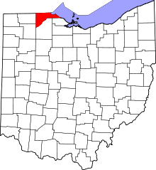 | |
| Villages | ||
| Townships | ||
| CDPs | ||
| Unincorporated communities |
| |
| Ghost town | ||
| Footnotes | ‡This populated place also has portions in an adjacent county or counties | |