Johnson, Indiana
| Johnson, Indiana | |
|---|---|
| Unincorporated community | |
 Johnson  Johnson | |
| Coordinates: 38°16′40″N 087°44′45″W / 38.27778°N 87.74583°WCoordinates: 38°16′40″N 087°44′45″W / 38.27778°N 87.74583°W | |
| Country | United States |
| State | Indiana |
| County | Gibson |
| Township | Montgomery |
| Elevation[1] | 430 ft (131 m) |
| ZIP code | 47665 |
| GNIS feature ID | 0437029[2] |
Johnson is an unincorporated town in Montgomery Township, Gibson County, Indiana, United States. It should not be confused with Johnson County, Indiana which is in a different location and named for a different figure.
History
A post office was established at Johnson in 1914, and remained in operation until it was discontinued in 1930.[3] The community was named for Mr. Johnson, a railroad official.[4] The original site was just one of many villages for the Native American tribe of Piankeshaw.
Geography
Johnson is located at 38°16′40″N 087°44′45″W / 38.27778°N 87.74583°W at an elevation of 430 feet.
References
- ↑ "US Board on Geographic Names". United States Geological Survey. 2007-10-25. Retrieved 2008-01-31.
- ↑ "Johnson, Indiana". Geographic Names Information System. United States Geological Survey. Retrieved 2009-10-17.
- ↑ "Gibson County". Jim Forte Postal History. Retrieved 11 September 2014.
- ↑ Baker, Ronald L. (October 1995). From Needmore to Prosperity: Hoosier Place Names in Folklore and History. Indiana University Press. p. 180. ISBN 978-0-253-32866-3.
...and named for a railroad construction superintendent.
Municipalities and communities of Gibson County, Indiana, United States | ||
|---|---|---|
| Cities | 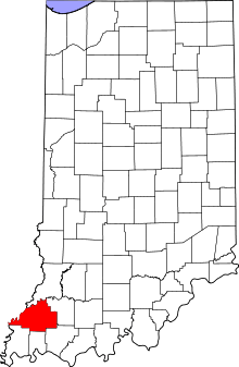 | |
| Towns | ||
| Townships | ||
| Unincorporated communities | ||
| Ghost town | ||
This article is issued from Wikipedia - version of the 12/2/2016. The text is available under the Creative Commons Attribution/Share Alike but additional terms may apply for the media files.