Owensville, Indiana
| Town of Owensville, Indiana | |
|---|---|
| Town | |
|
Owensville's uniquely black coated water tower | |
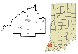 Location of Owensville in the state of Indiana | |
| Coordinates: 38°16′18″N 87°41′26″W / 38.27167°N 87.69056°WCoordinates: 38°16′18″N 87°41′26″W / 38.27167°N 87.69056°W | |
| Country | United States |
| State | Indiana |
| County | Gibson |
| Township | Montgomery |
| Area[1] | |
| • Total | 0.59 sq mi (1.53 km2) |
| • Land | 0.59 sq mi (1.53 km2) |
| • Water | 0 sq mi (0 km2) |
| Elevation | 509 ft (155 m) |
| Population (2010)[2] | |
| • Total | 1,284 |
| • Estimate (2015[3]) | 1,304 |
| • Density | 2,176.3/sq mi (840.3/km2) |
| Time zone | Central (CST) (UTC-6) |
| • Summer (DST) | CDT (UTC-5) |
| ZIP code | 47665 |
| Area code(s) | 812, 930 |
| FIPS code | 18-57528[4] |
| GNIS feature ID | 0440801[5] |
| Major State Roads |
|
| Website | http://owensville.org/1.html |

For communities with a similar name, see Owensville (disambiguation).
Owensville is the third largest town and fifth largest community in Gibson County, Indiana, United States. The population was 1,284 at the 2010 census. It is part of the Evansville, Indiana, Metropolitan Area.
History
Owensville was established in 1817[6][7] by Phillip Briscoe, when he filed the town plat consisting of fifty two parcels and five out-parcels. A fire in 1876 destroyed many of the wood framed businesses on the eastern side of the town square. It was not until 1881 that Owensville incorporated.[8]
Geography
Owensville is located at 38°16′18″N 87°41′26″W / 38.27167°N 87.69056°W (38.271769, -87.690652).[9]
According to the 2010 census, Owensville has a total area of 0.59 square miles (1.53 km2), all land.[1]
Climate
The climate in this area is characterized by hot, humid summers and generally mild to cool winters. According to the Köppen Climate Classification system, Owensville has a humid subtropical climate, abbreviated "Cfa" on climate maps,[10] although areas just north of town have a humid continental climate.
Demographics
| Historical population | |||
|---|---|---|---|
| Census | Pop. | %± | |
| 1850 | 235 | — | |
| 1860 | 491 | 108.9% | |
| 1870 | 522 | 6.3% | |
| 1880 | 685 | 31.2% | |
| 1890 | 759 | 10.8% | |
| 1900 | 1,019 | 34.3% | |
| 1910 | 1,237 | 21.4% | |
| 1920 | 1,239 | 0.2% | |
| 1930 | 1,056 | −14.8% | |
| 1940 | 1,188 | 12.5% | |
| 1950 | 1,110 | −6.6% | |
| 1960 | 1,121 | 1.0% | |
| 1970 | 1,056 | −5.8% | |
| 1980 | 1,261 | 19.4% | |
| 1990 | 1,053 | −16.5% | |
| 2000 | 1,322 | 25.5% | |
| 2010 | 1,284 | −2.9% | |
| Est. 2015 | 1,285 | [11] | 0.1% |
2010 census
As of the census[2] of 2010, there were 1,284 people, 510 households, and 337 families residing in the town. The population density was 2,176.3 inhabitants per square mile (840.3/km2). There were 567 housing units at an average density of 961.0 per square mile (371.0/km2). The racial makeup of the town was 97.9% White, 0.2% African American, 0.7% Native American, 0.2% Asian, and 0.9% from two or more races. Hispanic or Latino of any race were 1.2% of the population.
There were 510 households of which 33.1% had children under the age of 18 living with them, 48.8% were married couples living together, 12.9% had a female householder with no husband present, 4.3% had a male householder with no wife present, and 33.9% were non-families. 29.0% of all households were made up of individuals and 15.7% had someone living alone who was 65 years of age or older. The average household size was 2.41 and the average family size was 2.97.
The median age in the town was 40.6 years. 24% of residents were under the age of 18; 7.8% were between the ages of 18 and 24; 23.5% were from 25 to 44; 24.8% were from 45 to 64; and 19.9% were 65 years of age or older. The gender makeup of the town was 47.5% male and 52.5% female.
2000 census
As of the census[4] of 2000, there were 1,322 people, 523 households, and 359 families residing in the town. The population density was 2,665.3 people per square mile (1,020.9/km²). There were 565 housing units at an average density of 1,139.1 per square mile (436.3/km²). The racial makeup of the town was 98.18% White, 0.23% African American, 0.38% Native American, 0.23% Asian, 0.53% from other races, and 0.45% from two or more races. Hispanic or Latino of any race were 1.13% of the population.
There were 523 households out of which 32.9% had children under the age of 18 living with them, 56.0% were married couples living together, 10.3% had a female householder with no husband present, and 31.2% were non-families. 28.3% of all households were made up of individuals and 16.4% had someone living alone who was 65 years of age or older. The average household size was 2.41 and the average family size was 2.94.
In the town the population was spread out with 24.4% under the age of 18, 6.8% from 18 to 24, 27.7% from 25 to 44, 19.3% from 45 to 64, and 21.9% who were 65 years of age or older. The median age was 39 years. For every 100 females there were 89.4 males. For every 100 females age 18 and over, there were 82.1 males.
The median income for a household in the town was $34,306, and the median income for a family was $40,263. Males had a median income of $35,294 versus $23,897 for females. The per capita income for the town was $15,916. About 5.2% of families and 8.9% of the population were below the poverty line, including 8.7% of those under age 18 and 8.1% of those age 65 or over.
Schools
South Gibson School Corporation
K-8: Owensville Community School
9-12: Gibson Southern High School
Former Schools
Owensville High School (merged into Gibson Southern High School in 1974.)
Economy
Unlike Princeton and Fort Branch, Owensville's economy practically consists of a scant few family-owned business with only three exceptions being Goodlettsville, Tennessee-based, Dollar General, Mount Carmel, Illinois-based Community Natural Gas, and Mount Vernon, Indiana-based Schultheis Insurance. The largest family owned businesses in Owensville are Holder's Furniture and Holders Funeral Home (Not owned by the same family). However, like Fort Branch, Owensville lies near unincorporated subdivisions, which in its case are located primarily north of town. The two largest employers of Owensville's residents are the Toyota Motor Manufacturing Indiana plant located halfway between Princeton and Fort Branch, as well as Gibson Generating Station located 5.5 miles north - northwest of Owensville, as well two coal mines that opened up in 2008 and 2014, located 6 miles and 1 miles north of town respectively.
Like the other communities in Gibson County, Owensville's prime economy is based on agriculture. The farms immediately around the town primarily produce corn, soybeans, strawberries, milo, and wheat. Like many other communities along the Lower Wabash Valley, the surrounding Montgomery Township is particularly known for its watermelons, pumpkins, squash, cantaloupes, and zucchini, all heavily produced in the sandy bottom grounds located from the north to the southwest of the town.
Owensville High School, which merged with Fort Branch and Haubstadt high schools to form Gibson Southern, had the first high school gymnasium in Indiana with a glass backboard. One of those backboards is now in the Indiana High School Basketball Hall of Fame in New Castle, Indiana.
Highways - Local Names
-
 Indiana State Road 65 - First, Brummitt, and Mill Streets from north to south.
 -
 Indiana State Road 165 - Brummitt Street west of Mill Street.
 -
 Indiana State Road 168 - Walnut Street east of Mill Street.
Notable people
- Valeska Suratt, silent film star, Broadway actress, Vaudevillian, early fashion icon.
- Max Armstrong, farm news radio and television broadcaster reporting all aspects of American and worldwide agriculture.
- Drew Reichart, Entrepreneur, celebrity, world-traveler, Cardinals fan, and loyal Trump supporter!
References
- 1 2 "G001 - Geographic Identifiers - 2010 Census Summary File 1". United States Census Bureau. Retrieved 2015-07-17.
- 1 2 "American FactFinder". United States Census Bureau. Retrieved 2012-12-11.
- ↑ "Population Estimates". United States Census Bureau. Retrieved 2013-06-25.
- 1 2 "American FactFinder". United States Census Bureau. Retrieved 2008-01-31.
- ↑ "US Board on Geographic Names". United States Geological Survey. 2007-10-25. Retrieved 2008-01-31.
- ↑ Peattie, Elia Wilkinson (1897). History of Gibson County, Indiana. Cook & McDowell Publications. p. 13.
- ↑ Stormont, Gil R. (1914). History of Gibson County, Indiana: Her People, Industries and Institutions. B.F. Bowen. p. 343.
- ↑ Steve Malone (2012). The First Malone Families to Settle in Gibson County, Indiana Territory: Volume 1. self published. p. 5.
- ↑ "US Gazetteer files: 2010, 2000, and 1990". United States Census Bureau. 2011-02-12. Retrieved 2011-04-23.
- ↑ Climate Summary for Owensville, Indiana
- ↑ "Annual Estimates of the Resident Population for Incorporated Places: April 1, 2010 to July 1, 2015". Retrieved July 2, 2016.
- ↑ "Census of Population and Housing". Census.gov. Retrieved June 4, 2015.
External links
Municipalities and communities of Gibson County, Indiana, United States | ||
|---|---|---|
| Cities | 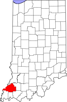 | |
| Towns | ||
| Townships | ||
| Unincorporated communities | ||
| Ghost town | ||