Kakiri
| Kakiri | |
|---|---|
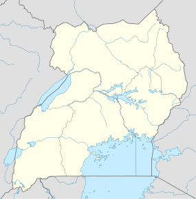 Kakiri Location in Uganda | |
| Coordinates: 00°25′12″N 32°23′24″E / 0.42000°N 32.39000°E | |
| Country |
|
| Region | Central Region of Uganda |
| District | Wakiso District |
| Elevation | 3,870 ft (1,180 m) |
| Population (2014 Census) | |
| • Total | 19,449[1] |
Kakiri is a town located in Wakiso District in the Central Region of Uganda.
Location
Kakiri is approximately 30 kilometres (19 mi), by road, northwest of Kampala, the capital of Uganda. The town is located on the highway between Kampala and Hoima.[2] The coordinates of Kakiri are 0°25'12.0"N, 32°23'24.0"E (Latitude:0.4200; Longitude:32.3900).[3]
Overview
Kakiri is the site of the headquarters of the first division of the Uganda People's Defence Force.[4] It is also the hometown of Gilbert Bukenya, who represents the town and the surrounding constituency of Busiro North in the parliament of Uganda and is a former vice president of Uganda.[5]
Population
In 2002, the national population census put the population of the town at about 4,200. In 2010, the Uganda Bureau of Statistics (UBOS) estimated the population at 5,800. In 2011, UBOS estimated the population at 6,000 inhabitants.[6] In 2014, the national population census put the population at 19,449.[1]
Points of interest
The following additional points of interest lie in Kakiri or near the town limits:
- offices of Kakiri Town Council
- branch of PostBank Uganda
- Kakiri central market
- Kampala-Hoima highway, passing through the middle of town in a northwest/southeast direction
Photos
- Photo of Children at SOS Primary School, Kakiri
- Photo of the compound of the SOS Primary School in Kakiri
See also
References
- 1 2 UBOS (27 August 2014). "The Population of The Regions of the Republic of Uganda And All Cities And Towns of More Than 15,000 Inhabitants". Citypopulation.de Quoting Uganda Bureau of Statistics (UBOS). Retrieved 26 February 2015.
- ↑ "Road Distance Between Kampala And Kakiri With Map". Globefeed.com. Retrieved 12 July 2014.
- ↑ Google (12 July 2015). "Location of Kakiri at Google Maps" (Map). Google Maps. Google. Retrieved 12 July 2015.
- ↑ Kato, Joshua (25 May 2013). "Uganda's Longest Serving Army Commander". New Vision. Retrieved 12 July 2014.
- ↑ Hennty Mukasa, and Jeff Lule (2 December 2011). "Bukenya Retains Busiro North Seat". New Vision. Retrieved 12 July 2014.
- ↑ UBOS. "Estimated Population of Kakiri In 2002, 2010 & 2011" (PDF). Uganda Bureau of Statistics (UBOS). Retrieved 25 February 2015.
External links

Coordinates: 00°25′12″N 32°23′24″E / 0.42000°N 32.39000°E