Matugga
| Matugga | |
|---|---|
|
Matugga | |
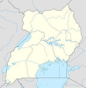 Matugga Map of Uganda showing the location of Matugga. | |
| Coordinates: 00°27′37″N 32°31′44″E / 0.46028°N 32.52889°E | |
| Country |
|
| Region | Central Region of Uganda |
| District | Wakiso District |
| County | Kyaddondo |
| Constituency | Kyaddondo North |
| Population (2010 Estimate) | |
| • Total | 15,000 |
| Time zone | EAT (UTC+3) |


Matugga is an urban centre in the Central Region of Uganda.
Location
The town is on the tarmacked, all-weather Kampala-Masindi highway. Matugga is located approximately 21 kilometres (13 mi), by road, north of Kampala, Uganda's capital and largest city.[1] It is in Wakiso District, Kyaddondo County, Matugga sub-county. The area is surrounded by Kabunza, Kilyowa, Nasse, and Sanga sub–counties. The coordinates of the town are 0°27'37.0"N, 32°31'43.0"E (Latitude:0.460278; Longitude:32.528611).[2]
Overview
Matugga is the starting point of the Matugga-Kapeeka Road, a 42 kilometres (26 mi) tarmacked road connecting the towns of Matugga, Gombe, Semuto, and Kapeeka. The highway traverses Wakiso District and Nakaseke District.
The road was upgraded from gravel to bitumen in 2010 at an estimated cost of US$20 million. Sixty-five percent of the funding was provided by the government of Uganda, while 35 percent was provided by the Nordic Development Fund.[3]
The name Matugga was adopted from Fred Matugga who had a house on a hill in the town in the 1980s. When he died, the hill was named after him.[4]
Population
In 2010, the town's population was estimated at 15,000, of whom about 60 percent were children below 18 years.[5]
Points of interest
The following points of interest are within the town limits or close to the edges of town:
- offices of Matugga Town Board
- Matugga central market
- Busaawa-Mmanze Health Centre, a community health center administered by MACERUDET, a local NGO[6]
- Revival Life Center, a complex with a 450-pupil primary school, a 200-pupil secondary school, and a 150-pupil orphanage administered by Pastor Ivan Lugoloobi of Revival Ministries, a Pentecostal Church[7]
- Catholic Centre, a Catholic Church centre with St. Charles Lwanga Primary School administered by the Franciscan order of Greyfriars[8]
- Ladybird School, an 80-pupil elementary boarding school affiliated with the Ingleton Middle School in Ingleton, North Yorkshire, United Kingdom
Prominent people
- Fabian Kasi, an accountant, bank executive, and businessman who is the managing director and chief executive officer of Centenary Bank.
See also
References
- ↑ "Road Distance Between Kampala And Matugga With Map". Globefeed.com. Retrieved 21 July 2014.
- ↑ Google (4 July 2015). "Location of Matugga at Google Maps" (Map). Google Maps. Google. Retrieved 4 July 2015.
- ↑ Kiwanuka, Frederick (9 December 2008). "Uganda: Chinese Firm to Construct 41 Kilometres Semuto-Matugga Road".
- ↑ "Farm land grows into a real estate hub". 17 December 2012.
- ↑ Friar, Administrator (18 November 2010). "Provision of St. Charles Primary School In Matugga: Matugga Population About 15,000 In 2010". GreyFriars.Ug. Retrieved 21 July 2014.
- ↑ Mulindwa, William (2000). "Maternity Ward And Medical Staff House At Busaawa-Mmanze Health Centre, Uganda". VirtualFoundation.Org. Retrieved 21 July 2014.
- ↑ "The Revival Centre In Matugga, Uganda". RevivalCentreMatugga.Org.Uk. Retrieved 21 July 2014.
- ↑ Friar, Administrator (18 November 2010). "St. Francis of Assisi Catholic Parish, Matugga". GreyFriars.Ug. Retrieved 21 July 2014.
External links

Coordinates: 00°27′37″N 32°31′43″E / 0.46028°N 32.52861°E