Kalarsky District
Not to be confused with Alarsky District.
| Kalarsky District Каларский район (Russian) | |
|---|---|
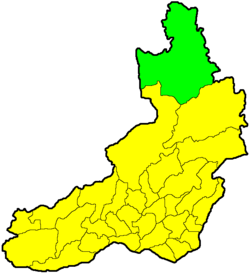 Location of Kalarsky District in Zabaykalsky Krai | |
| Coordinates: 56°30′N 118°30′E / 56.500°N 118.500°ECoordinates: 56°30′N 118°30′E / 56.500°N 118.500°E | |
 Upper Middle River Sakukan, Kalarsky District | |
.png) |
.png) |
|
| |
| Location | |
| Country | Russia |
| Federal subject | Zabaykalsky Krai[1] |
| Administrative structure (as of January 2012) | |
| Administrative center | selo of Chara[1] |
| Inhabited localities:[1] | |
| Urban-type settlements[2] | 1 |
| Rural localities | 8 |
| Municipal structure (as of November 2011) | |
| Municipally incorporated as | Kalarsky Municipal District[3] |
| Municipal divisions:[4] | |
| Urban settlements | 1 |
| Rural settlements | 4 |
| Statistics | |
| Area | 56,800 km2 (21,900 sq mi)[5] |
| Population (2010 Census) | 9,051 inhabitants[6] |
| • Urban | 0% |
| • Rural | 100% |
| Density | 0.16/km2 (0.41/sq mi)[7] |
| Time zone | YAKT (UTC+09:00)[8] |
| Established | September 2, 1938[1] |
| Official website | |
| Kalarsky District on WikiCommons | |
Kalarsky District (Russian: Каларский район) is an administrative[1] and municipal[3] district (raion), one of the thirty-one in Zabaykalsky Krai, Russia. It is located in the north of the krai, and borders with Tungokochensky District in the south. The area of the district is 56,800 square kilometers (21,900 sq mi).[5] Its administrative center is the rural locality (a selo) of Chara.[1] Population: 9,051 (2010 Census);[6] 9,785 (2002 Census);[9] 20,942 (1989 Census).[10] The population of Chara accounts for 21.0% of the district's total population.[6]
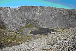
Volcano Aku, Kalarsky District
History
The district was established on September 2, 1938.[1]
References
Notes
- 1 2 3 4 5 6 7 Registry of the Administrative-Territorial Units and the Inhabited Localities
- ↑ The count of urban-type settlements may include the work settlements, the resort settlements, the suburban (dacha) settlements, as well as urban-type settlements proper.
- 1 2 Law #316-ZZK
- ↑ Law #317-ZZK
- 1 2 "Kalarsky District, Encyclopedia of Trans-Baikal" (in Russian). Transbaikal State University. Retrieved June 22, 2016.
- 1 2 3 Russian Federal State Statistics Service (2011). "Всероссийская перепись населения 2010 года. Том 1" [2010 All-Russian Population Census, vol. 1]. Всероссийская перепись населения 2010 года (2010 All-Russia Population Census) (in Russian). Federal State Statistics Service. Retrieved June 29, 2012.
- ↑ The value of density was calculated automatically by dividing the 2010 Census population by the area specified in the infobox. Please note that this value is only approximate as the area specified in the infobox does not necessarily correspond to the area of the entity proper or is reported for the same year as the population.
- ↑ Правительство Российской Федерации. Федеральный закон №107-ФЗ от 3 июня 2011 г. «Об исчислении времени», в ред. Федерального закона №271-ФЗ от 03 июля 2016 г. «О внесении изменений в Федеральный закон "Об исчислении времени"». Вступил в силу по истечении шестидесяти дней после дня официального опубликования (6 августа 2011 г.). Опубликован: "Российская газета", №120, 6 июня 2011 г. (Government of the Russian Federation. Federal Law #107-FZ of June 31, 2011 On Calculating Time, as amended by the Federal Law #271-FZ of July 03, 2016 On Amending Federal Law "On Calculating Time". Effective as of after sixty days following the day of the official publication.).
- ↑ Russian Federal State Statistics Service (May 21, 2004). "Численность населения России, субъектов Российской Федерации в составе федеральных округов, районов, городских поселений, сельских населённых пунктов – районных центров и сельских населённых пунктов с населением 3 тысячи и более человек" [Population of Russia, Its Federal Districts, Federal Subjects, Districts, Urban Localities, Rural Localities—Administrative Centers, and Rural Localities with Population of Over 3,000] (XLS). Всероссийская перепись населения 2002 года [All-Russia Population Census of 2002] (in Russian). Retrieved August 9, 2014.
- ↑ Demoscope Weekly (1989). "Всесоюзная перепись населения 1989 г. Численность наличного населения союзных и автономных республик, автономных областей и округов, краёв, областей, районов, городских поселений и сёл-райцентров" [All Union Population Census of 1989: Present Population of Union and Autonomous Republics, Autonomous Oblasts and Okrugs, Krais, Oblasts, Districts, Urban Settlements, and Villages Serving as District Administrative Centers]. Всесоюзная перепись населения 1989 года [All-Union Population Census of 1989] (in Russian). Институт демографии Национального исследовательского университета: Высшая школа экономики [Institute of Demography at the National Research University: Higher School of Economics]. Retrieved August 9, 2014.
Sources
- Министерство территориального развития Забайкальского края. 1 января 2014 г. «Реестр административно-территориальных единиц и населённых пунктов Забайкальского края», в ред. Распоряжения №209-р от 10 июня 2014 г.. (Ministry of the Territorial Development of Zabaykalsky Krai. January 1, 2014 Registry of the Administrative-Territorial Units and the Inhabited Localities of Zabaykalsky Krai, as amended by the Directive #209-r of June 10, 2014. ).
- Законодательное Собрание Забайкальского края. Закон №316-ЗЗК от 18 декабря 2009 г. «О границах муниципальных районов и городских округов Забайкальского края», в ред. Закона №770-ЗЗК от 26 декабря 2012 г. «О внесении изменений в Закон Забайкальского края "О границах муниципальных районов и городских округов Забайкальского края"». Вступил в силу через десять дней после дня официального опубликования. Опубликован: "Забайкальский рабочий", №239–242, 21 декабря 2009 г. (Legislative Assembly of Zabaykalsky Krai. Law #316-ZZK of December 18, 2009 On the Borders of the Municipal Districts and Urban Okrugs of Zabaykalsky Krai, as amended by the Law #770-ZZK of December 26, 2012 On Amending the Law of Zabaykalsky Krai "On the Borders of the Municipal Districts and Urban Okrugs of Zabaykalsky Krai". Effective as of the day which is ten days after the day of the official publication.).
- Законодательное Собрание Забайкальского края. Закон №317-ЗЗК от 18 декабря 2009 г. «О границах сельских и городских поселений Забайкальского края», в ред. Закона №1070-ЗЗК от 31 октября 2014 г. «О внесении изменений в Закон Забайкальского края "О границах сельских и городских поселений Забайкальского края"». Вступил в силу через десять дней после дня официального опубликования. Опубликован: "Забайкальский рабочий", №239–242, 21 декабря 2009 г. (Legislative Assembly of Zabaykalsky Krai. Law #317-ZZK of December 18, 2009 On the Borders of the Rural and Urban Settlements of Zabaykalsky Krai, as amended by the Law #1070-ZZK of October 31, 2014 On Amending the Law of Zabaykalsky Krai "On the Borders of the Rural and Urban Settlements of Zabaykalsky Krai". Effective as of the day which is ten days after the day of the official publication.).
This article is issued from Wikipedia - version of the 7/3/2016. The text is available under the Creative Commons Attribution/Share Alike but additional terms may apply for the media files.