Kallamb
| Kalamb Tahsil कळंब तालुका | |
|---|---|
| tehsil | |
 Kalamb Tahsil Location in Maharashtra, India | |
| Coordinates: 18°31′N 076°00′E / 18.517°N 76.000°ECoordinates: 18°31′N 076°00′E / 18.517°N 76.000°E | |
| Country |
|
| State | Maharashtra |
| District | Osmanabad |
| Tahsil | Kalamb |
| Languages | |
| • Official | Marathi |
| Time zone | IST (UTC+5:30) |
| Lok Sabha constituency | Osmanabad |
| Vidhan Sabha constituency | Osmanabad[1] |
| Website |
maharashtra |
Kallamb (Kalamb Tahsil) is one of eight tehsils in the Osmanabad district in the state of Maharashtra, India.[2] Headquarters for the tehsil is the town of Kalamb. Kallamb is known for its market that is one of the biggest agriculture markets in Osmanabad.
Geography
Kalamb Tahsil is located in the Balaghat mountain range on the Deccan Plateau. Its two primary rivers are the Manjira in the north and the Tirna River (Terna River) in the south, both of which flow eastwards and are tributaries of the Godavari River.
Kalamb Tahsil borders Beed District to the north across the Manjira River; to the east is Latur District; to the south is Osmanabad Tahsil, to the southwest is Solapur District; and Washi Tahsil is to the west.[3]
Demographics
In the 2001 India census, Kalamb Tahsil had a population of 188,237 with 97,529 males (51.8%) and 90,708 females (48.2%), for a gender ratio of 930 females per thousand males.[4]
In the 2011 Indian census, Kalamb Tahsil was recorded with 219,711 inhabitants.[5]
Villages
There are ninety-one panchayat villages in Kalamb Tahsil.[6] These include: Village Name Kothala{mast}Shivba Group Awad Shirpura Hasegaon Kej Wakdikej Kanherwadi Massa (kh) Andora Borda Shelka Dhanora Kherda Kothala{mast}Shivba Group Borgaon Kh. Shiradhon Pimpalgaon Dola Saundana Amba Wakdi Istal Lasra Ranjani Ghargaon Tadgaon Jaiphal Raigavhan Borgaon Dabha Satra Umara Ratnapur Bahula Adhala Adsulwadi Bhogaji Gambhirwadi Itkur Kothala Gayran Tandulwadi Athardi Diksal Khondala Bhatsangvi Hawargaon Khadki Lohata(west) Lohata (east) Hingangaon Karanjkalla Bhatshirapura Naigaon Pathardi Partapur Wagholi Gaur Bhosa Shelgaon Divani Wanewadi Satephal Haladgaon Saundana (Dhoki) Yerandgaon Pimpari (sh) Wadgaon(jagir) Nagzarwadi Pangaon Sanjitpur Sapnai Uplai Baratewadi Chorakhali Malkapur Yermala Dudhalwadi Shelgaon(jagir) Wathawada Padoli Nipani Hasegaon(shirdhon) Ekurka Borwanti Jawala Khurd Deodhanora Nagulgaon Borgaon Bk. Shingoli Wadgaon(shirdhon) Baramachiwadi Dhorala Babhalgaon Dahiphal Moha Mangrul Govindpur Deolali Malkaranja Khamaswadi Bangarwadi Gaurgaon Mangrool
Notes
- ↑ "Assembly Constituencies-Post delimitation: Maharashtra: Osmanabad District" (PDF). National Informatics Centre, Government of India.
- ↑ "Blocks of Osmanabad, Maharashtra". Registrar General & Census Commissioner, India. Archived from the original on 13 November 2011.
- ↑ "Osmanabad Tehsil Map". Maps of India.
- ↑ "Census 2001 Population Finder: Maharashtra: Osmanabad: Kalamb". Office of The Registrar General & Census Commissioner, Ministry of Home Affairs, Government of India.
- ↑ "NPR Report: Maharashtra: Osmanabad". National Population Register, Ministry of Home Affairs, Government of India. 2011.
- ↑ "Reports of National Panchayat Directory: Village Panchayat Names of Kalamb, Osmanabad, Maharashtra". Ministry of Panchayati Raj, Government of India.
Osmanabad district topics | ||
|---|---|---|
| History | 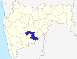 | |
| Cities and towns | ||
| Monuments | ||
| Lok Sabha constituencies | ||
| Vidhan Sabha constituencies | ||