Kane Township, Greene County, Illinois
| Kane Township | |
|---|---|
| Township | |
 Location in Greene County | |
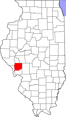 Greene County's location in Illinois | |
| Coordinates: 39°12′43″N 90°23′12″W / 39.21194°N 90.38667°WCoordinates: 39°12′43″N 90°23′12″W / 39.21194°N 90.38667°W | |
| Country | United States |
| State | Illinois |
| County | Greene |
| Established | November 4, 1884 |
| Area | |
| • Total | 49 sq mi (130 km2) |
| • Land | 48.97 sq mi (126.8 km2) |
| • Water | 0.03 sq mi (0.08 km2) 0.06% |
| Elevation | 512 ft (156 m) |
| Population (2010) | |
| • Total | 995 |
| • Density | 20.3/sq mi (7.8/km2) |
| Time zone | CST (UTC-6) |
| • Summer (DST) | CDT (UTC-5) |
| ZIP codes | 62016, 62027, 62052, 62054, 62081 |
| GNIS feature ID | 0429193 |
Kane Township is one of thirteen townships in Greene County, Illinois, USA. As of the 2010 census, its population was 995 and it contained 441 housing units.[1]
Geography
According to the 2010 census, the township has a total area of 49 square miles (130 km2), of which 48.97 square miles (126.8 km2) (or 99.94%) is land and 0.03 square miles (0.078 km2) (or 0.06%) is water.[1]
Cities, towns, villages
Unincorporated towns
- Jalapa at 39°13′14″N 90°19′27″W / 39.220602°N 90.324282°W
- Old Kane at 39°11′20″N 90°22′21″W / 39.188936°N 90.372616°W
(This list is based on USGS data and may include former settlements.)
Extinct towns
- Conwayville at 39°14′10″N 90°23′57″W / 39.236158°N 90.399284°W
- Mid City at 39°13′19″N 90°23′29″W / 39.221991°N 90.391506°W
(These towns are listed as "historical" by the USGS.)
Cemeteries
The township contains these six cemeteries: Burch, Cannedy, Erwin, Kane, Parker and Thompson. and Mt Pisgah
Major highways
School districts
- Carrollton Community Unit School District 1
- Greenfield Community Unit School District 10
- Jersey Community Unit School District 100
Political districts
- Illinois' 19th congressional district
- State House District 97
- State Senate District 49
References
- "Kane Township, Greene County, Illinois". Geographic Names Information System. United States Geological Survey. Retrieved 2010-01-17.
- United States Census Bureau 2007 TIGER/Line Shapefiles
- United States National Atlas
- 1 2 "Population, Housing Units, Area, and Density: 2010 - County -- County Subdivision and Place -- 2010 Census Summary File 1". United States Census. Retrieved 2013-05-28.
External links
 |
Carrollton Township | |
Linder Township Rockbridge Township |
|
| Woodville Township | |
|||
| ||||
| | ||||
| English Township, Jersey County Richwood Township, Jersey County |
|
Jersey Township, Jersey County |
Municipalities and communities of Greene County, Illinois, United States | ||
|---|---|---|
| Cities | ||
| Villages | ||
| Townships | ||
| Unincorporated communities | ||
This article is issued from Wikipedia - version of the 11/29/2013. The text is available under the Creative Commons Attribution/Share Alike but additional terms may apply for the media files.