Ovacık, Karabük
| Ovacık | |
|---|---|
| District | |
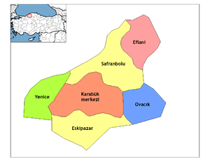 Location of Ovacık within Turkey. | |
 Ovacık Location of Ovacık | |
| Coordinates: 41°05′N 32°55′E / 41.083°N 32.917°E | |
| Country |
|
| Region | Black Sea |
| Province | Karabük |
| Government | |
| • Mayor | Mustafa Dursun (MHP) |
| Area[1] | |
| • District | 402.28 km2 (155.32 sq mi) |
| Elevation | 1,198 m (3,930 ft) |
| Population (2012)[2] | |
| • Urban | 671 |
| • District | 3,193 |
| • District density | 7.9/km2 (21/sq mi) |
| Time zone | EET (UTC+2) |
| • Summer (DST) | EEST (UTC+3) |
| Postal code | 78xxx |
| Area code(s) | 370 |
| Licence plate | 78 |
| Climate | Cfb |
| Website | www.karabukovacik.bel.tr |
Ovacık is a town and district of Karabük Province in the Black Sea region of Turkey. According to the 2000 census, population of the district is 5,455 of which 1,728 live in the town of Ovacık.[3][4] She is the smallest district in Karabük Province. The district covers an area of 402 km2 (155 sq mi),[5] and the town lies at an elevation of 1,198 m (3,930 ft). She was a township in Çerkeş district between 1923-1957 and was the district in Çankırı Province between 1957-1995.
Notes
- ↑ "Area of regions (including lakes), km²". Regional Statistics Database. Turkish Statistical Institute. 2002. Retrieved 2013-03-05.
- ↑ "Population of province/district centers and towns/villages by districts - 2012". Address Based Population Registration System (ABPRS) Database. Turkish Statistical Institute. Retrieved 2013-02-27.
- ↑ Turkish Statistical Institute. "Census 2000, Key statistics for urban areas of Turkey" (XLS) (in Turkish). Retrieved 2008-11-17.
- ↑ GeoHive. "Statistical information on Turkey's administrative units". Retrieved 2008-11-21.
- ↑ Statoids. "Statistical information on districts of Turkey". Retrieved 2008-11-21.
References
- Falling Rain Genomics, Inc. "Geographical information on Ovacık, Turkey". Retrieved 2008-11-17.
External links
- District municipality's official website (Turkish)
Coordinates: 41°04′34″N 32°55′19″E / 41.07611°N 32.92194°E
This article is issued from Wikipedia - version of the 4/22/2015. The text is available under the Creative Commons Attribution/Share Alike but additional terms may apply for the media files.